
- Elevation
- 168 m
- above sea level
- Local time
- UTC+00:00
- Europe/London · UTC+00:00
- Airports
- LTN London Luton Airport5 km
- LHR London Heathrow Airport43 km
About Woodside
Woodside is a village. Location: Slip End, Central Bedfordshire. Elevation: 168 m.
Woodside is a hamlet located in the Central Bedfordshire district of Bedfordshire, England. Located at the junction of Woodside Road and Grove Road, Woodside stands 546 feet (166 m) above sea level. The underlying geology is a Chalk Group known as Lewes Nodular Chalk Formation and Seaford Chalk Formation which was deposited between 84 and 94 million years ago in the Cretaceous Period. The superficial geology is clay with flints, deposited in the Quaternary and Neogene Periods.
Source: Wikipedia · CC BY-SA 4.0
Photos of Woodside
-

M J Richardson · CC BY-SA 2.0 -

David Howard · CC BY-SA 2.0 -

Rob Farrow · CC BY-SA 2.0 -
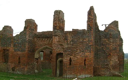
Someries Castle Forscher scs · CC BY-SA 4.0 -
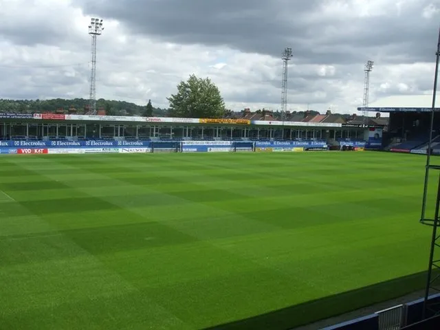
Kenilworth Road Barry Ephgrave · CC BY-SA 2.0


Climate of Woodside
Best months for sightseeingBest months for sightseeing: June–August.
This month · November
A cold month
Day 9° · Night 3° · Rain 65 mm
- Hottest month
- July (day 21°)
- Coldest month
- February (night 1°)
- Wettest month
- January (66 mm)
- Driest month
- July (45 mm)
Bars: average monthly low and high temperature. Below: precipitation. Monthly averages for 1970–2000 at about 18 km resolution, adjusted for elevation. Highlighted months are mild and relatively dry. Source: WorldClim 2.1 (CC BY 4.0).
Show values as a table
| Month | Jan | Feb | Mar | Apr | May | Jun | Jul | Aug | Sep | Oct | Nov | Dec |
|---|---|---|---|---|---|---|---|---|---|---|---|---|
| Average high (°C) | 6° | 7° | 9° | 12° | 16° | 19° | 21° | 21° | 18° | 13° | 9° | 7° |
| Average low (°C) | 1° | 1° | 2° | 3° | 6° | 9° | 12° | 12° | 9° | 7° | 3° | 2° |
| Precipitation (mm) | 66 | 46 | 54 | 52 | 51 | 60 | 45 | 54 | 59 | 66 | 65 | 65 |
How to get to Woodside
The nearest airport is London Luton Airport (LTN), 5 km to the east as the crow flies. The nearest large city is Luton, 3 km to the northeast.
Airports
- London Luton Airport (LTN) Luton, Luton 5 kmeast
- London Heathrow Airport (LHR) London 43 kmsouth
- London Stansted Airport (STN) London, Essex 47 kmeast
Nearby large cities
- Luton Population: 225.3K 3 kmnortheast
- Watford Population: 125.7K 23 kmsouth
- Milton Keynes Population: 256.4K 30 kmnorthwest
- Bedford Population: 106.9K 31 kmnorth
- Harrow Population: 149.2K 32 kmsouth
Straight-line distances; road distances are longer. Airport data: OurAirports.
Day trips from Woodside
Within 100 km: 891 historic and cultural sites, 531 natural sites, 300 lakes, rivers and coasts.
0–25 km138 places
- Broad Water Island Island 22 kmE
- Heron Island Island 14 kmSE
- Chantry Island Island 19 kmS
- Bird Island Island 24 kmN
25–60 km800 places
- White Hart Lane Landmark 38 kmSE
- The Lynch Island 51 kmSW
- Holm Island Island 47 kmS
- Sunbury Court Island 50 kmS
60–100 km784 places
- Spotlites @ Kings Theatre Attraction 86 kmSE
- West Mersea Beach Beach 95 kmE
- Yantlet beach Beach 88 kmSE
- Osea Island Island 85 kmE
Straight-line distances.
Nearby attractions & nature
Everything nearby-
Kenilworth Road Landmark, Luton2.9 km N
-
Someries Castle Historic site, Hyde4.5 km E
-
Blow's Down Mountain, Caddington4.8 km NW
-
Lewsey Farm Mediumwave Transmitter Landmark, Luton6.1 km NW
-
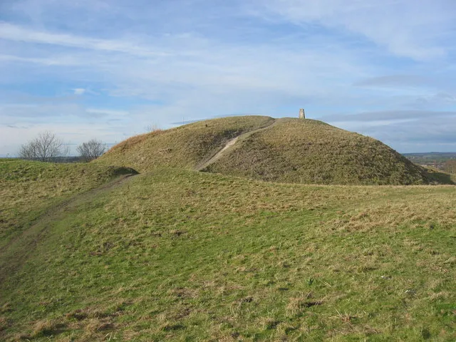 Totternhoe Castle Historic site, Totternhoe10 km W
-
Dunstable Downs, Chilterns Gateway Centre and Whipsnade Estate Natural site, Whipsnade6.8 km W
Sources & licences
Data last updated: · 2 independent sources