- Elevation
- 158 m
- above sea level
- Local time
- UTC+00:00
- Europe/London · UTC+00:00
- Airports
- LPL Liverpool John Lennon Airport40 km
- MAN Manchester Airport48 km
About Wirswall Hill
Wirswall Hill is a mountain. Location: Wirswall, Cheshire East. Elevation: 158 m. The best months to visit are June–August. The nearest airport is Liverpool John Lennon Airport (40 km). Nearby sights include Norbury Hill and Ash Grange Hill.
Photos of Wirswall Hill
-
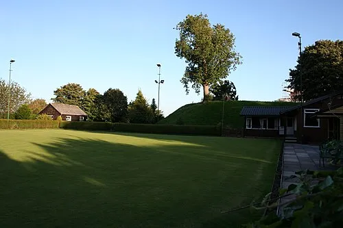
Malpas Castle Hill Dave.Dunford · CC BY-SA 4.0

Climate of Wirswall Hill
Best months for sightseeingBest months for sightseeing: June–August.
This month · November
A cold month
Day 9° · Night 3° · Rain 71 mm
- Hottest month
- July (day 20°)
- Coldest month
- February (night 0°)
- Wettest month
- November (71 mm)
- Driest month
- February (46 mm)
Bars: average monthly low and high temperature. Below: precipitation. Monthly averages for 1970–2000 at about 18 km resolution, adjusted for elevation. Highlighted months are mild and relatively dry. Source: WorldClim 2.1 (CC BY 4.0).
Show values as a table
| Month | Jan | Feb | Mar | Apr | May | Jun | Jul | Aug | Sep | Oct | Nov | Dec |
|---|---|---|---|---|---|---|---|---|---|---|---|---|
| Average high (°C) | 7° | 7° | 9° | 12° | 15° | 18° | 20° | 20° | 17° | 13° | 9° | 7° |
| Average low (°C) | 0° | 0° | 2° | 3° | 5° | 8° | 11° | 10° | 8° | 5° | 3° | 1° |
| Precipitation (mm) | 62 | 46 | 53 | 50 | 51 | 56 | 50 | 62 | 65 | 66 | 71 | 69 |
How to get to Wirswall Hill
The nearest airport is Liverpool John Lennon Airport (LPL), 40 km to the north as the crow flies. The nearest large city is Newcastle-under-Lyme, 30 km to the east.
Airports
- Liverpool John Lennon Airport (LPL) Liverpool 40 kmnorth
- Manchester Airport (MAN) Manchester, Greater Manchester 48 kmnortheast
- Birmingham Airport (BHX) Birmingham, West Midlands 87 kmsoutheast
Nearby large cities
- Newcastle-under-Lyme Population: 127.7K 30 kmeast
- Stoke-on-Trent Population: 258.4K 33 kmeast
- Telford Population: 155.6K 38 kmsoutheast
- Warrington Population: 172.3K 45 kmnorth
- Birkenhead Population: 325.3K 50 kmnorthwest
Straight-line distances; road distances are longer. Airport data: OurAirports.
Day trips from Wirswall Hill
Within 100 km: 830 historic and cultural sites, 2,180 natural sites, 195 lakes, rivers and coasts.
0–25 km98 places
- Duckbay Island Island 4 kmE
- Newton Mere Lake 16 kmSW
- Crose Mere Lake 18 kmSW
- Hawkstone lake Lake 14 kmS
25–60 km920 places
- Thurstaston Beach Beach 49 kmNW
- Hilbre Island Island 57 kmNW
- Little Eye Island 55 kmNW
- Birch Island Island 42 kmNE
60–100 km2,187 places
- Formby Beach Beach 70 kmNW
- Ainsdale Beach Beach 73 kmN
- St Anne's Beach Beach 87 kmN
- Ynys Tywyn Island 98 kmW
Straight-line distances.
Nearest towns and villages
-
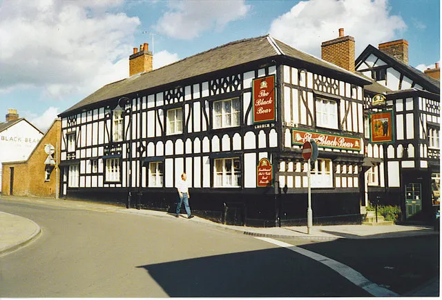 Whitchurch Town, Whitchurch3 km S
-
Wirswall Village, Wirswall0.3 km SW
-
Marbury Village, Marbury cum Quoisley1.9 km NE
-
Marbury cum Quoisley Municipality, Cheshire East2.2 km NE
-
Whitchurch Municipality, Shropshire2.4 km S
-
Ash Village, Whitchurch Rural5.1 km S
Nearby attractions & nature
Everything nearby-
Norbury Hill Mountain, Norbury3 km N
-
Ash Grange Hill Mountain, Whitchurch Rural4.7 km SE
-
Duckbay Island Island, Dodcott cum Wilkesley4.1 km E
-
Hampton Post Mountain, Hampton6.9 km NW
-
Oat Hill Mountain, Malpas7.2 km NW
-
Combermere Abbey Historic site, Dodcott cum Wilkesley4.2 km E
-
Pan Castle Historic site, Whitchurch4.3 km SW
-
Larkton Hill Mountain, Bickerton10 km NW
Sources & licences
Data last updated: