Godrevy Lighthouse
Located in Gwinear-Gwithian, Cornwall Coordinates: 50°14′33″ N 5°24′01″ W
- Local time
- UTC+00:00
- Europe/London · UTC+00:00
- Elevation
- 4 m
- above sea level
- Airports
- NQY Cornwall Airport Newquay36 km
- EXT Exeter International Airport151 km
About Godrevy Lighthouse
Godrevy Lighthouse is a landmark. Location: Gwinear-Gwithian, Cornwall.
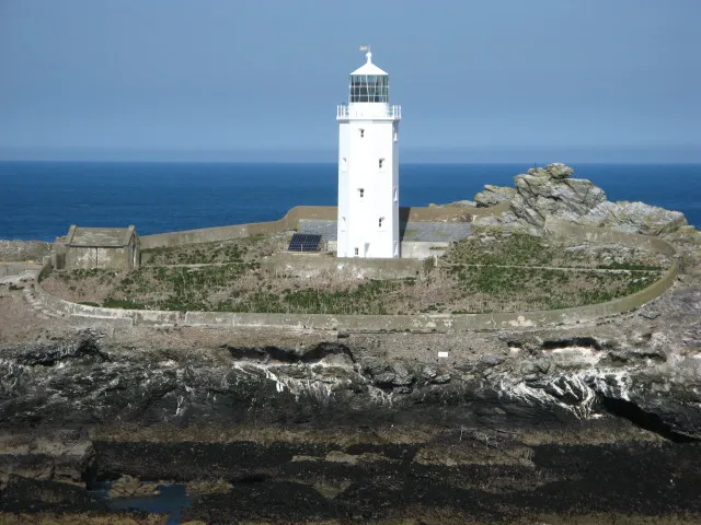
Godrevy Lighthouse (Cornish: Golowji Godrevi) was built in 1858–1859 on Godrevy Island in St Ives Bay, Cornwall. Standing approximately 300 metres (980 ft) off Godrevy Head, it marks the Stones reef, which has been a hazard to shipping for centuries.
Source: Wikipedia · CC BY-SA 4.0
At a glance
- Built
- 1859
- Architect
- James Walker
- Heritage designation
- Grade II listed building
- Height
- 26 m
Source: Wikidata
Photos of Godrevy Lighthouse
-

ArildV · CC BY-SA 4.0 -

Chris Combe from York, UK · CC BY-SA 2.0 -

Darren Shilson from St Stephen, UK, United Kingdom · CC BY 2.0 -

Andrew Bone from Weymouth, England · CC BY 2.0 -

chris lovelock · CC BY 2.0


Climate of Godrevy Lighthouse
Best months for sightseeingBest months for sightseeing: June–September.
This month · November
A wet month
Day 12° · Night 8° · Rain 118 mm
- Hottest month
- August (day 20°)
- Coldest month
- February (night 5°)
- Wettest month
- January (127 mm)
- Driest month
- July (52 mm)
Bars: average monthly low and high temperature. Below: precipitation. Monthly averages for 1970–2000 at about 18 km resolution, adjusted for elevation. Highlighted months are mild and relatively dry. Source: WorldClim 2.1 (CC BY 4.0).
Show values as a table
| Month | Jan | Feb | Mar | Apr | May | Jun | Jul | Aug | Sep | Oct | Nov | Dec |
|---|---|---|---|---|---|---|---|---|---|---|---|---|
| Average high (°C) | 10° | 10° | 11° | 12° | 15° | 17° | 19° | 20° | 18° | 15° | 12° | 11° |
| Average low (°C) | 5° | 5° | 6° | 6° | 9° | 11° | 13° | 13° | 12° | 10° | 8° | 6° |
| Precipitation (mm) | 127 | 97 | 87 | 60 | 60 | 60 | 52 | 72 | 88 | 104 | 118 | 124 |
Other places to visit in this season: June July August September
How to get to Godrevy Lighthouse
The nearest airport is Cornwall Airport Newquay (NQY), 36 km to the northeast as the crow flies. For international flights: Cardiff International Airport (CWL) (194 km). The nearest large city is Plymouth, 91 km to the east.
Airports
- Cornwall Airport Newquay (NQY) Newquay 36 kmnortheast
- Exeter International Airport (EXT) Exeter, Devon 151 kmeast
- Cardiff International Airport (CWL) Cardiff 194 kmnortheast
Nearby large cities
- Plymouth Population: 260.2K 91 kmeast
- Exeter Population: 130.7K 143 kmnortheast
- Swansea Population: 300.4K 184 kmnortheast
- Cardiff Population: 372.1K 208 kmnortheast
- Brest Population: 144.9K 216 kmsouth
Straight-line distances; road distances are longer. Airport data: OurAirports.
Day trips from Godrevy Lighthouse
Within 100 km: 96 historic and cultural sites, 346 natural sites, 133 lakes, rivers and coasts.
0–25 km80 places
- Chapel Porth Beach Beach 13 kmNE
- Perranporth Beach Beach 21 kmNE
- Holywell Bay Beach Beach 25 kmNE
- Saint Michaels Mount Island 15 kmSW
25–60 km213 places
- Sennen Cove Beach 28 kmSW
- Lansallos Beach Beach 59 kmE
- Vault Beach Beach 43 kmE
- Gylly Beach Beach 26 kmSE
60–100 km282 places
- Tregantle Beach Beach 81 kmE
- Buckator Beach Beach 73 kmNE
- Bishop Rock Island 85 kmSW
- White Island Island 70 kmSW
Straight-line distances.
Nearby attractions & nature
Everything nearby-
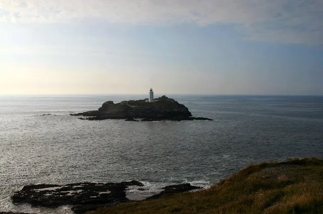 Godrevy Island Island, England0.8 km N
-
Red River River, Gwinear-Gwithian1.6 km SE
-
Hells Mouth Stack Mountain, Cornwall2.8 km E
-
St Ives Lighthouse Landmark, St. Ives6.3 km SW
-
St Ives Bay Sands Mountain, Hayle4.7 km S
-
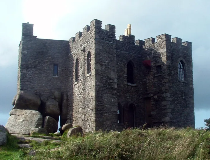 Carn Brea Castle Historic site, Carn Brea11 km E
-
Saint Ives Bay Natural site, Cornwall4.1 km SW
-
Crane Island Island, Illogan5.7 km E
Nearest towns and villages
-
Gwithian Village, Gwinear-Gwithian2.6 km SE
-
Hayle Town, Hayle6.7 km S
-
Upton Towans Village, Gwinear-Gwithian3.8 km S
-
St Ives Town, St. Ives7.3 km SW
Sources & licences
Data last updated: · 2 independent sources