Land's End
Local name: Pedn an Wlas
Located in Sennen, Cornwall Coordinates: 50°03′57″ N 5°42′58″ W
- Elevation
- 23 m
- above sea level
- Local time
- UTC+00:00
- Europe/London · UTC+00:00
- Airports
- NQY Cornwall Airport Newquay66 km
- EXT Exeter International Airport180 km
About Land's End
Land's End is a natural site. Location: Sennen, Cornwall.
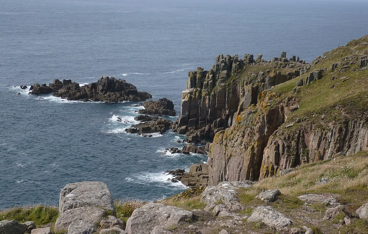
Land's End (Cornish: Penn an Wlas or Pedn an Wlas) is a headland and tourist and holiday complex in western Cornwall, England, United Kingdom, on the Penwith peninsula about eight miles (13 km) west-south-west of Penzance at the western end of the A30 road. To the east of it is the English Channel, and to the west the Celtic Sea. Land's End is the most westerly point of mainland England and the most south-westerly point in Great Britain. However, it is not the westernmost point on mainland Great Britain.
Source: Wikipedia · CC BY-SA 4.0
Climate of Land's End
Best months for sightseeingBest months for sightseeing: June–September.
This month · November
A wet month
Day 12° · Night 8° · Rain 120 mm
- Hottest month
- August (day 19°)
- Coldest month
- February (night 6°)
- Wettest month
- January (132 mm)
- Driest month
- July (51 mm)
Bars: average monthly low and high temperature. Below: precipitation. Monthly averages for 1970–2000 at about 18 km resolution, adjusted for elevation. Highlighted months are mild and relatively dry. Source: WorldClim 2.1 (CC BY 4.0).
Show values as a table
| Month | Jan | Feb | Mar | Apr | May | Jun | Jul | Aug | Sep | Oct | Nov | Dec |
|---|---|---|---|---|---|---|---|---|---|---|---|---|
| Average high (°C) | 10° | 10° | 10° | 12° | 14° | 17° | 19° | 19° | 17° | 15° | 12° | 11° |
| Average low (°C) | 6° | 6° | 6° | 7° | 9° | 11° | 13° | 14° | 12° | 10° | 8° | 7° |
| Precipitation (mm) | 132 | 102 | 89 | 61 | 58 | 60 | 51 | 72 | 89 | 106 | 120 | 128 |
Other places to visit in this season: June July August September
How to get to Land's End
The nearest airport is Cornwall Airport Newquay (NQY), 66 km to the northeast as the crow flies. For international flights: Brest Bretagne airport (BES) (203 km). The nearest large city is Plymouth, 117 km to the east.
Airports
- Cornwall Airport Newquay (NQY) Newquay 66 kmnortheast
- Exeter International Airport (EXT) Exeter, Devon 180 kmnortheast
- Brest Bretagne airport (BES) Brest 203 kmsoutheast
Nearby large cities
- Plymouth Population: 260.2K 117 kmeast
- Exeter Population: 130.7K 172 kmnortheast
- Brest Population: 144.9K 207 kmsoutheast
- Swansea Population: 300.4K 213 kmnortheast
- Cardiff Population: 372.1K 238 kmnortheast
Straight-line distances; road distances are longer. Airport data: OurAirports.
Nearest towns and villages
-
Land's End Village, Sennen0.2 km E
-
Trevescan Village, Sennen1.5 km E
-
Sennen Village, Sennen1.7 km NE
-
Mayon Village, Sennen1.9 km NE
-
Sennen Cove Village, Sennen2 km NE
-
Carn Towan Village, Sennen2.6 km NE
Nearby attractions & nature
Everything nearby-
Bosistow Island Mountain, St. Levan2.4 km SE
-
Cowloe Island, Cornwall1.8 km N
-
Sennen Cove Beach, Sennen2.3 km NE
-
Mill Bay Natural site, England2.1 km SE
-
Gwennap Head Natural site, St. Levan4.3 km SE
-
Whitesand Bay Natural site, England4 km N
-
Carn Brea Mountain, St. Just5.4 km NE
-
Porthgwarra Beach Beach, St. Levan4.5 km SE
Sources & licences
Data last updated: · 2 independent sources