- Local time
- UTC+00:00
- Europe/London · UTC+00:00
- Elevation
- 273 m
- above sea level
- Airports
- NCL Newcastle International Airport63 km
- MME Teesside International Airport100 km
About Tower Brae
Tower Brae is a landmark. Location: Askerton, Cumberland. The best months to visit are June–August. The nearest airport is Newcastle International Airport (63 km). Nearby sights include Collin Bank and Wintershields.
Photos of Tower Brae
-
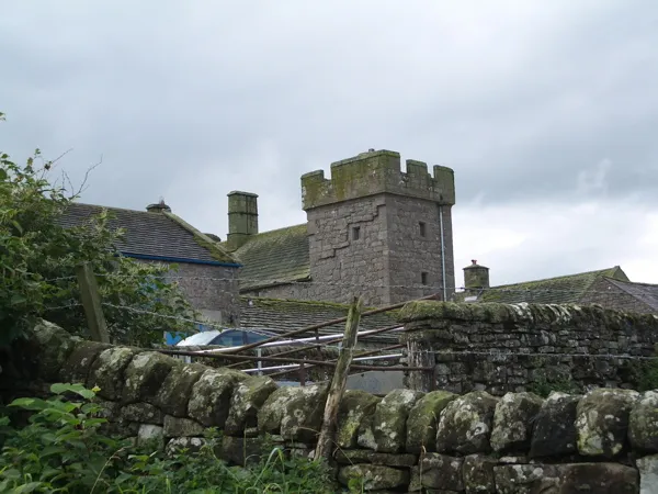
Askerton Castle Keith Salvesen · CC BY-SA 2.0 -
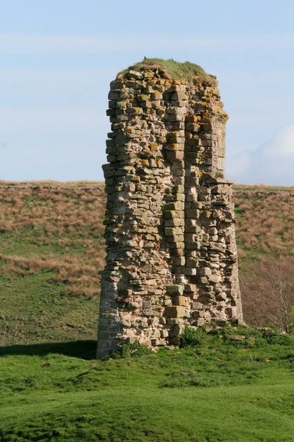
Triermain Castle Peter McDermott · CC BY-SA 2.0 -
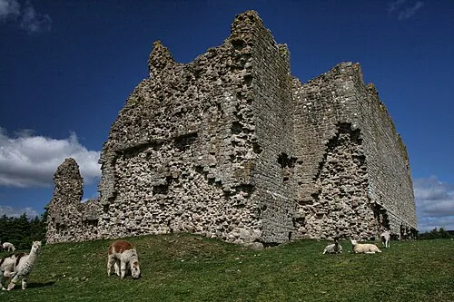
Bewcastle Castle Peter McDermott · CC BY-SA 2.0


Climate of Tower Brae
Best months for sightseeingBest months for sightseeing: June–August.
This month · November
A wet month
Day 8° · Night 2° · Rain 103 mm
- Hottest month
- July (day 18°)
- Coldest month
- January (night -1°)
- Wettest month
- January (106 mm)
- Driest month
- April (61 mm)
Bars: average monthly low and high temperature. Below: precipitation. Monthly averages for 1970–2000 at about 18 km resolution, adjusted for elevation. Highlighted months are mild and relatively dry. Source: WorldClim 2.1 (CC BY 4.0).
Show values as a table
| Month | Jan | Feb | Mar | Apr | May | Jun | Jul | Aug | Sep | Oct | Nov | Dec |
|---|---|---|---|---|---|---|---|---|---|---|---|---|
| Average high (°C) | 5° | 6° | 7° | 10° | 13° | 16° | 18° | 18° | 15° | 12° | 8° | 6° |
| Average low (°C) | -1° | 0° | 1° | 2° | 4° | 7° | 9° | 9° | 7° | 5° | 2° | 0° |
| Precipitation (mm) | 106 | 77 | 87 | 61 | 64 | 68 | 74 | 83 | 89 | 101 | 103 | 106 |
How to get to Tower Brae
The nearest airport is Newcastle International Airport (NCL), 63 km to the east as the crow flies. The nearest large city is Newcastle upon Tyne, 68 km to the east.
Airports
- Newcastle International Airport (NCL) Newcastle upon Tyne, Tyne and Wear 63 kmeast
- Teesside International Airport (MME) Darlington, Durham 100 kmsoutheast
- Edinburgh Airport (EDI) Ingliston, Edinburgh 110 kmnorthwest
Nearby large cities
- Newcastle upon Tyne Population: 300.1K 68 kmeast
- Sunderland Population: 170.1K 84 kmeast
- Middlesbrough Population: 142.7K 106 kmsoutheast
- Edinburgh Population: 515K 106 kmnorth
- Glasgow Population: 626.4K 135 kmnorthwest
Straight-line distances; road distances are longer. Airport data: OurAirports.
Day trips from Tower Brae
Within 100 km: 772 historic and cultural sites, 3,056 natural sites, 626 lakes, rivers and coasts.
0–25 km207 places
- Fishgarth Holm Island 23 kmS
- Coathouse Island Island 22 kmSW
- Little Corby Island Island 18 kmSW
- Goat Island Island 8 kmW
25–60 km1,287 places
- Powillimount Beach Beach 60 kmW
- Kirkland Scar Island 34 kmW
- Cherry Holm Island 58 kmS
- Rampsholme Island Island 59 kmSW
60–100 km2,960 places
- High Moor Mountain 97 kmS
- St. Bees Beach Seafront Beach 86 kmSW
- Cocklawburn Beach Beach 89 kmNE
- Cheswick Sands Beach 89 kmNE
Straight-line distances.
Nearby attractions & nature
Everything nearby-
Collin Bank Landmark, Askerton0.9 km NE
-
Wintershields Landmark, Askerton1.1 km W
-
Bewcastle Castle Historic site, Bewcastle2.3 km N
-
The Beacon Mountain, Askerton1.4 km SE
-
Askerton Castle Historic site, Askerton3.6 km SW
-
Fanum Cocidi Historic site, Bewcastle2.4 km N
-
Hall Hills Landmark, Bewcastle2.5 km N
-
Braes Tower Landmark, Bewcastle3 km N
Nearest towns and villages
-
Shopford Village, Askerton0.8 km NW
-
Bewcastle Village, Bewcastle2.3 km N
-
Kingwater Village, Cumberland4.6 km E
-
Kirkcambeck Village, Askerton4.8 km SW
Sources & licences
Data last updated: