Anthorn VLF Transmitter, Outer Ring Mast 4
Located in Bowness, Cumberland Coordinates: 54°54′33″ N 3°16′09″ W
- Local time
- UTC+00:00
- Europe/London · UTC+00:00
- Elevation
- 12 m
- above sea level
- Airports
- NCL Newcastle International Airport102 km
- PIK Glasgow Prestwick Airport106 km
About Anthorn VLF Transmitter, Outer Ring Mast 4
Anthorn VLF Transmitter, Outer Ring Mast 4 is a landmark. Location: Bowness, Cumberland. The best months to visit are June–August. The nearest airport is Newcastle International Airport (102 km). Nearby sights include Anthorn VLF Transmitter, Inner Ring Mast 4 and Anthorn VLF Transmitter, Inner Ring Mast 5.
Climate of Anthorn VLF Transmitter, Outer Ring Mast 4
Best months for sightseeingBest months for sightseeing: June–August.
This month · November
A cold month
Day 9° · Night 4° · Rain 98 mm
- Hottest month
- July (day 19°)
- Coldest month
- January (night 2°)
- Wettest month
- December (103 mm)
- Driest month
- April (53 mm)
Bars: average monthly low and high temperature. Below: precipitation. Monthly averages for 1970–2000 at about 18 km resolution, adjusted for elevation. Highlighted months are mild and relatively dry. Source: WorldClim 2.1 (CC BY 4.0).
Show values as a table
| Month | Jan | Feb | Mar | Apr | May | Jun | Jul | Aug | Sep | Oct | Nov | Dec |
|---|---|---|---|---|---|---|---|---|---|---|---|---|
| Average high (°C) | 7° | 7° | 9° | 12° | 15° | 17° | 19° | 19° | 16° | 13° | 9° | 7° |
| Average low (°C) | 2° | 2° | 3° | 4° | 6° | 9° | 11° | 11° | 9° | 7° | 4° | 2° |
| Precipitation (mm) | 100 | 75 | 78 | 53 | 55 | 61 | 70 | 78 | 84 | 102 | 98 | 103 |
How to get to Anthorn VLF Transmitter, Outer Ring Mast 4
The nearest airport is Newcastle International Airport (NCL), 102 km to the east as the crow flies. The nearest large city is Newcastle upon Tyne, 106 km to the east.
Airports
- Newcastle International Airport (NCL) Newcastle upon Tyne, Tyne and Wear 102 kmeast
- Glasgow Prestwick Airport (PIK) Prestwick, South Ayrshire 106 kmnorthwest
- Edinburgh Airport (EDI) Ingliston, Edinburgh 116 kmnorth
Nearby large cities
- Newcastle upon Tyne Population: 300.1K 106 kmeast
- Edinburgh Population: 515K 116 kmnorth
- Sunderland Population: 170.1K 121 kmeast
- Blackpool Population: 145K 122 kmsouth
- Glasgow Population: 626.4K 123 kmnorthwest
Straight-line distances; road distances are longer. Airport data: OurAirports.
Day trips from Anthorn VLF Transmitter, Outer Ring Mast 4
Within 100 km: 560 historic and cultural sites, 3,123 natural sites, 688 lakes, rivers and coasts.
0–25 km150 places
- Powillimount Beach Beach 20 kmW
- Kirkland Scar Island 7 kmNE
- Cottage Island Island 19 kmN
- Dormont Island Island 20 kmNW
25–60 km1,820 places
- St. Bees Beach Seafront Beach 51 kmSW
- Hestan Island Island 36 kmW
- Green Island Island 54 kmW
- Wood Howe Island 54 kmSE
60–100 km2,401 places
- High Moor Mountain 77 kmS
- Roanhead Beach Beach 83 kmS
- Tuft Rock Island 64 kmS
- Walney Island Island 89 kmS
Straight-line distances.
Nearby attractions & nature
Everything nearby-
Anthorn VLF Transmitter, Inner Ring Mast 4 Landmark, Bowness0.4 km W
-
Anthorn VLF Transmitter, Inner Ring Mast 5 Landmark, Bowness0.4 km NW
-
Anthorn VLF Transmitter, Central Mast Landmark, Bowness0.7 km NW
-
Anthorn VLF Transmitter, Outer Ring Mast 3 Landmark, Bowness0.7 km SW
-
Anthorn VLF Transmitter, Inner Ring Mast 3 Landmark, Bowness0.8 km W
-
Anthorn VLF Transmitter, Inner Ring Mast 6 Landmark, Bowness0.8 km NW
-
Anthorn VLF Transmitter, Inner Ring Mast 1 Landmark, Bowness1 km NW
-
Anthorn VLF Transmitter, Inner Ring Mast 2 Landmark, Bowness1 km W
Nearest towns and villages
-
Anthorn Village, Bowness0.5 km W
-
Cardurnock Village, Bowness1.2 km NW
-
Kirkbride Village, Kirkbride4.7 km E
-
Newton Arlosh Village, Holme East Waver3 km SE
More sights in Bowness
-
Anthorn VLF Transmitter, Outer Ring Mast 1 Landmark, Bowness1.1 km NW
-
Anthorn VLF Transmitter, Outer Ring Mast 2 Landmark, Bowness1.1 km W
-
Cardurnock Tower Landmark, Bowness1.8 km NW
-
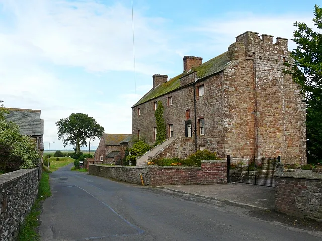 Drumburgh Castle Historic site, Bowness8.1 km E
-
Bowness on Solway Landmark, Bowness6 km NE
Sources & licences
Data last updated: