
- Elevation
- 24 m
- above sea level
- Local time
- UTC+00:00
- Europe/London · UTC+00:00
- Airports
- NCL Newcastle International Airport107 km
- PIK Glasgow Prestwick Airport113 km
About Langrigg
Langrigg is a village. Location: Bromfield, Cumberland. Elevation: 24 m.
Langrigg is a hamlet in Cumbria, England. It lies to the northeast of Aspatria and south of Abbeytown, just to the southwest of Bromfield. Historically, it formed part of the Langrigg and Mealrigg township, in the Parish of Bromfield, then an independent parish from 1894 until 1934.
Source: Wikipedia · CC BY-SA 4.0
Photos of Langrigg
-
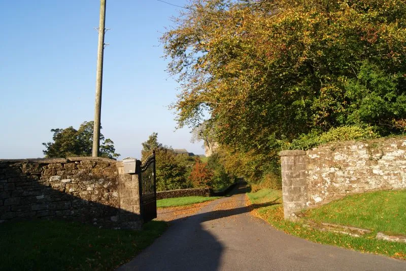
Hayton Castle Belinda E Wroe · CC BY 2.0

Climate of Langrigg
Best months for sightseeingBest months for sightseeing: June–August.
This month · November
A wet month
Day 9° · Night 4° · Rain 121 mm
- Hottest month
- July (day 19°)
- Coldest month
- January (night 2°)
- Wettest month
- December (129 mm)
- Driest month
- April (66 mm)
Bars: average monthly low and high temperature. Below: precipitation. Monthly averages for 1970–2000 at about 18 km resolution, adjusted for elevation. Highlighted months are mild and relatively dry. Source: WorldClim 2.1 (CC BY 4.0).
Show values as a table
| Month | Jan | Feb | Mar | Apr | May | Jun | Jul | Aug | Sep | Oct | Nov | Dec |
|---|---|---|---|---|---|---|---|---|---|---|---|---|
| Average high (°C) | 7° | 7° | 9° | 12° | 15° | 17° | 19° | 19° | 16° | 13° | 9° | 7° |
| Average low (°C) | 2° | 2° | 3° | 4° | 6° | 9° | 11° | 11° | 9° | 7° | 4° | 2° |
| Precipitation (mm) | 126 | 93 | 97 | 66 | 66 | 69 | 78 | 91 | 99 | 125 | 121 | 129 |
How to get to Langrigg
The nearest airport is Newcastle International Airport (NCL), 107 km to the east as the crow flies. The nearest large city is Newcastle upon Tyne, 110 km to the east.
Airports
- Newcastle International Airport (NCL) Newcastle upon Tyne, Tyne and Wear 107 kmeast
- Glasgow Prestwick Airport (PIK) Prestwick, South Ayrshire 113 kmnorthwest
- Isle of Man Airport (IOM) Castletown, Rushen 117 kmsouthwest
Nearby large cities
- Newcastle upon Tyne Population: 300.1K 110 kmeast
- Blackpool Population: 145K 111 kmsouth
- Preston Population: 313.3K 122 kmsouth
- Sunderland Population: 170.1K 124 kmeast
- Edinburgh Population: 515K 128 kmnorth
Straight-line distances; road distances are longer. Airport data: OurAirports.
Day trips from Langrigg
Within 100 km: 538 historic and cultural sites, 2,924 natural sites, 650 lakes, rivers and coasts.
0–25 km224 places
- Powillimount Beach Beach 20 kmNW
- Kirkland Scar Island 18 kmNE
- Buckholme Island Island 13 kmS
- Bassenthwaite Lake Lake 18 kmS
25–60 km1,683 places
- St. Bees Beach Seafront Beach 40 kmSW
- Tuft Rock Island 53 kmSE
- Murrays Isles Island 60 kmW
- Hestan Island Island 33 kmW
60–100 km2,205 places
- British Isles Island 100 kmSW
- High Moor Mountain 66 kmS
- Roanhead Beach Beach 71 kmS
- Walney Island Island 77 kmS
Straight-line distances.
Nearby attractions & nature
Everything nearby-
St Mungos Castle Historic site, Bromfield1.8 km NE
-
Crookdake Hall Landmark, Bromfield3.6 km SE
-
Newton Castle Historic site, Westnewton3.9 km SW
-
Hards Farm Hill Mountain, Holme St. Cuthbert4.2 km W
-
Hayton Castle Historic site, Hayton and Mealo6.8 km SW
-
Harbybrow Tower Landmark, Allhallows5.1 km SE
Sources & licences
Data last updated: · 2 independent sources