Broadwath
Located in Wetheral, Cumberland Coordinates: 54°53′24″ N 2°48′15″ W
- Elevation
- 47 m
- above sea level
- Local time
- UTC+00:00
- Europe/London · UTC+00:00
About Broadwath
Broadwath is a village. Location: Wetheral, Cumberland. Elevation: 47 m.
Broadwath is a hamlet in the Cumberland district, in the English county of Cumbria. Broadwath is on Cairn Beck. Nearby settlements include the villages of Wetheral, Warwick Bridge, Great Corby and Heads Nook.
Read more on Wikipedia Text: Wikipedia contributors · CC BY-SA 4.0 · shortened
In comparison
- Nearest larger town: Great Corby, 2 km SW
- 50 sights and natural places within 10 km Our Lady and St Wilfrid Roman Catholic Church, Corby Castle
Climate of Broadwath
Best months for sightseeing: June–August.
| Month | Jan | Feb | Mar | Apr | May | Jun | Jul | Aug | Sep | Oct | Nov | Dec |
|---|---|---|---|---|---|---|---|---|---|---|---|---|
| Average high (°C) | 7° | 7° | 9° | 11° | 15° | 17° | 19° | 19° | 16° | 13° | 9° | 7° |
| Average low (°C) | 1° | 1° | 2° | 4° | 6° | 9° | 11° | 11° | 9° | 6° | 3° | 2° |
| Precipitation (mm) | 89 | 64 | 73 | 52 | 55 | 60 | 66 | 73 | 75 | 85 | 89 | 91 |
Monthly averages for 1970–2000 at about 18 km resolution, adjusted for elevation. Highlighted months are mild and relatively dry. Source: WorldClim 2.1 (CC BY 4.0).
Airports nearest to Broadwath
- Newcastle International Airport (NCL) Newcastle upon Tyne, Tyne and Wear 73 km
- Teesside International Airport (MME) Darlington, Durham 98 km
- Edinburgh Airport (EDI) Ingliston, Edinburgh 123 km
Straight-line distance; airports with scheduled flights only. Source: OurAirports (public domain).
Nearby attractions & nature
Everything nearby-
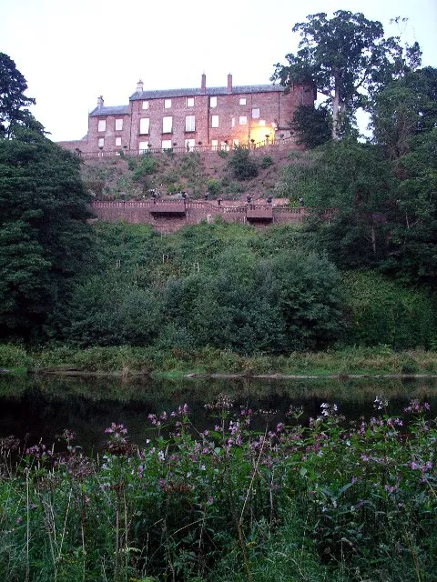 Corby Castle Historic site, Wetheral1.8 km SW
-
Our Lady and St Wilfrid Roman Catholic Church Attraction, Wetheral1.8 km NW
-
Little Corby Island Island, Hayton2.3 km NW
-
Hayton Castle Hill Historic site, Hayton3.3 km NE
-
Coathouse Island Island, Wetheral3 km S
-
Tootop Wood Mountain, Hayton4.8 km NE
Sources & licences
Data last updated: · 2 independent sources