- Elevation
- 48 m
- above sea level
- Local time
- UTC+00:00
- Europe/London · UTC+00:00
- Places inside
- 1
- listed under Low Dinsdale
- Airports
- MME Teesside International Airport3 km
- NCL Newcastle International Airport61 km
About Low Dinsdale
Low Dinsdale is a municipality. Location: Darlington, England. Elevation: 48 m. The best months to visit are June–September. The nearest airport is Teesside International Airport (3 km). Nearby sights include Tower Hill and The Darlington Arena.
Climate of Low Dinsdale
Best months for sightseeingBest months for sightseeing: June–September.
This month · November
A cold month
Day 9° · Night 4° · Rain 67 mm
- Hottest month
- July (day 20°)
- Coldest month
- January (night 1°)
- Wettest month
- November (67 mm)
- Driest month
- February (43 mm)
Bars: average monthly low and high temperature. Below: precipitation. Monthly averages for 1970–2000 at about 18 km resolution, adjusted for elevation. Highlighted months are mild and relatively dry. Source: WorldClim 2.1 (CC BY 4.0).
Show values as a table
| Month | Jan | Feb | Mar | Apr | May | Jun | Jul | Aug | Sep | Oct | Nov | Dec |
|---|---|---|---|---|---|---|---|---|---|---|---|---|
| Average high (°C) | 7° | 7° | 9° | 11° | 14° | 17° | 20° | 20° | 17° | 13° | 9° | 7° |
| Average low (°C) | 1° | 1° | 2° | 3° | 6° | 9° | 11° | 11° | 9° | 6° | 4° | 2° |
| Precipitation (mm) | 65 | 43 | 53 | 45 | 49 | 53 | 50 | 63 | 60 | 65 | 67 | 65 |
Other places to visit in this season: June July August September
How to get to Low Dinsdale
The nearest airport is Teesside International Airport (MME), 3 km to the east as the crow flies. For international flights: Newcastle International Airport (NCL) (61 km). The nearest large city is Middlesbrough, 18 km to the northeast.
Airports
- Teesside International Airport (MME) Darlington, Durham 3 kmeast
- Newcastle International Airport (NCL) Newcastle upon Tyne, Tyne and Wear 61 kmnorth
- Leeds Bradford Airport (LBA) Leeds, West Yorkshire 72 kmsouth
Nearby large cities
- Middlesbrough Population: 142.7K 18 kmnortheast
- Sunderland Population: 170.1K 45 kmnorth
- Newcastle upon Tyne Population: 300.1K 53 kmnorth
- York Population: 156.1K 66 kmsoutheast
- Leeds Population: 536.3K 79 kmsouth
Straight-line distances; road distances are longer. Airport data: OurAirports.
Day trips from Low Dinsdale
Within 100 km: 700 historic and cultural sites, 1,117 natural sites, 234 lakes, rivers and coasts.
0–25 km84 places
- Michell's Island Island 16 kmW
- Newsham Tarn Lake 22 kmW
- Roseberry Topping Mountain 24 kmE
- Cringle Moor - Drake Howe Mountain 22 kmSE
25–60 km514 places
- Seaton Carew Beach Beach 26 kmNE
- Redcar Beach Beach 29 kmNE
- Whitby Beach Beach 54 kmE
- The Island Island 31 kmS
60–100 km1,453 places
- Great Britain Island 65 kmSW
- North Beach Beach 96 kmSE
- Fraisethorpe Beach Beach 97 kmSE
- Tuft Rock Island 95 kmW
Straight-line distances.
Places in Low Dinsdale
1 placeCities & villages1
- Low Dinsdale · Village
Nearby attractions & nature
Everything nearby-
Tower Hill Historic site, Middleton St. George0.9 km NE
-
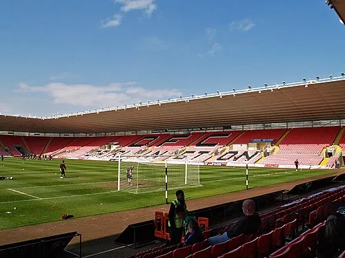 The Darlington Arena Landmark, Hurworth3.7 km W
-
Blackwell Castle Hill Historic site, Darlington6.6 km W
-
Sadberge Castle Historic site, Sadberge5 km N
-
Saint Peter's Church Attraction, Croft-on-Tees5.4 km W
-
Egglescliffe Castleholmes Historic site, Aislaby7.3 km E
-
Ingleby Barwick Round Hill Historic site, Ingleby Barwick9.4 km E
-
Stapleton Castlegathe Historic site, Stapleton7.6 km W
Sources & licences
Data last updated: