Wardlow Hay Cop
Located in Wardlow, Derbyshire Dales District Coordinates: 53°15′45″ N 1°44′02″ W
- Elevation
- 370 m
- above sea level
- Local time
- UTC+00:00
- Europe/London · UTC+00:00
- Airports
- MAN Manchester Airport38 km
- EMA East Midlands Airport55 km
About Wardlow Hay Cop
Wardlow Hay Cop is a mountain. Location: Wardlow, Derbyshire Dales District. Elevation: 370 m.
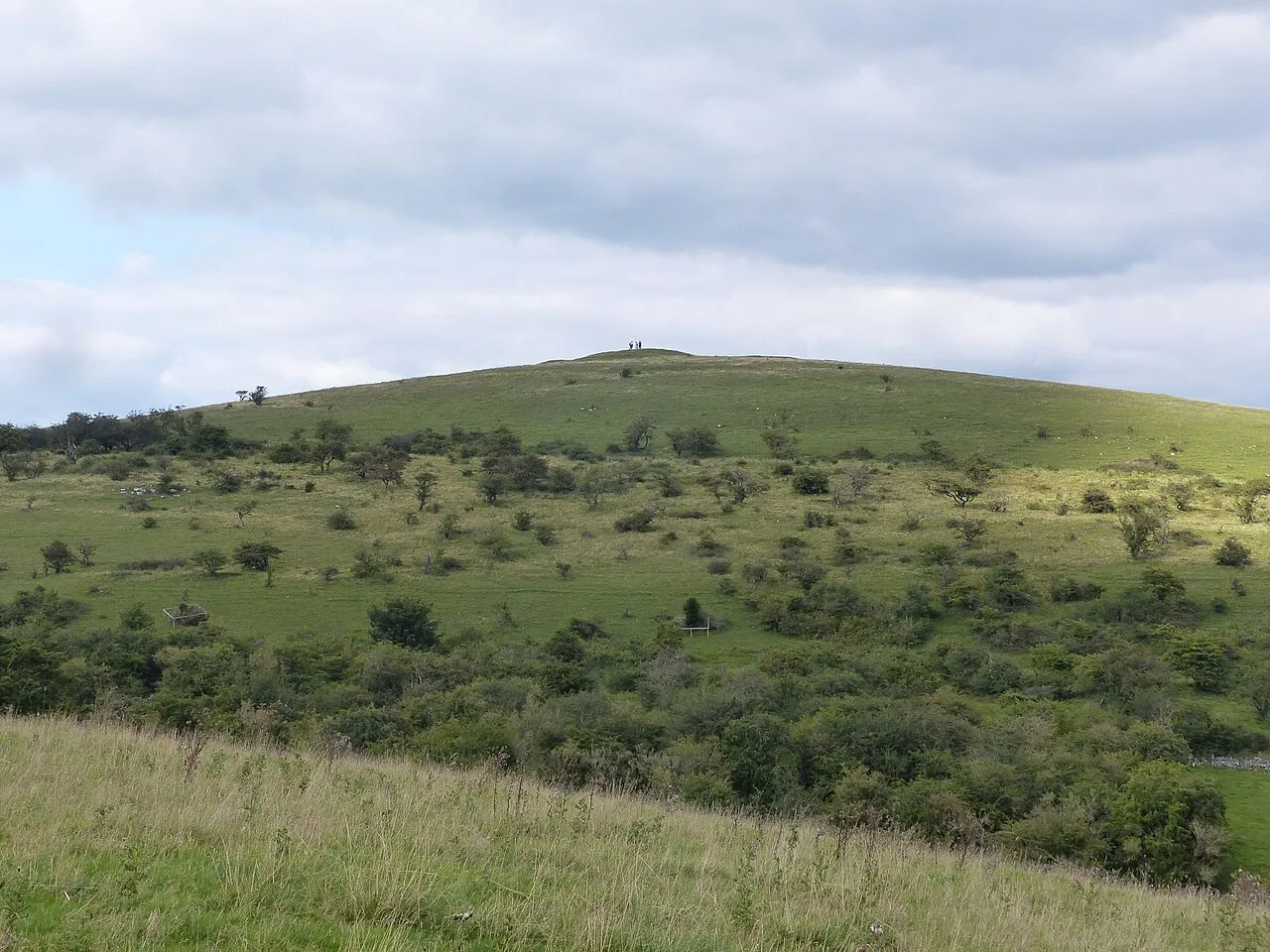
Wardlow Hay Cop is a geographical feature, a knoll about 7 miles (11 km) east of Buxton and about 4 miles (6 km) north-west of Bakewell, in Derbyshire, England. Cressbrook Dale is nearby to the west, and the village of Wardlow lies to the north-east. It is in the White Peak, an area of carboniferous limestone in the Peak District. Its elevation is 370 metres (1,210 ft), and its prominence is 53 metres (174 ft). There is a bowl barrow at the summit, on which a triangulation pillar stands.
Source: Wikipedia · CC BY-SA 4.0
Climate of Wardlow Hay Cop
Best months for sightseeingBest months for sightseeing: June–August.
This month · November
A wet month
Day 8° · Night 2° · Rain 110 mm
- Hottest month
- July (day 18°)
- Coldest month
- February (night 0°)
- Wettest month
- December (113 mm)
- Driest month
- May (71 mm)
Bars: average monthly low and high temperature. Below: precipitation. Monthly averages for 1970–2000 at about 18 km resolution, adjusted for elevation. Highlighted months are mild and relatively dry. Source: WorldClim 2.1 (CC BY 4.0).
Show values as a table
| Month | Jan | Feb | Mar | Apr | May | Jun | Jul | Aug | Sep | Oct | Nov | Dec |
|---|---|---|---|---|---|---|---|---|---|---|---|---|
| Average high (°C) | 5° | 5° | 7° | 9° | 13° | 16° | 18° | 18° | 15° | 11° | 8° | 6° |
| Average low (°C) | 0° | 0° | 1° | 2° | 5° | 8° | 10° | 10° | 8° | 5° | 2° | 1° |
| Precipitation (mm) | 108 | 80 | 87 | 74 | 71 | 80 | 71 | 87 | 86 | 104 | 110 | 113 |
How to get to Wardlow Hay Cop
The nearest airport is Manchester Airport (MAN), 38 km to the west as the crow flies. The nearest large city is Chesterfield, 21 km to the east.
Airports
- Manchester Airport (MAN) Manchester, Greater Manchester 38 kmwest
- East Midlands Airport (EMA) Nottingham, Leicestershire 55 kmsoutheast
- Leeds Bradford Airport (LBA) Leeds, West Yorkshire 67 kmnorth
Nearby large cities
- Chesterfield Population: 113.1K 21 kmeast
- Sheffield Population: 556.5K 22 kmnortheast
- Rotherham Population: 117.6K 31 kmnortheast
- Stockport Population: 139.1K 33 kmnorthwest
- Mansfield Population: 172K 38 kmeast
Straight-line distances; road distances are longer. Airport data: OurAirports.
Day trips from Wardlow Hay Cop
Within 100 km: 644 historic and cultural sites, 913 natural sites, 169 lakes, rivers and coasts.
0–25 km231 places
- Ladybower Reservoir Lake 13 kmN
- Howden Reservoir Lake 19 kmN
- Derwent Reservoir Lake 17 kmN
- Dale Dyke Reservoir Lake 18 kmN
25–60 km513 places
- Horninglow island Island 51 kmS
- Saint George's Island Island 42 kmNW
- Don Island Island 31 kmNE
- Barton Island Island 53 kmSE
60–100 km982 places
- Great Britain Island 84 kmN
- Thurstaston Beach Beach 94 kmW
- Formby Beach Beach 97 kmW
- Ainsdale Beach Beach 96 kmNW
Straight-line distances.
Nearest towns and villages
-
Tideswell Village, Tideswell3.1 km NW
-
Wardlow Village, Wardlow1.1 km N
-
Litton Village, Derbyshire Dales District1.6 km NW
-
Little Longstone Village, Derbyshire Dales District1.8 km S
-
Wardlow Mires Village, Wardlow1.6 km N
-
Great Longstone Village, Great Longstone3.2 km SE
Nearby attractions & nature
Everything nearby-
Longstone Moor Mountain, Great Longstone1.2 km SE
-
Littonslack Hill Mountain, Litton1.2 km W
-
Litton Edge Mountain, Litton1.9 km NW
-
Tideswell Dale Natural site, Derbyshire2.6 km SW
-
High Field Mountain, Brushfield2.2 km SW
-
Fin Cop Mountain, Ashford-in-the-Water3.1 km S
-
High Rake Mountain, Great Longstone3.1 km E
-
Darlton Quarry Mountain, Stoney Middleton3.9 km NE
Sources & licences
Data last updated: · 2 independent sources