Derbyshire Dales District
Located in Derbyshire, England Coordinates: 53°07′48″ N 1°42′20″ W
- Population
- 71,288
- 71.3K
- Elevation
- 313 m
- above sea level
- Local time
- UTC+00:00
- Europe/London · UTC+00:00
- Places inside
- 111
- listed under Derbyshire Dales District
- Airports
- EMA East Midlands Airport42 km
- MAN Manchester Airport45 km
About Derbyshire Dales District
Derbyshire Dales District is a municipality. Location: Derbyshire, England. Population: 71,288. Elevation: 313 m. The best months to visit are June–August. The nearest airport is East Midlands Airport (42 km). Nearby sights include Dove Dale and Gratton Hill.
Climate of Derbyshire Dales District
Best months for sightseeingBest months for sightseeing: June–August.
This month · November
A cold month
Day 8° · Night 2° · Rain 94 mm
- Hottest month
- July (day 19°)
- Coldest month
- February (night 0°)
- Wettest month
- November (94 mm)
- Driest month
- February (66 mm)
Bars: average monthly low and high temperature. Below: precipitation. Monthly averages for 1970–2000 at about 18 km resolution, adjusted for elevation. Highlighted months are mild and relatively dry. Source: WorldClim 2.1 (CC BY 4.0).
Show values as a table
| Month | Jan | Feb | Mar | Apr | May | Jun | Jul | Aug | Sep | Oct | Nov | Dec |
|---|---|---|---|---|---|---|---|---|---|---|---|---|
| Average high (°C) | 5° | 5° | 7° | 10° | 14° | 16° | 19° | 18° | 15° | 12° | 8° | 6° |
| Average low (°C) | 0° | 0° | 1° | 2° | 5° | 8° | 10° | 10° | 8° | 5° | 2° | 1° |
| Precipitation (mm) | 88 | 66 | 72 | 66 | 69 | 74 | 67 | 82 | 78 | 91 | 94 | 94 |
How to get to Derbyshire Dales District
The nearest airport is East Midlands Airport (EMA), 42 km to the southeast as the crow flies. The nearest large city is Chesterfield, 23 km to the northeast.
Airports
- East Midlands Airport (EMA) Nottingham, Leicestershire 42 kmsoutheast
- Manchester Airport (MAN) Manchester, Greater Manchester 45 kmnorthwest
- Birmingham Airport (BHX) Birmingham, West Midlands 75 kmsouth
Nearby large cities
- Chesterfield Population: 113.1K 23 kmnortheast
- Derby Population: 270.5K 28 kmsoutheast
- Sheffield Population: 556.5K 32 kmnortheast
- Mansfield Population: 172K 34 kmeast
- Stoke-on-Trent Population: 258.4K 35 kmsouthwest
Straight-line distances; road distances are longer. Airport data: OurAirports.
Places in Derbyshire Dales District
111 placesBar: population relative to the most populous place in this list.
Cities & villages59
- Abney and Abney Grange · Village
- Aldwark · Village
- Alkmonton · Village
- Ashbourne · Village
- Ashford-in-the-Water · Village
- Atlow · Village
- Bakewell · Village
- Ballidon · Village
- Baslow and Bubnell · Village
- Beeley · Village
- Biggin · Village
- Birchover · Village
- Blackwell in the Peak · Village
- Bonsall · Village
- Boylestone · Village
- Bradbourne · Village
- Bradley · Village
- Bradwell · Village
- Brailsford · Village
- Brassington · Village
- Brushfield · Village
- Callow · Village
- Calver · Village
- Carsington · Village
- Chatsworth · Village
- Chelmorton · Village
- Clifton and Compton · Village
- Cromford · Village
- Cubley · Village
- Curbar · Village
- Darley Dale · Village
- Doveridge · Village
- Eaton and Alsop · Village
- Edensor · Village
- Edlaston and Wyaston · Village
- Elton · Village
- Eyam · Village
- Fenny Bentley · Village
- Flagg · Village
- Foolow · Village
- Froggatt · Village
- Gratton · Village
- Great Hucklow · Village
- Great Longstone · Village
- Grindleford · Village
- Grindlow · Village
- Harthill · Village
- Hartington Middle Quarter · Village
- Hartington Nether Quarter · Village
- Hartington Town Quarter · Village
- Hassop · Village
- Hathersage · Village
- Hazlebadge · Village
- Highlow · Village
- Hognaston · Village
- Hollington · Village
- Hopton · Village
- Hulland · Village
- Hulland Ward · Village
Nearby attractions & nature
Everything nearby-
Dove Dale Natural site, England8.8 km SW
-
Gratton Hill Mountain, Alstonefield6.9 km W
-
Wetton Hill Mountain, Wetton8.9 km W
-
Narrowdale Hill Mountain, Alstonefield7.7 km W
-
Tideswell Dale Natural site, Derbyshire14 km N
-
Stanshope Pasture Mountain, Alstonefield8.2 km SW
-
Darley Dale Natural site, England8.2 km NE
-
Ilamtops Low Mountain, Ilam9 km SW
Other cities and towns in Derbyshire
-
North East Derbyshire Municipality, Derbyshire16 km NE
-
Amber Valley District Municipality, Derbyshire20 km SE
-
Chesterfield District Municipality, Derbyshire25 km NE
-
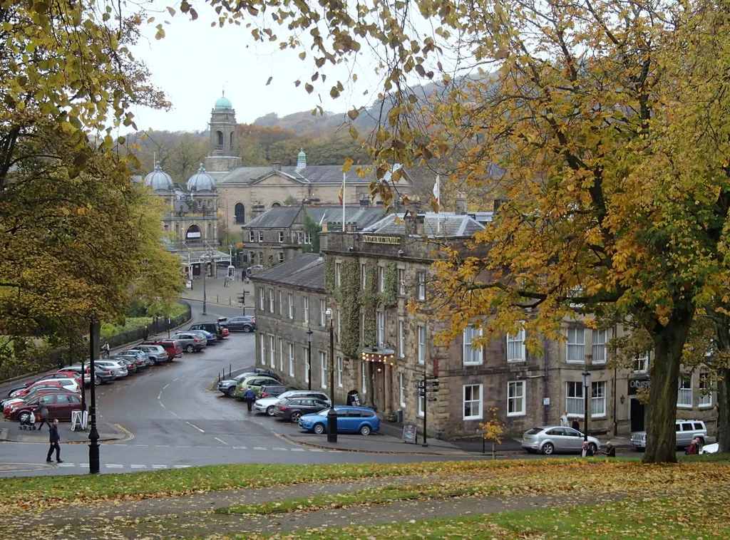 Buxton Town, High Peak District20 km NW
-
High Peak District Municipality, Derbyshire28 km N
-
Bolsover District Municipality, Derbyshire30 km E
Sources & licences
Data last updated: