- Elevation
- 169 m
- above sea level
- Local time
- UTC+00:00
- Europe/London · UTC+00:00
- Places inside
- 10
- listed under New Mills
- Airports
- MAN Manchester Airport20 km
- LPL Liverpool John Lennon Airport58 km
About New Mills
New Mills is a village. Location: High Peak District, Derbyshire. Elevation: 169 m. The best months to visit are June–August. The nearest airport is Manchester Airport (20 km). Nearby sights include Lantern Pike and Mellor Moor.
Photos of New Mills
-
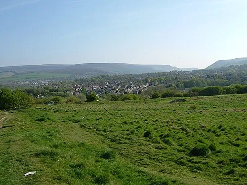
Ardotalia Clem Rutter, Rochester, Kent · CC BY-SA 3.0

Climate of New Mills
Best months for sightseeingBest months for sightseeing: June–August.
This month · November
A wet month
Day 9° · Night 4° · Rain 130 mm
- Hottest month
- July (day 20°)
- Coldest month
- February (night 1°)
- Wettest month
- December (132 mm)
- Driest month
- May (78 mm)
Bars: average monthly low and high temperature. Below: precipitation. Monthly averages for 1970–2000 at about 18 km resolution, adjusted for elevation. Highlighted months are mild and relatively dry. Source: WorldClim 2.1 (CC BY 4.0).
Show values as a table
| Month | Jan | Feb | Mar | Apr | May | Jun | Jul | Aug | Sep | Oct | Nov | Dec |
|---|---|---|---|---|---|---|---|---|---|---|---|---|
| Average high (°C) | 6° | 6° | 8° | 11° | 15° | 18° | 20° | 19° | 16° | 13° | 9° | 7° |
| Average low (°C) | 1° | 1° | 2° | 4° | 7° | 10° | 12° | 12° | 10° | 7° | 4° | 2° |
| Precipitation (mm) | 127 | 94 | 104 | 82 | 78 | 86 | 80 | 97 | 100 | 123 | 130 | 132 |
How to get to New Mills
The nearest airport is Manchester Airport (MAN), 20 km to the west as the crow flies. The nearest large city is Stockport, 11 km to the west.
Airports
- Manchester Airport (MAN) Manchester, Greater Manchester 20 kmwest
- Liverpool John Lennon Airport (LPL) Liverpool 58 kmwest
- Leeds Bradford Airport (LBA) Leeds, West Yorkshire 58 kmnorth
Nearby large cities
- Stockport Population: 139.1K 11 kmwest
- Oldham Population: 237.1K 19 kmnorthwest
- Manchester Population: 569K 20 kmnorthwest
- Salford Population: 129.8K 23 kmnorthwest
- Huddersfield Population: 149K 32 kmnortheast
Straight-line distances; road distances are longer. Airport data: OurAirports.
Day trips from New Mills
Within 100 km: 680 historic and cultural sites, 1,024 natural sites, 189 lakes, rivers and coasts.
0–25 km216 places
- Saint George's Island Island 21 kmNW
- Woodhead Reservoir Lake 14 kmNE
- Valehouse Reservoir Lake 11 kmN
- Torside Reservoir Lake 12 kmNE
25–60 km560 places
- The Island Island 45 kmNW
- Don Island Island 42 kmE
- Calder Island Island 45 kmNE
- Stennard Island Island 46 kmNE
60–100 km1,117 places
- Great Britain Island 68 kmN
- Thurstaston Beach Beach 77 kmW
- Formby Beach Beach 76 kmW
- Ainsdale Beach Beach 75 kmW
Straight-line distances.
Places in New Mills
10 placesBar: population relative to the most populous place in this list.
Cities & villages9
- Eaves Knoll · Neighbourhood
- Hague Bar · Village
- Hidebank · Neighbourhood
- High Lee · Neighbourhood
- Low Leighton · Neighbourhood
- Newtown · Neighbourhood
- Rowarth · Village
- Thornsett · Village
- Torr Top · Neighbourhood
Nearby attractions & nature
Everything nearby-
Lantern Pike Mountain, Hayfield1.9 km E
-
Mellor Moor Mountain, Stockport2.1 km W
-
Knarrs Mountain, Hayfield3.4 km NE
-
Chinley Churn Mountain, Chinley, Buxworth and Brownside4.4 km SE
-
Marpleridge Mountain, Stockport4.5 km W
-
Ardotalia Historic site, High Peak District7.4 km N
Sources & licences
Data last updated: