- Elevation
- 98 m
- above sea level
- Local time
- UTC+00:00
- Europe/London · UTC+00:00
- Airports
- EXT Exeter International Airport55 km
- NQY Cornwall Airport Newquay87 km
About Sorley
Sorley is a village. Location: Churchstow, South Hams District. Elevation: 98 m. The best months to visit are June–September. The nearest airport is Exeter International Airport (55 km). Nearby sights include Woodleigh Hill and Blackdown Camp.
Climate of Sorley
Best months for sightseeingBest months for sightseeing: June–September.
This month · November
A wet month
Day 11° · Night 6° · Rain 107 mm
- Hottest month
- July (day 19°)
- Coldest month
- February (night 3°)
- Wettest month
- December (123 mm)
- Driest month
- July (47 mm)
Bars: average monthly low and high temperature. Below: precipitation. Monthly averages for 1970–2000 at about 18 km resolution, adjusted for elevation. Highlighted months are mild and relatively dry. Source: WorldClim 2.1 (CC BY 4.0).
Show values as a table
| Month | Jan | Feb | Mar | Apr | May | Jun | Jul | Aug | Sep | Oct | Nov | Dec |
|---|---|---|---|---|---|---|---|---|---|---|---|---|
| Average high (°C) | 8° | 8° | 10° | 12° | 15° | 17° | 19° | 19° | 17° | 14° | 11° | 9° |
| Average low (°C) | 4° | 3° | 4° | 5° | 8° | 11° | 13° | 13° | 11° | 9° | 6° | 5° |
| Precipitation (mm) | 116 | 95 | 80 | 58 | 58 | 56 | 47 | 66 | 78 | 99 | 107 | 123 |
Other places to visit in this season: June July August September
How to get to Sorley
The nearest airport is Exeter International Airport (EXT), 55 km to the northeast as the crow flies. For international flights: Cardiff International Airport (CWL) (125 km). The nearest large city is Plymouth, 26 km to the west.
Airports
- Exeter International Airport (EXT) Exeter, Devon 55 kmnortheast
- Cornwall Airport Newquay (NQY) Newquay 87 kmwest
- Cardiff International Airport (CWL) Cardiff 125 kmnorth
Nearby large cities
- Plymouth Population: 260.2K 26 kmwest
- Exeter Population: 130.7K 50 kmnorth
- Poole Population: 151.5K 136 kmeast
- Cardiff Population: 372.1K 137 kmnorth
- Bournemouth Population: 163.6K 143 kmeast
Straight-line distances; road distances are longer. Airport data: OurAirports.
Day trips from Sorley
Within 100 km: 173 historic and cultural sites, 852 natural sites, 113 lakes, rivers and coasts.
0–25 km161 places
- Burgh Island Island 9 kmW
- Goodrington Sands Beach 20 kmNE
- Lannacombe Beach Beach 12 kmSE
- Gara Rock beach Beach 10 kmS
25–60 km347 places
- Oddicombe Beach Beach 28 kmNE
- Babbacombe Beach Beach 28 kmNE
- Tregantle Beach Beach 35 kmW
- Lansallos Beach Beach 56 kmW
60–100 km630 places
- Chesil Beach Beach 94 kmNE
- Saunton Sands Beach 94 kmN
- Charmouth Beach Beach 79 kmNE
- Vault Beach Beach 72 kmW
Straight-line distances.
Nearby attractions & nature
Everything nearby-
Woodleigh Hill Mountain, Woodleigh3 km N
-
Blackdown Camp Mountain, Loddiswell5.6 km N
-
Blackdown Rings Historic site, Loddiswell5.5 km N
-
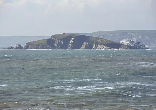 Burgh Island Island, Devon8.6 km W
-
Were Down Mountain, Aveton Gifford4.5 km W
-
Ilton Castle Historic site, Malborough6.2 km S
Sources & licences
Data last updated: