Isle of Purbeck
Located in Corfe Castle, Purbeck District Coordinates: 50°38′16″ N 2°03′30″ W
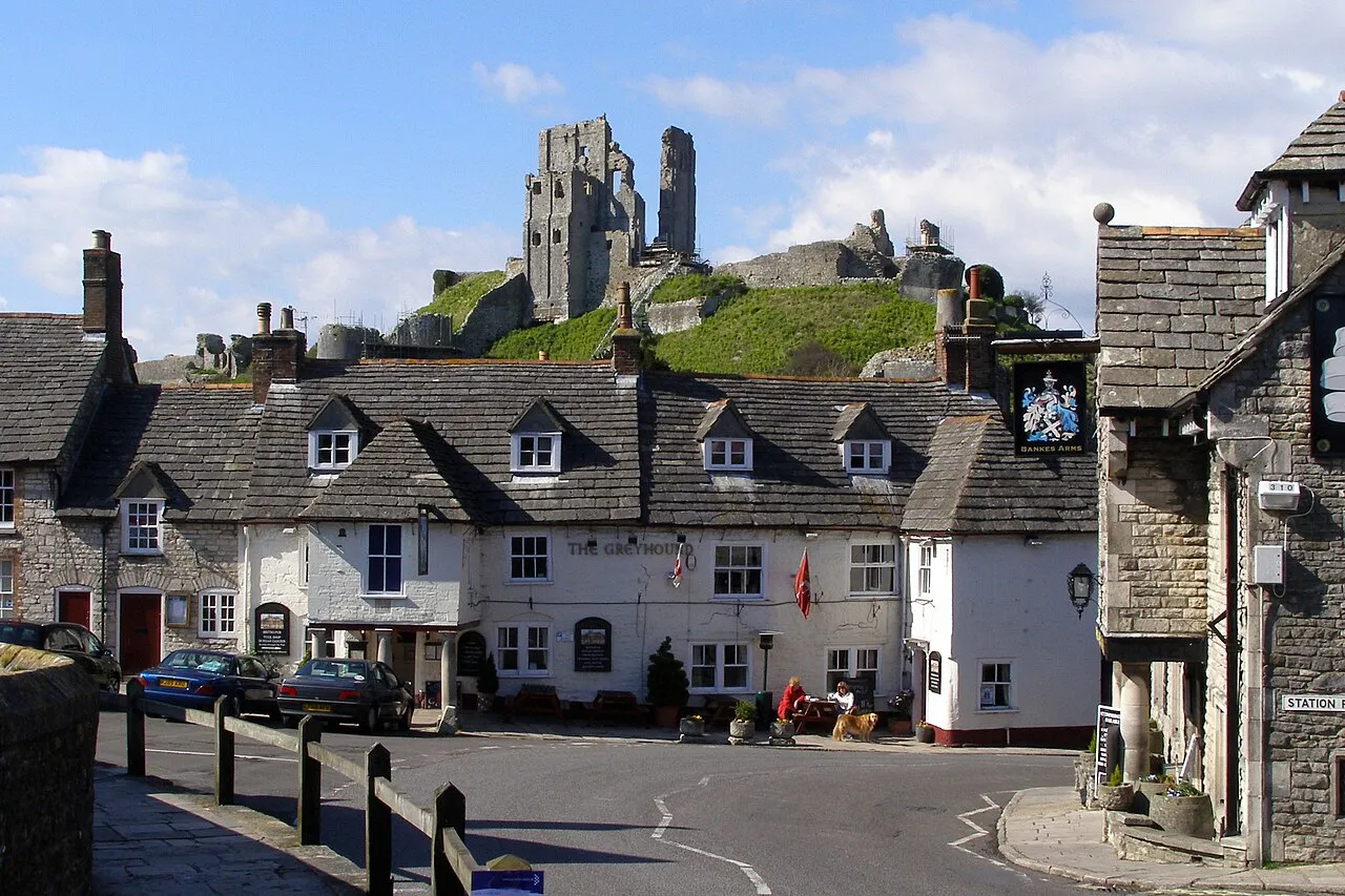
- Elevation
- 23 m
- above sea level
- Local time
- UTC+00:00
- Europe/London · UTC+00:00
- Airports
- BOH Bournemouth Airport22 km
- SOU Southampton Airport60 km
About Isle of Purbeck
Isle of Purbeck is a natural site. Location: Corfe Castle, Purbeck District.
The Isle of Purbeck is a peninsula in Dorset, England. It is bordered by the English Channel to the south and east, where cliffs fall to the sea, and by the marshy lands of the River Frome and Poole Harbour to the north. Its western boundary is less well defined, with some medieval sources placing it at Flower's Barrow above Worbarrow Bay. John Hutchins, author of The History and Antiquities of the County of Dorset, defined Purbeck's western boundary as the Luckford Lake stream, which runs south from the Frome.
Source: Wikipedia · CC BY-SA 4.0
Photos of Isle of Purbeck
-

Tiia Monto · CC BY-SA 3.0 -

Tiia Monto · CC BY-SA 3.0 -

Huligan0 · CC BY-SA 3.0 -

Huligan0 · CC BY-SA 3.0 -

Alexsheppard11 · Public domain


Climate of Isle of Purbeck
Best months for sightseeingBest months for sightseeing: June–August.
This month · November
A cold month
Day 11° · Night 5° · Rain 92 mm
- Hottest month
- July (day 21°)
- Coldest month
- February (night 2°)
- Wettest month
- December (101 mm)
- Driest month
- July (42 mm)
Bars: average monthly low and high temperature. Below: precipitation. Monthly averages for 1970–2000 at about 18 km resolution, adjusted for elevation. Highlighted months are mild and relatively dry. Source: WorldClim 2.1 (CC BY 4.0).
Show values as a table
| Month | Jan | Feb | Mar | Apr | May | Jun | Jul | Aug | Sep | Oct | Nov | Dec |
|---|---|---|---|---|---|---|---|---|---|---|---|---|
| Average high (°C) | 8° | 8° | 10° | 13° | 16° | 19° | 21° | 21° | 18° | 15° | 11° | 9° |
| Average low (°C) | 3° | 2° | 4° | 5° | 8° | 10° | 12° | 12° | 11° | 8° | 5° | 3° |
| Precipitation (mm) | 96 | 71 | 66 | 51 | 49 | 52 | 42 | 53 | 70 | 88 | 92 | 101 |
How to get to Isle of Purbeck
The nearest airport is Bournemouth Airport (BOH), 22 km to the northeast as the crow flies. For international flights: Bristol Airport (BRS) (95 km). The nearest large city is Poole, 10 km to the northeast.
Airports
- Bournemouth Airport (BOH) Bournemouth 22 kmnortheast
- Southampton Airport (SOU) Southampton 60 kmnortheast
- Bristol Airport (BRS) Bristol 95 kmnorthwest
Nearby large cities
- Poole Population: 151.5K 10 kmnortheast
- Bournemouth Population: 163.6K 16 kmnortheast
- Southampton Population: 269.8K 55 kmnortheast
- Portsmouth Population: 208.1K 71 kmeast
- Bath Population: 101.6K 85 kmnorth
Straight-line distances; road distances are longer. Airport data: OurAirports.
Day trips from Isle of Purbeck
Within 100 km: 250 historic and cultural sites, 619 natural sites, 93 lakes, rivers and coasts.
0–25 km109 places
- Brownsea Island Island 9 kmNE
- Studland Beach Beach 8 kmE
- Man O'War Beach Beach 15 kmW
- Round Island Island 6 kmNE
25–60 km286 places
- Isle of Wight Island 55 kmE
- Avon Beach Beach 25 kmNE
- Chesil Beach Beach 36 kmW
- Calshot Beach Beach 56 kmE
60–100 km567 places
- Portsea Island Natural site 72 kmE
- Charmouth Beach Beach 60 kmW
- Pagham Beach Beach 94 kmE
- Bembridge Beach Beach 69 kmE
Straight-line distances.
Nearest towns and villages
-
Corfe Castle Village, Corfe Castle0.2 km NE
-
Kingston Village, Corfe Castle2.4 km S
-
Churck Knowle Village, Church Knowle1.9 km W
-
Woolgarston Village, Corfe Castle2.7 km E
-
Norden Village, Arne2.3 km NW
-
Worth Matravers Village, Worth Matravers4.6 km S
Nearby attractions & nature
Everything nearby-
Challow Hill Mountain, Corfe Castle0.5 km NE
-
East Hill Mountain, Corfe Castle0.5 km NE
-
West Hill Mountain, Corfe Castle0.6 km NW
-
Rollington Hill Mountain, Corfe Castle1.6 km E
-
Corfe Castle Historic site, Corfe Castle0.3 km N
-
Brenscombe Hill Mountain, Corfe Castle2.8 km E
-
Knowle Hill Mountain, Church Knowle2.5 km W
-
Creech Barrow Hill Mountain, Church Knowle3.9 km W
Sources & licences
Data last updated: · 2 independent sources