Anvil Point Lighthouse
Located in Swanage, Purbeck District Coordinates: 50°35′31″ N 1°57′35″ W
- Local time
- UTC+00:00
- Europe/London · UTC+00:00
- Elevation
- 16 m
- above sea level
- Airports
- BOH Bournemouth Airport23 km
- SOU Southampton Airport58 km
About Anvil Point Lighthouse
Anvil Point Lighthouse is a landmark. Location: Swanage, Purbeck District.
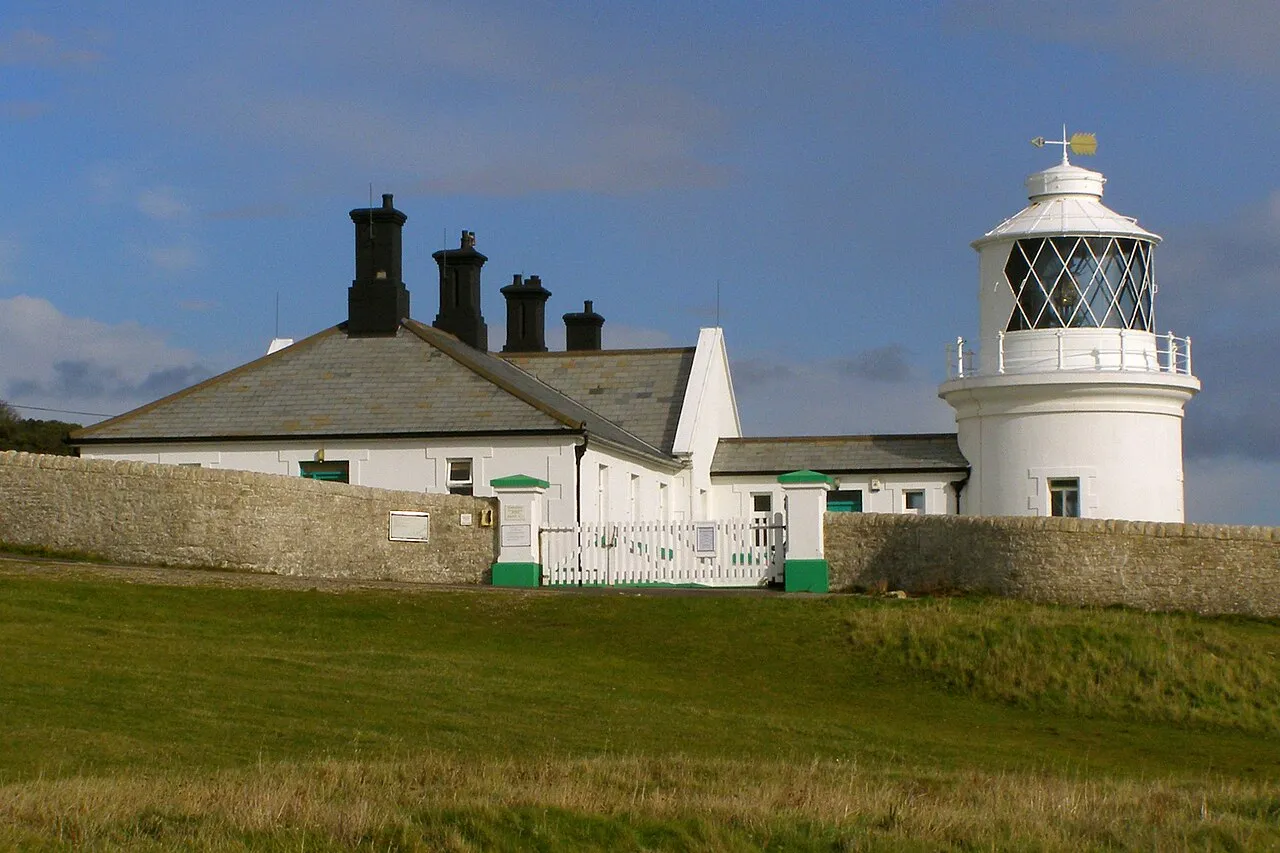
The Anvil Point Lighthouse is a fully automated lighthouse located at Durlston Country Park near Swanage in Dorset, England. It is owned by Trinity House. The lighthouse, residential block and associated buildings are listed Grade II as part of a single entry on the National Heritage List for England.
Source: Wikipedia · CC BY-SA 4.0
At a glance
- Built
- 1881
- Height
- 12 m
Source: Wikidata
Photos of Anvil Point Lighthouse
-

United Kingdom Hydrographic Office · Public domain -

Tk420 · CC BY-SA 4.0 -

Colin Park · CC BY-SA 2.0 -

Greg Fitchett · CC BY-SA 2.0 -

Jim Champion from Southampton, UK · CC BY-SA 2.0


Climate of Anvil Point Lighthouse
Best months for sightseeingBest months for sightseeing: June–August.
This month · November
A cold month
Day 11° · Night 5° · Rain 93 mm
- Hottest month
- July (day 21°)
- Coldest month
- February (night 2°)
- Wettest month
- December (102 mm)
- Driest month
- July (40 mm)
Bars: average monthly low and high temperature. Below: precipitation. Monthly averages for 1970–2000 at about 18 km resolution, adjusted for elevation. Highlighted months are mild and relatively dry. Source: WorldClim 2.1 (CC BY 4.0).
Show values as a table
| Month | Jan | Feb | Mar | Apr | May | Jun | Jul | Aug | Sep | Oct | Nov | Dec |
|---|---|---|---|---|---|---|---|---|---|---|---|---|
| Average high (°C) | 8° | 8° | 10° | 12° | 16° | 19° | 21° | 21° | 18° | 15° | 11° | 9° |
| Average low (°C) | 3° | 2° | 4° | 5° | 8° | 10° | 12° | 12° | 11° | 8° | 5° | 4° |
| Precipitation (mm) | 95 | 69 | 66 | 50 | 48 | 52 | 40 | 52 | 70 | 88 | 93 | 102 |
How to get to Anvil Point Lighthouse
The nearest airport is Bournemouth Airport (BOH), 23 km to the north as the crow flies. The nearest large city is Poole, 14 km to the north.
Airports
- Bournemouth Airport (BOH) Bournemouth 23 kmnorth
- Southampton Airport (SOU) Southampton 58 kmnortheast
- Alderney Airport (ACI) Saint Anne 100 kmsouth
Nearby large cities
- Poole Population: 151.5K 14 kmnorth
- Bournemouth Population: 163.6K 15 kmnorth
- Southampton Population: 269.8K 52 kmnortheast
- Portsmouth Population: 208.1K 66 kmeast
- Bath Population: 101.6K 92 kmnorth
Straight-line distances; road distances are longer. Airport data: OurAirports.
Day trips from Anvil Point Lighthouse
Within 100 km: 228 historic and cultural sites, 580 natural sites, 84 lakes, rivers and coasts.
0–25 km97 places
- Brownsea Island Island 11 kmN
- Avon Beach Beach 22 kmNE
- Studland Beach Beach 8 kmN
- Man O'War Beach Beach 22 kmW
25–60 km255 places
- Isle of Wight Island 49 kmE
- Chesil Beach Beach 43 kmW
- Calshot Beach Beach 52 kmNE
- Ventnor Beach Beach 53 kmE
60–100 km540 places
- Portsea Island Natural site 67 kmE
- Charmouth Beach Beach 68 kmW
- Pagham Beach Beach 89 kmE
- Bembridge Beach Beach 63 kmE
Straight-line distances.
Nearby attractions & nature
Everything nearby-
The Great Globe Landmark, Swanage0.7 km NE
-
Durlston Country Park Natural site, Swanage0.5 km NE
-
All Saints Church Attraction, Swanage3.2 km N
-
Day's Park Natural site, Swanage3.1 km N
-
St Nicholas Church Attraction, Studland5.7 km N
-
Swanage Bay Natural site, England3 km N
-
Nine Barrow Down Mountain, Swanage4.8 km NW
-
Ballard Down Mountain, Studland4.4 km N
Nearest towns and villages
-
Swanage Town, Swanage1.8 km N
-
Durlston Neighbourhood, Swanage1.1 km N
-
Herston Neighbourhood, Swanage2.1 km N
-
New Swanage Neighbourhood, Swanage3.4 km N
Sources & licences
Data last updated: · 2 independent sources