- Elevation
- 277 m
- above sea level
- Local time
- UTC+00:00
- Europe/London · UTC+00:00
- Airports
- EXT Exeter International Airport42 km
- BRS Bristol Airport65 km
About Pilsdon Pen
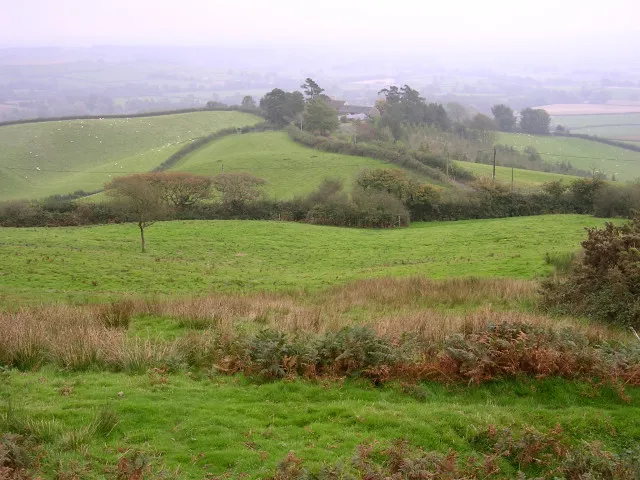
Pilsdon Pen is a mountain. Location: Pilsdon, West Dorset District. Elevation: 277 m.
Pilsdon Pen is a 277-metre (909 ft) hill in Dorset in South West England, situated at the north end of the Marshwood Vale, approximately 4.5 miles (7.2 km) west of Beaminster. It is Dorset's second highest point and has panoramic views extending for many miles. It was bequeathed to the National Trust by the Pinney family in 1982. For many years it was thought to be Dorset's highest hill, until modern survey revealed that nearby Lewesdon Hill was 2 metres higher.
Source: Wikipedia · CC BY-SA 4.0
Climate of Pilsdon Pen
Best months for sightseeingBest months for sightseeing: June–September.
This month · November
A cold month
Day 10° · Night 4° · Rain 97 mm
- Hottest month
- July (day 19°)
- Coldest month
- February (night 1°)
- Wettest month
- December (104 mm)
- Driest month
- April (59 mm)
Bars: average monthly low and high temperature. Below: precipitation. Monthly averages for 1970–2000 at about 18 km resolution, adjusted for elevation. Highlighted months are mild and relatively dry. Source: WorldClim 2.1 (CC BY 4.0).
Show values as a table
| Month | Jan | Feb | Mar | Apr | May | Jun | Jul | Aug | Sep | Oct | Nov | Dec |
|---|---|---|---|---|---|---|---|---|---|---|---|---|
| Average high (°C) | 7° | 7° | 9° | 11° | 14° | 17° | 19° | 19° | 17° | 13° | 10° | 8° |
| Average low (°C) | 1° | 1° | 2° | 3° | 6° | 9° | 11° | 11° | 9° | 7° | 4° | 2° |
| Precipitation (mm) | 103 | 77 | 72 | 59 | 60 | 60 | 62 | 71 | 76 | 92 | 97 | 104 |
Other places to visit in this season: June July August September
How to get to Pilsdon Pen
The nearest airport is Exeter International Airport (EXT), 42 km to the west as the crow flies. For international flights: Bristol Airport (BRS) (65 km). The nearest large city is Exeter, 50 km to the west.
Airports
- Exeter International Airport (EXT) Exeter, Devon 42 kmwest
- Bristol Airport (BRS) Bristol 65 kmnorth
- Bournemouth Airport (BOH) Bournemouth 70 kmeast
Nearby large cities
- Exeter Population: 130.7K 50 kmwest
- Poole Population: 151.5K 61 kmeast
- Bournemouth Population: 163.6K 68 kmeast
- Bath Population: 101.6K 71 kmnortheast
- Bristol Population: 479K 74 kmnorth
Straight-line distances; road distances are longer. Airport data: OurAirports.
Day trips from Pilsdon Pen
Within 100 km: 391 historic and cultural sites, 1,100 natural sites, 143 lakes, rivers and coasts.
0–25 km121 places
- Charmouth Beach Beach 9 kmSW
- Staple Hill Mountain 23 kmNW
- Lewesdon Hill Mountain 2 kmE
- Hardown Hill Mountain 7 kmS
25–60 km473 places
- Chesil Beach Beach 27 kmSE
- Man O'War Beach Beach 45 kmSE
- Kilve Beach Beach 51 kmNW
- Round Island Island 59 kmE
60–100 km1,040 places
- Brownsea Island Island 62 kmE
- Burgh Island Island 96 kmSW
- Avon Beach Beach 78 kmE
- Goodrington Sands Beach 68 kmSW
Straight-line distances.
Nearest towns and villages
-
Bettiscombe Village, West Dorset District1.7 km SW
-
Broadwindsor Village, Broadwindsor2.8 km NE
-
Burstock Village, West Dorset District1.9 km NE
-
Pilsdon Village, Pilsdon1.5 km S
-
Broadwindsor Village, West Dorset District2.6 km NE
-
Marshwood Village, West Dorset District2.8 km SW
Nearby attractions & nature
Everything nearby-
Pilsdon Historic site, Pilsdon0.2 km NW
-
Lewesdon Hill Mountain, Broadwindsor2.4 km E
-
Payne's Down Mountain, Thorncombe2.9 km W
-
Blackdown Hill Mountain, Broadwindsor3.2 km NW
-
Conegar Hill Mountain, Broadwindsor3.3 km NE
-
Gerrard's Hill Mountain, Stoke Abbott4.7 km E
-
Lambert's Castle Hill Mountain, Marshwood4.7 km SW
-
Coppet Hill Mountain, Symondsbury5.4 km S
Sources & licences
Data last updated: · 2 independent sources