Southill
Located in Weymouth and Portland District, Dorset Coordinates: 50°37′29″ N 2°28′40″ W
- Elevation
- 8 m
- above sea level
- Local time
- UTC+00:00
- Europe/London · UTC+00:00
- Airports
- BOH Bournemouth Airport48 km
- EXT Exeter International Airport67 km
About Southill
Southill is a neighbourhood. Location: Weymouth and Portland District, Dorset. The best months to visit are June–September. The nearest airport is Bournemouth Airport (48 km). Nearby sights include Sandsfoot Castle and The Look Out.
Photos of Southill
-
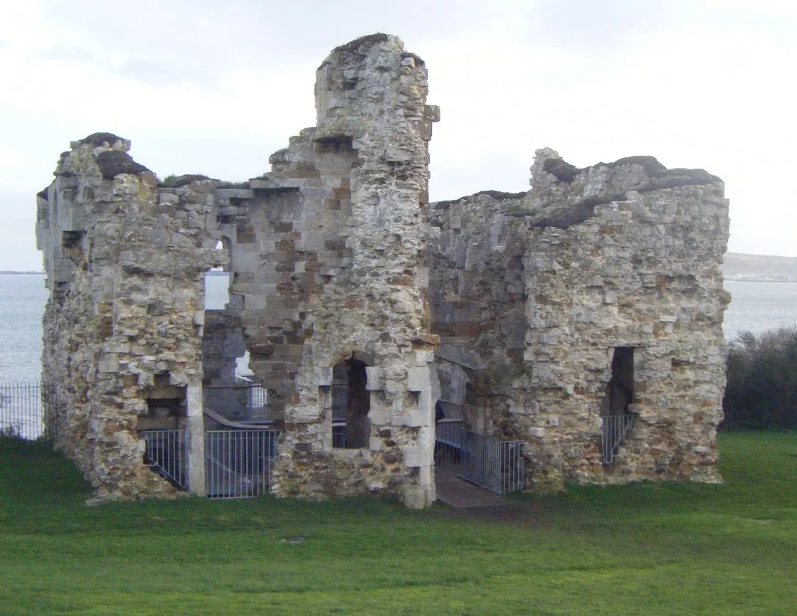
Sandsfoot Castle Ajsmith141 · CC BY-SA 3.0

Climate of Southill
Best months for sightseeingBest months for sightseeing: June–September.
This month · November
Outside the best season
Day 12° · Night 6° · Rain 81 mm
- Hottest month
- August (day 21°)
- Coldest month
- February (night 3°)
- Wettest month
- January (95 mm)
- Driest month
- July (45 mm)
Bars: average monthly low and high temperature. Below: precipitation. Monthly averages for 1970–2000 at about 18 km resolution, adjusted for elevation. Highlighted months are mild and relatively dry. Source: WorldClim 2.1 (CC BY 4.0).
Show values as a table
| Month | Jan | Feb | Mar | Apr | May | Jun | Jul | Aug | Sep | Oct | Nov | Dec |
|---|---|---|---|---|---|---|---|---|---|---|---|---|
| Average high (°C) | 9° | 9° | 11° | 13° | 16° | 19° | 21° | 21° | 19° | 16° | 12° | 10° |
| Average low (°C) | 4° | 3° | 4° | 5° | 8° | 11° | 13° | 13° | 12° | 9° | 6° | 4° |
| Precipitation (mm) | 95 | 71 | 63 | 51 | 49 | 48 | 45 | 54 | 63 | 83 | 81 | 94 |
Other places to visit in this season: June July August September
How to get to Southill
The nearest airport is Bournemouth Airport (BOH), 48 km to the east as the crow flies. For international flights: Bristol Airport (BRS) (86 km). The nearest large city is Poole, 36 km to the east.
Airports
- Bournemouth Airport (BOH) Bournemouth 48 kmeast
- Exeter International Airport (EXT) Exeter, Devon 67 kmwest
- Bristol Airport (BRS) Bristol 86 kmnorth
Nearby large cities
- Poole Population: 151.5K 36 kmeast
- Bournemouth Population: 163.6K 44 kmeast
- Exeter Population: 130.7K 75 kmwest
- Southampton Population: 269.8K 82 kmnortheast
- Bath Population: 101.6K 84 kmnorth
Straight-line distances; road distances are longer. Airport data: OurAirports.
Day trips from Southill
Within 100 km: 275 historic and cultural sites, 839 natural sites, 116 lakes, rivers and coasts.
0–25 km87 places
- Chesil Beach Beach 6 kmW
- Man O'War Beach Beach 15 kmE
- Wakeling Island Island 12 kmNE
- Overton Island Island 12 kmNE
25–60 km292 places
- Brownsea Island Island 37 kmE
- Avon Beach Beach 54 kmE
- Studland Beach Beach 38 kmE
- Charmouth Beach Beach 32 kmW
60–100 km851 places
- Isle of Wight Island 84 kmE
- Goodrington Sands Beach 81 kmW
- Calshot Beach Beach 85 kmE
- Oddicombe Beach Beach 75 kmW
Straight-line distances.
Nearby attractions & nature
Everything nearby-
Sandsfoot Castle Historic site, Weymouth and Portland District3.5 km S
-
The Look Out Mountain, Weymouth and Portland District2.7 km NE
-
Wyke Regis Mountain, Weymouth and Portland District2.7 km S
-
Jordan Hill Mountain, Weymouth and Portland District3.8 km E
-
Weymouth South Pier Lighthouse Landmark, Dorset3.1 km SE
-
Fleet Hill Mountain, Fleet3.5 km W
Sources & licences
Data last updated: