- Elevation
- 164 m
- above sea level
- Local time
- UTC+00:00
- Europe/London · UTC+00:00
- Places inside
- 2
- listed under Naunton
- Airports
- BHX Birmingham Airport61 km
- BRS Bristol Airport84 km
About Naunton
Naunton is a village. Location: Cotswold District, Gloucestershire. Elevation: 164 m. The best months to visit are June–August. The nearest airport is Birmingham Airport (61 km). Nearby sights include Cotswold Motoring Museum and Upper Slaughter Castle.
Photos of Naunton
-
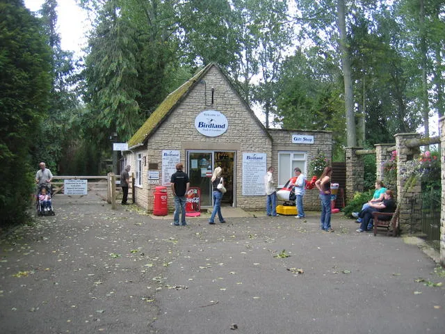
Birdland Park and Gardens David Stowell · CC BY-SA 2.0 -
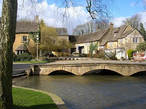
Cotswold Motoring Museum DeFacto · CC BY-SA 3.0


Climate of Naunton
Best months for sightseeingBest months for sightseeing: June–August.
This month · November
A cold month
Day 10° · Night 4° · Rain 85 mm
- Hottest month
- July (day 21°)
- Coldest month
- February (night 1°)
- Wettest month
- December (95 mm)
- Driest month
- July (58 mm)
Bars: average monthly low and high temperature. Below: precipitation. Monthly averages for 1970–2000 at about 18 km resolution, adjusted for elevation. Highlighted months are mild and relatively dry. Source: WorldClim 2.1 (CC BY 4.0).
Show values as a table
| Month | Jan | Feb | Mar | Apr | May | Jun | Jul | Aug | Sep | Oct | Nov | Dec |
|---|---|---|---|---|---|---|---|---|---|---|---|---|
| Average high (°C) | 7° | 7° | 9° | 12° | 16° | 19° | 21° | 21° | 17° | 14° | 10° | 7° |
| Average low (°C) | 1° | 1° | 2° | 4° | 7° | 10° | 12° | 12° | 9° | 7° | 4° | 2° |
| Precipitation (mm) | 88 | 65 | 74 | 62 | 63 | 74 | 58 | 74 | 79 | 79 | 85 | 95 |
How to get to Naunton
The nearest airport is Birmingham Airport (BHX), 61 km to the north as the crow flies. The nearest large city is Cheltenham, 17 km to the west.
Airports
- Birmingham Airport (BHX) Birmingham, West Midlands 61 kmnorth
- Bristol Airport (BRS) Bristol 84 kmsouthwest
- London Luton Airport (LTN) Luton, Luton 101 kmeast
Nearby large cities
- Cheltenham Population: 118.8K 17 kmwest
- Gloucester Population: 132.4K 28 kmwest
- Swindon Population: 201.7K 39 kmsouth
- Worcester Population: 101.7K 41 kmnorthwest
- Oxford Population: 162.1K 44 kmsoutheast
Straight-line distances; road distances are longer. Airport data: OurAirports.
Day trips from Naunton
Within 100 km: 898 historic and cultural sites, 1,067 natural sites, 184 lakes, rivers and coasts.
0–25 km74 places
- Glover's Island Island 23 kmN
- Kemerton Lake 22 kmNW
- Churchdown Hill Mountain 24 kmW
- Cleeve Hill Mountain 12 kmW
25–60 km511 places
- Alney Island Island 29 kmW
- Andersey Island Island 47 kmSE
- Rose Isle Island 46 kmSE
- Lock Wood Island Island 49 kmSE
60–100 km1,564 places
- The Lynch Island 80 kmSE
- Windsor Racecourse Island Island 95 kmSE
- Wargrave Island Island 80 kmSE
- Loddon Island Island 83 kmSE
Straight-line distances.
Places in Naunton
2 placesBar: population relative to the most populous place in this list.
Cities & villages1
- Aylworth · Village
Nearby attractions & nature
Everything nearby-
Cotswold Motoring Museum Museum, Bourton-on-the-Water6 km SE
-
Upper Slaughter Castle Historic site, Upper Slaughter4.3 km E
-
Birdland Park and Gardens Attraction, Bourton-on-the-Water6.5 km SE
-
Swell Hill Mountain, Swell5.4 km NE
-
St Mary Attraction, Lower Slaughter5.3 km E
-
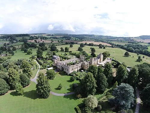 Sudeley Castle Historic site, Sudeley9.3 km NW
Sources & licences
Data last updated: