West Thamesmead
Located in Greenwich, Greater London Coordinates: 51°29′53″ N 0°05′19″ E
- Elevation
- 3 m
- above sea level
- Local time
- UTC+00:00
- Europe/London · UTC+00:00
- Airports
- LCY London City Airport2 km
- LHR London Heathrow Airport38 km
About West Thamesmead
West Thamesmead is a neighbourhood. Location: Greenwich, Greater London. The best months to visit are June–August. The nearest airport is London City Airport (2 km). Nearby sights include North Woolwich Old Station Museum and The Valley.
Photos of West Thamesmead
-
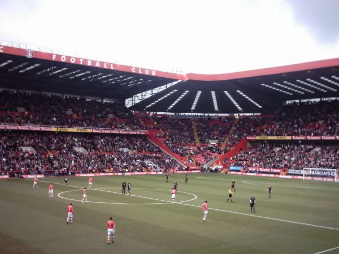
The Valley en:User:Superbfc · CC BY-SA 3.0 -
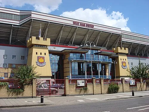
Upton Park Oxyman · CC BY 2.5 -
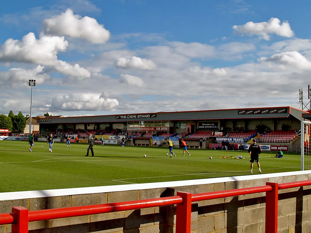
Victoria Road David Ingham from Lancashire, England · CC BY-SA 2.0 -
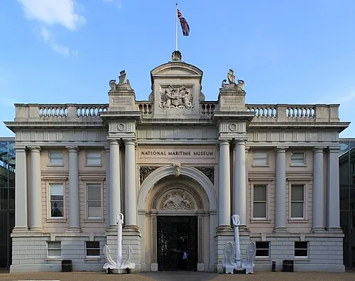
National Maritime Museum Katie Chan · CC BY-SA 3.0 -
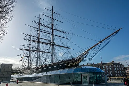
Cutty Sark Krzysztof Belczyński from Warsaw, POLAND · CC BY-SA 2.0


Climate of West Thamesmead
Best months for sightseeingBest months for sightseeing: June–August.
This month · November
A cold month
Day 11° · Night 4° · Rain 68 mm
- Hottest month
- July (day 23°)
- Coldest month
- February (night 2°)
- Wettest month
- January (70 mm)
- Driest month
- July (42 mm)
Bars: average monthly low and high temperature. Below: precipitation. Monthly averages for 1970–2000 at about 18 km resolution, adjusted for elevation. Highlighted months are mild and relatively dry. Source: WorldClim 2.1 (CC BY 4.0).
Show values as a table
| Month | Jan | Feb | Mar | Apr | May | Jun | Jul | Aug | Sep | Oct | Nov | Dec |
|---|---|---|---|---|---|---|---|---|---|---|---|---|
| Average high (°C) | 8° | 8° | 11° | 13° | 17° | 20° | 23° | 23° | 19° | 15° | 11° | 8° |
| Average low (°C) | 2° | 2° | 3° | 4° | 7° | 10° | 13° | 12° | 10° | 7° | 4° | 3° |
| Precipitation (mm) | 70 | 44 | 51 | 46 | 48 | 54 | 42 | 50 | 60 | 65 | 68 | 67 |
How to get to West Thamesmead
The nearest airport is London City Airport (LCY), 2 km to the west as the crow flies. For international flights: London Heathrow Airport (LHR) (38 km). The nearest large city is Barking, 4 km to the north.
Airports
- London City Airport (LCY) London 2 kmwest
- London Heathrow Airport (LHR) London 38 kmwest
- London Southend Airport (SEN) Southend-on-Sea, Essex 43 kmeast
Nearby large cities
- Barking Population: 218.5K 4 kmnorth
- Ilford Population: 168.2K 7 kmnorth
- Bexley Population: 228K 8 kmsoutheast
- Dagenham Population: 108.4K 8 kmnortheast
- Walthamstow Population: 109.4K 13 kmnorthwest
Straight-line distances; road distances are longer. Airport data: OurAirports.
Day trips from West Thamesmead
Within 100 km: 821 historic and cultural sites, 587 natural sites, 324 lakes, rivers and coasts.
0–25 km340 places
- White Hart Lane Landmark 16 kmNW
- Rook Island Island 9 kmN
- Duck Island Island 15 kmW
- Lincoln Island Island 9 kmN
25–60 km573 places
- Isle of Sheppey Island 53 kmE
- Spotlites @ Kings Theatre Attraction 33 kmSE
- Yantlet beach Beach 41 kmE
- Central Beach Beach 59 kmE
60–100 km819 places
- St Nicholas Church Shoreham Attraction 78 kmS
- The Marlipins Museum Museum 78 kmS
- Camber Sands Beach 80 kmSE
- West Mersea Beach Beach 66 kmNE
Straight-line distances.
Nearby attractions & nature
Everything nearby-
North Woolwich Old Station Museum Museum, Newham1.8 km W
-
The Valley Landmark, Greenwich3.9 km W
-
Shooters Hill Mountain, Greenwich3.4 km SW
-
Upton Park Landmark, Newham5.1 km NW
-
Beckton Alps Mountain, Newham3 km NW
-
River Roding River, England2.8 km NE
Other cities and towns in Greenwich
-
 Greenwich Neighbourhood, Greenwich7.3 km W
-
Blackheath Westcombe Neighbourhood, Greenwich5.6 km SW
-
Thamesmead Moorings Neighbourhood, Greenwich1 km NE
-
Glyndon Neighbourhood, Greenwich1.2 km SW
-
Royal Arsenal West Neighbourhood, Greenwich1.2 km SW
-
Plumstead Neighbourhood, Greenwich1.8 km SE
Sources & licences
Data last updated: