
- Population
- 4,179
- 4.2K
- Elevation
- 92 m
- above sea level
- Local time
- UTC+00:00
- Europe/London · UTC+00:00
- Airports
- LHR London Heathrow Airport19 km
- LCY London City Airport29 km
About Stanmore
Stanmore is a village. Location: Harrow, Greater London. Population: 4,179. Elevation: 92 m.
Stanmore is part of the London Borough of Harrow in Greater London. It is centred 11 miles (18 km) northwest of Charing Cross, lies on the outskirts of the London urban area and includes Stanmore Hill, one of the highest points of London, at 152 metres (499 ft) high. The district, which developed from the ancient Middlesex parishes of Great and Little Stanmore, lies immediately west of Roman Watling Street (the A5 road) and forms the eastern part of the modern London Borough of Harrow.
Source: Wikipedia · CC BY-SA 4.0
Photos of Stanmore
-
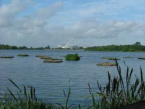
Welsh Harp Andrewself · CC BY-SA 4.0 -
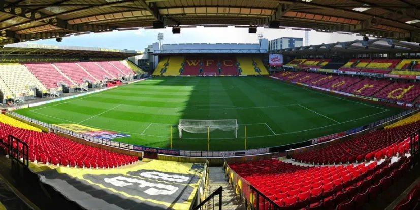
Vicarage Road Jbb503 · CC BY-SA 4.0 -
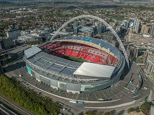
Wembley Stadium Arne Müseler · CC BY-SA 3.0 de -

Stone-X Stadium oatsy40 from London · CC BY 2.0


Climate of Stanmore
Best months for sightseeingBest months for sightseeing: June–August.
This month · November
A cold month
Day 10° · Night 4° · Rain 61 mm
- Hottest month
- July (day 22°)
- Coldest month
- February (night 1°)
- Wettest month
- October (64 mm)
- Driest month
- February (41 mm)
Bars: average monthly low and high temperature. Below: precipitation. Monthly averages for 1970–2000 at about 18 km resolution, adjusted for elevation. Highlighted months are mild and relatively dry. Source: WorldClim 2.1 (CC BY 4.0).
Show values as a table
| Month | Jan | Feb | Mar | Apr | May | Jun | Jul | Aug | Sep | Oct | Nov | Dec |
|---|---|---|---|---|---|---|---|---|---|---|---|---|
| Average high (°C) | 7° | 8° | 10° | 13° | 17° | 20° | 22° | 22° | 19° | 15° | 10° | 8° |
| Average low (°C) | 2° | 1° | 3° | 4° | 7° | 10° | 12° | 12° | 10° | 7° | 4° | 3° |
| Precipitation (mm) | 63 | 41 | 49 | 46 | 50 | 55 | 43 | 51 | 58 | 64 | 61 | 62 |
How to get to Stanmore
The nearest airport is London Heathrow Airport (LHR), 19 km to the southwest as the crow flies. The nearest large city is Harrow, 4 km to the south.
Airports
- London Heathrow Airport (LHR) London 19 kmsouthwest
- London City Airport (LCY) London 29 kmsoutheast
- London Luton Airport (LTN) Luton, Luton 29 kmnorth
Nearby large cities
- Harrow Population: 149.2K 4 kmsouth
- Watford Population: 125.7K 7 kmnorthwest
- Archway Population: 215.7K 14 kmsoutheast
- Enfield Population: 156.9K 17 kmeast
- Tottenham Population: 130K 17 kmeast
Straight-line distances; road distances are longer. Airport data: OurAirports.
Day trips from Stanmore
Within 100 km: 853 historic and cultural sites, 614 natural sites, 317 lakes, rivers and coasts.
0–25 km411 places
- White Hart Lane Landmark 17 kmE
- Holm Island Island 25 kmSW
- Sunbury Court Island 24 kmS
- Rivermead Island 24 kmS
25–60 km596 places
- The Lynch Island 42 kmW
- Windsor Racecourse Island Island 27 kmSW
- Wargrave Island Island 40 kmW
- Loddon Island Island 42 kmSW
60–100 km777 places
- Isle of Sheppey Island 83 kmE
- Spotlites @ Kings Theatre Attraction 65 kmSE
- St Nicholas Church Shoreham Attraction 86 kmS
- The Marlipins Museum Museum 87 kmS
Straight-line distances.
Nearby attractions & nature
Everything nearby-
Betley Priory Attraction, Harrow1.6 km NW
-
Bushey Heath Mountain, Hertsmere District2.3 km NW
-
Deacons Hill Mountain, Elstree and Borehamwood3.2 km NE
-
Harrow on the Hill Mountain, Harrow4.9 km S
-
Wembley Stadium Landmark, Brent7.2 km S
-
Stone-X Stadium Landmark, Barnet6.6 km E
Other cities and towns in Harrow
-
West Harrow Neighbourhood, Harrow5.2 km SW
-
 Rayners Lane Neighbourhood, Harrow6.3 km SW
-
Stanmore Park Neighbourhood, Harrow0.6 km W
-
Canons Neighbourhood, Harrow1 km NE
-
Canons Park Village, Harrow1.8 km SE
-
Queensbury Neighbourhood, Harrow2.5 km SE
Sources & licences
Data last updated: · 2 independent sources