Twickenham
Located in Richmond upon Thames, Greater London Coordinates: 51°26′42″ N 0°20′16″ W

- Population
- 62,148
- 62.1K
- Elevation
- 12 m
- above sea level
- Local time
- UTC+00:00
- Europe/London · UTC+00:00
- Airports
- LHR London Heathrow Airport9 km
- LCY London City Airport28 km
About Twickenham
Twickenham is a village. Location: Richmond upon Thames, Greater London. Population: 62,148. Elevation: 12 m.
Twickenham ( TWICK-ən-əm) is a suburban town in London, England, on the River Thames 9.9 miles (15.9 km) southwest of Charing Cross. Historically in Middlesex, since 1965 it has formed part of the London Borough of Richmond upon Thames, whose administrative headquarters are in the area. The population, including St Margarets and Whitton, was 62,148 at the 2011 census. Twickenham is the home of the Rugby Football Union, with hundreds of thousands of spectators visiting Twickenham Stadium each year.
Source: Wikipedia · CC BY-SA 4.0
At a glance
- Area
- 12.4 km²
Source: Wikidata
Photos of Twickenham
-

Lewis Clarke · CC BY-SA 2.0 -

Joe Mabel · CC BY-SA 4.0 -

Daderot · CC0 -

Daderot · CC0 -

Cristian Bortes from Cluj-Napoca, Romania · CC BY 2.0


Climate of Twickenham
Best months for sightseeingBest months for sightseeing: June–August.
This month · November
A cold month
Day 11° · Night 5° · Rain 58 mm
- Hottest month
- July (day 23°)
- Coldest month
- February (night 2°)
- Wettest month
- October (62 mm)
- Driest month
- February (38 mm)
Bars: average monthly low and high temperature. Below: precipitation. Monthly averages for 1970–2000 at about 18 km resolution, adjusted for elevation. Highlighted months are mild and relatively dry. Source: WorldClim 2.1 (CC BY 4.0).
Show values as a table
| Month | Jan | Feb | Mar | Apr | May | Jun | Jul | Aug | Sep | Oct | Nov | Dec |
|---|---|---|---|---|---|---|---|---|---|---|---|---|
| Average high (°C) | 8° | 8° | 11° | 13° | 18° | 21° | 23° | 23° | 19° | 15° | 11° | 9° |
| Average low (°C) | 2° | 2° | 3° | 5° | 8° | 11° | 13° | 13° | 10° | 8° | 5° | 3° |
| Precipitation (mm) | 59 | 38 | 45 | 44 | 48 | 51 | 40 | 48 | 56 | 62 | 58 | 59 |
How to get to Twickenham
The nearest airport is London Heathrow Airport (LHR), 9 km to the west as the crow flies. The nearest large city is Sutton, 14 km to the southeast.
Airports
- London Heathrow Airport (LHR) London 9 kmwest
- London City Airport (LCY) London 28 kmeast
- London Gatwick Airport (LGW) London 35 kmsouth
Nearby large cities
- Sutton Population: 187.6K 14 kmsoutheast
- Harrow Population: 149.2K 15 kmnorth
- City of Westminster Population: 247.6K 15 kmnortheast
- London Population: 9M 16 kmnortheast
- Croydon Population: 173.3K 18 kmeast
Straight-line distances; road distances are longer. Airport data: OurAirports.
Day trips from Twickenham
Within 100 km: 851 historic and cultural sites, 630 natural sites, 326 lakes, rivers and coasts.
0–25 km465 places
- Holm Island Island 13 kmW
- Sunbury Court Island 6 kmSW
- Rivermead Island 6 kmSW
- Lot's Ait Island 5 kmNE
25–60 km523 places
- White Hart Lane Landmark 26 kmNE
- The Lynch Island 39 kmW
- Wargrave Island Island 38 kmW
- Loddon Island Island 37 kmW
60–100 km819 places
- Portsea Island Natural site 88 kmSW
- Isle of Sheppey Island 82 kmE
- Spotlites @ Kings Theatre Attraction 61 kmE
- St Nicholas Church Shoreham Attraction 67 kmS
Straight-line distances.
Nearby attractions & nature
Everything nearby-
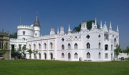 Strawberry Hill House Museum, Richmond upon Thames0.8 km S
-
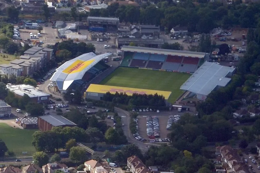 The Stoop Landmark, Richmond upon Thames0.7 km NW
-
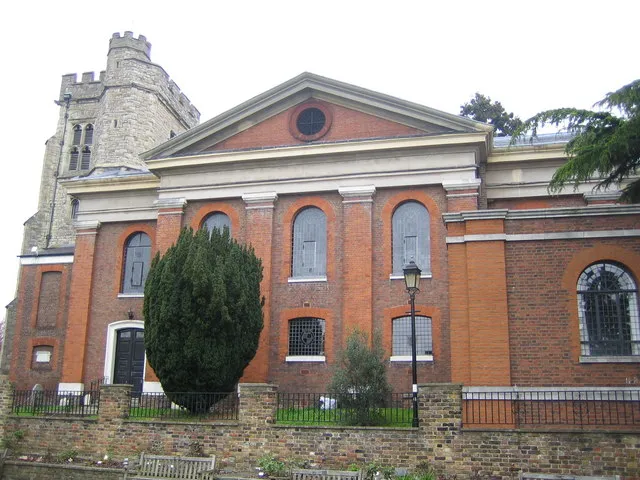 St Mary's Church Attraction, Richmond upon Thames0.9 km E
-
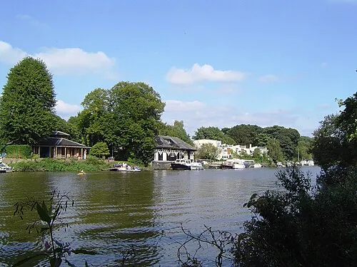 Eel Pie Island Island, Richmond upon Thames0.9 km E
-
 Marble Hill House Museum, Richmond upon Thames1.8 km E
-
Radnor Gardens Natural site, Richmond upon Thames0.6 km SE
Other cities and towns in Richmond upon Thames
-
 Strawberry Hill Village, Richmond upon Thames0.6 km SW
-
 Whitton Neighbourhood, Richmond upon Thames1.4 km W
-
 Ham Neighbourhood, Richmond upon Thames1.4 km SE
-
 Hampton Hill Neighbourhood, Richmond upon Thames2.3 km SW
-
Hampton Court Village, Richmond upon Thames4.6 km S
-
South Twickenham Neighbourhood, Richmond upon Thames0.5 km S
Sources & licences
Data last updated: · 2 independent sources