- Population
- 18,777
- 18.8K
- Elevation
- 7 m
- above sea level
- Local time
- UTC+00:00
- Europe/London · UTC+00:00
- Airports
- SOU Southampton Airport32 km
- LGW London Gatwick Airport62 km
About Emsworth
Emsworth is a town. Location: Havant District, Hampshire. Population: 18,777. Elevation: 7 m.
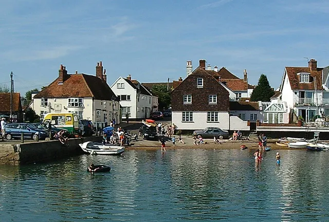
Emsworth is a town in the Borough of Havant in the county of Hampshire, on the south coast of England near the border with West Sussex. It lies at the north end of an arm of Chichester Harbour, a large and shallow inlet from the English Channel, and is equidistant between Portsmouth and Chichester. Emsworth had a population of 10,269 at the 2021 Census. The town has a basin for yachts and fishing boats, which fills at high tide and can be emptied through a sluice at low tide.
Source: Wikipedia · CC BY-SA 4.0
Photos of Emsworth
-

PNieuwenhuizen · CC BY-SA 4.0 -

HelenK · CC BY-SA 2.0 -

David Smith · CC BY-SA 2.0 -

Martin Addison · CC BY-SA 2.0 -
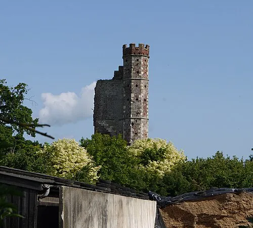
Warblington Castle Geni · CC BY-SA 4.0


Travel notes for Emsworth
From Wikivoyage
Emsworth is a town in Hampshire, Southern England.
Get in+
Emsworth has a train station on the South Coast Line between Portsmouth and Chichester
Havant is nearby and has better connections to London. Local buses run regularly to Emsworth from Havant Bus Station.
Emsworth is just off the A27 main road between Portsmouth and Chichester, there is a small car park in the centre of town.
Source: Wikivoyage · CC BY-SA 4.0 · abridged
Climate of Emsworth
Best months for sightseeingBest months for sightseeing: June–August.
This month · November
A cold month
Day 11° · Night 5° · Rain 98 mm
- Hottest month
- July (day 22°)
- Coldest month
- February (night 2°)
- Wettest month
- January (100 mm)
- Driest month
- July (51 mm)
Bars: average monthly low and high temperature. Below: precipitation. Monthly averages for 1970–2000 at about 18 km resolution, adjusted for elevation. Highlighted months are mild and relatively dry. Source: WorldClim 2.1 (CC BY 4.0).
Show values as a table
| Month | Jan | Feb | Mar | Apr | May | Jun | Jul | Aug | Sep | Oct | Nov | Dec |
|---|---|---|---|---|---|---|---|---|---|---|---|---|
| Average high (°C) | 8° | 8° | 10° | 13° | 17° | 19° | 22° | 22° | 19° | 15° | 11° | 9° |
| Average low (°C) | 3° | 2° | 3° | 5° | 8° | 11° | 13° | 13° | 10° | 8° | 5° | 4° |
| Precipitation (mm) | 100 | 65 | 76 | 57 | 52 | 58 | 51 | 60 | 79 | 93 | 98 | 99 |
How to get to Emsworth
The nearest airport is Southampton Airport (SOU), 32 km to the west as the crow flies. For international flights: London Gatwick Airport (LGW) (62 km). The nearest large city is Portsmouth, 12 km to the southwest.
Airports
- Southampton Airport (SOU) Southampton 32 kmwest
- London Gatwick Airport (LGW) London 62 kmnortheast
- Bournemouth Airport (BOH) Bournemouth 64 kmwest
Nearby large cities
- Portsmouth Population: 208.1K 12 kmsouthwest
- Southampton Population: 269.8K 33 kmwest
- Worthing Population: 113.9K 40 kmeast
- Basingstoke Population: 107.6K 47 kmnorth
- Brighton Population: 283.9K 56 kmeast
Straight-line distances; road distances are longer. Airport data: OurAirports.
Day trips from Emsworth
Within 100 km: 533 historic and cultural sites, 644 natural sites, 232 lakes, rivers and coasts.
0–25 km136 places
- Portsea Island Natural site 11 kmSW
- Pagham Beach Beach 17 kmSE
- Bembridge Beach Beach 20 kmSW
- Whale Island Island 12 kmW
25–60 km314 places
- Isle of Wight Island 31 kmSW
- St Nicholas Church Shoreham Attraction 46 kmE
- The Marlipins Museum Museum 47 kmE
- Avon Beach Beach 58 kmW
60–100 km959 places
- Brownsea Island Island 75 kmW
- Studland Beach Beach 74 kmW
- Man O'War Beach Beach 98 kmW
- Round Island Island 78 kmW
Straight-line distances.
Nearby attractions & nature
Everything nearby-
Warblington Castle Historic site, Havant District2 km W
-
Fowley Island Island, Havant District1.6 km S
-
Comley Hill Mountain, Rowlands Castle2.8 km N
-
Thorney Island Island, England3.7 km S
-
Stansted Park Natural site, Stoughton4.2 km N
-
Long Island Island, Havant District5.1 km W
-
Racton Monument (Ruin) Landmark, Stoughton4.5 km NE
-
Rowlands Castle Historic site, Rowlands Castle4.9 km N
Other cities and towns in Havant District
-
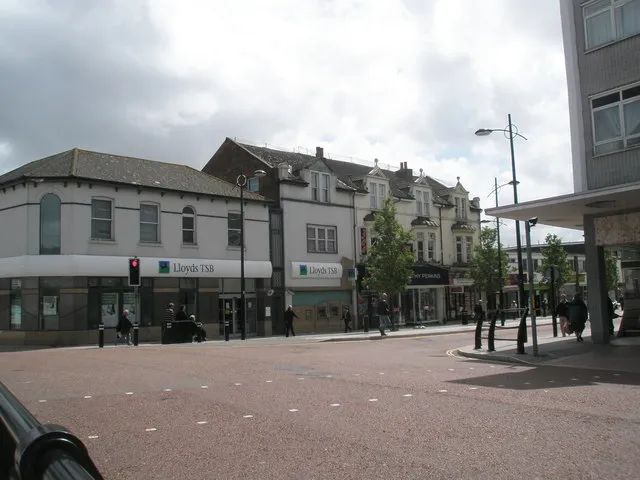 Waterlooville Town, Havant District7.5 km NW
-
South Hayling Town, Havant District7.3 km SW
-
Hayling Island Town, Havant District7.5 km S
-
Cowplain Town, Havant District7.7 km NW
Sources & licences
Data last updated: · 2 independent sources