- Population
- 64,350
- 64.4K
- Elevation
- 54 m
- above sea level
- Local time
- UTC+00:00
- Europe/London · UTC+00:00
- Airports
- SOU Southampton Airport24 km
- BOH Bournemouth Airport58 km
About Waterlooville
Waterlooville is a town. Location: Havant District, Hampshire. Population: 64,350. Elevation: 54 m.
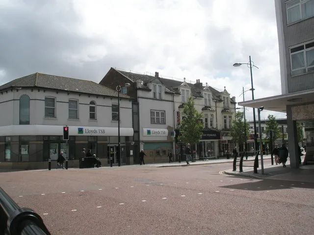
Waterlooville is a town in the Borough of Havant in Hampshire, England, about 6 miles (9.7 km) northeast of Portsmouth. It is the largest town in the borough. The Waterlooville built-up area had a population of 34,775 in the 2021 census. It is surrounded by Purbrook, Blendworth, Cowplain, Lovedean, Clanfield, Catherington, Crookhorn, Denmead, Hambledon, Horndean and Widley. It forms part of the South Hampshire conurbation. The town formed around the old A3 London to Portsmouth road.
Source: Wikipedia · CC BY-SA 4.0
At a glance
- Area
- 2.6 km²
Source: Wikidata
Photos of Waterlooville
-
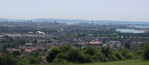
Ports Down en:User:AlanFord · Public domain -

Fort Southwick Martyn Pattison · CC BY-SA 2.0 -
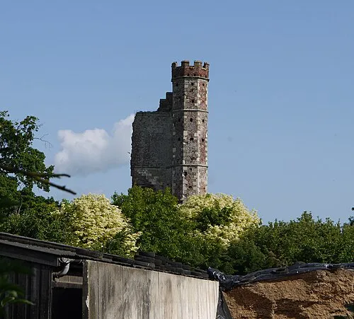
Warblington Castle Geni · CC BY-SA 4.0 -
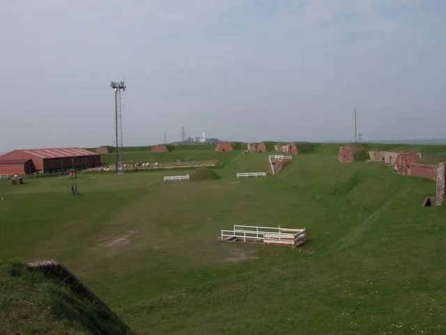
Fort Widley Martyn Pattison · CC BY-SA 2.0


Places bordering Waterlooville
- Portsmouth
Population of Waterlooville over time
| 1841 | 175 | |
|---|---|---|
| 1851 | 195 | |
| 1881 | 246 | |
| 1891 | 436 | |
| 1901 | 609 | |
| 1911 | 887 | |
| 1921 | 1,033 | |
| 1931 | 1,250 |
Censuses and official estimates; source: Wikidata.
Climate of Waterlooville
Best months for sightseeingBest months for sightseeing: June–August.
This month · November
A cold month
Day 11° · Night 4° · Rain 95 mm
- Hottest month
- July (day 22°)
- Coldest month
- February (night 2°)
- Wettest month
- January (95 mm)
- Driest month
- July (47 mm)
Bars: average monthly low and high temperature. Below: precipitation. Monthly averages for 1970–2000 at about 18 km resolution, adjusted for elevation. Highlighted months are mild and relatively dry. Source: WorldClim 2.1 (CC BY 4.0).
Show values as a table
| Month | Jan | Feb | Mar | Apr | May | Jun | Jul | Aug | Sep | Oct | Nov | Dec |
|---|---|---|---|---|---|---|---|---|---|---|---|---|
| Average high (°C) | 8° | 8° | 10° | 13° | 16° | 19° | 22° | 22° | 19° | 15° | 11° | 9° |
| Average low (°C) | 2° | 2° | 3° | 4° | 7° | 10° | 12° | 12° | 10° | 7° | 4° | 3° |
| Precipitation (mm) | 95 | 62 | 70 | 52 | 50 | 57 | 47 | 57 | 75 | 89 | 95 | 95 |
How to get to Waterlooville
The nearest airport is Southampton Airport (SOU), 24 km to the west as the crow flies. For international flights: London Gatwick Airport (LGW) (66 km). The nearest large city is Portsmouth, 10 km to the southwest.
Airports
- Southampton Airport (SOU) Southampton 24 kmwest
- Bournemouth Airport (BOH) Bournemouth 58 kmwest
- London Gatwick Airport (LGW) London 66 kmnortheast
Nearby large cities
- Portsmouth Population: 208.1K 10 kmsouthwest
- Southampton Population: 269.8K 26 kmwest
- Basingstoke Population: 107.6K 43 kmnorth
- Worthing Population: 113.9K 47 kmeast
- Woking Population: 103.9K 59 kmnortheast
Straight-line distances; road distances are longer. Airport data: OurAirports.
Day trips from Waterlooville
Within 100 km: 552 historic and cultural sites, 666 natural sites, 239 lakes, rivers and coasts.
0–25 km150 places
- Portsea Island Natural site 9 kmS
- Calshot Beach Beach 21 kmW
- Pagham Beach Beach 24 kmSE
- Bembridge Beach Beach 21 kmS
25–60 km340 places
- Isle of Wight Island 29 kmSW
- St Nicholas Church Shoreham Attraction 53 kmE
- The Marlipins Museum Museum 53 kmE
- Avon Beach Beach 52 kmW
60–100 km967 places
- Brownsea Island Island 70 kmW
- Studland Beach Beach 69 kmW
- Man O'War Beach Beach 92 kmW
- Round Island Island 73 kmW
Straight-line distances.
Waterlooville and similar cities
Side by side with cities of similar size in the same country: population, elevation and climate.
| Measure | Waterlooville | Taunton | Newtownabbey | Torquay |
|---|---|---|---|---|
| Population | 64.4K | 64.6K | 63.9K | 65.4K |
| Elevation | 54 m | 22 m | 15 m | 8 m |
| Summer day (hottest month) | 22° | 21° | 20° | 21° |
| Winter night (coldest month) | 2° | 3° | 1° | 4° |
| Annual rainfall | 844 mm | 954 mm | 880 mm | 947 mm |
| Best months | Jun–Aug | Jun–Aug | Jun–Aug | Jun–Sep |
| Distance | — | 146 km | 534 km | 182 km |
Climate values are 1970–2000 monthly averages; straight-line distance.
Nearby attractions & nature
Everything nearby-
Forest of Bere Natural site, England2.2 km N
-
Fort Widley Historic site, Portsmouth4 km SW
-
Fort Purbrook Historic site, Havant District3 km S
-
Warblington Castle Historic site, Havant District6.1 km SE
-
Motleys Castle Historic site, Rowlands Castle5 km NE
-
Farlington Marshes Mediumwave Transmitter Landmark, Portsmouth4.3 km S
-
Ports Down Mountain, Portsmouth6.2 km SW
-
North Binness Island Island, Havant District5 km S
Other cities and towns in Havant District
-
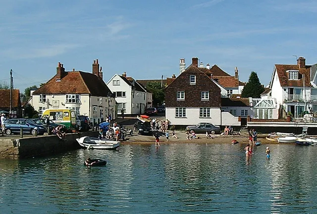 Emsworth Town, Havant District7.5 km SE
-
South Hayling Town, Havant District11 km S
-
Hayling Island Town, Havant District12 km S
Sources & licences
Data last updated: · 2 independent sources