- Local time
- UTC+00:00
- Europe/London · UTC+00:00
- Elevation
- 54 m
- above sea level
- Airports
- BRS Bristol Airport75 km
- BHX Birmingham Airport79 km
About Edgar Street
Edgar Street is a landmark. Location: Hereford, Herefordshire.
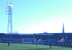
Edgar Street, currently known as MandM Edgar Street Stadium for sponsorship reasons, is a football stadium in Hereford and was the home of Hereford United Football Club from the club's formation in 1924 until December 2014, when the club was wound up. It is now the home of Hereford FC, a phoenix club formed to replace the former club. It is the largest football stadium in the county of Herefordshire and is located on the edge of Hereford city centre, adjacent to the former cattle market (now The Old Market).
Source: Wikipedia · CC BY-SA 4.0
Photos of Edgar Street
-

Airbus99 · CC BY-SA 4.0 -

Airbus99 · CC BY-SA 4.0 -

fitzyt · CC BY 3.0 -

Philip Halling · CC BY-SA 2.0 -

Philip Halling · CC BY-SA 2.0


Climate of Edgar Street
Best months for sightseeingBest months for sightseeing: June–August.
This month · November
A cold month
Day 10° · Night 4° · Rain 66 mm
- Hottest month
- July (day 22°)
- Coldest month
- February (night 1°)
- Wettest month
- January (77 mm)
- Driest month
- July (42 mm)
Bars: average monthly low and high temperature. Below: precipitation. Monthly averages for 1970–2000 at about 18 km resolution, adjusted for elevation. Highlighted months are mild and relatively dry. Source: WorldClim 2.1 (CC BY 4.0).
Show values as a table
| Month | Jan | Feb | Mar | Apr | May | Jun | Jul | Aug | Sep | Oct | Nov | Dec |
|---|---|---|---|---|---|---|---|---|---|---|---|---|
| Average high (°C) | 7° | 7° | 10° | 12° | 16° | 19° | 22° | 21° | 18° | 14° | 10° | 8° |
| Average low (°C) | 1° | 1° | 3° | 4° | 7° | 9° | 11° | 11° | 9° | 6° | 4° | 2° |
| Precipitation (mm) | 77 | 52 | 56 | 48 | 50 | 54 | 42 | 58 | 64 | 66 | 66 | 74 |
How to get to Edgar Street
The nearest airport is Bristol Airport (BRS), 75 km to the south as the crow flies. The nearest large city is Worcester, 37 km to the northeast.
Airports
- Bristol Airport (BRS) Bristol 75 kmsouth
- Birmingham Airport (BHX) Birmingham, West Midlands 79 kmnortheast
- Cardiff International Airport (CWL) Cardiff 86 kmsouthwest
Nearby large cities
- Worcester Population: 101.7K 37 kmnortheast
- Gloucester Population: 132.4K 39 kmsoutheast
- Cheltenham Population: 118.8K 47 kmeast
- Newport Population: 161.5K 56 kmsouth
- Dudley Population: 199.1K 65 kmnortheast
Straight-line distances; road distances are longer. Airport data: OurAirports.
Day trips from Edgar Street
Within 100 km: 1,032 historic and cultural sites, 2,183 natural sites, 148 lakes, rivers and coasts.
0–25 km233 places
- The Island Island 23 kmN
- Edmund's Tump Mountain 22 kmSW
- Garway Hill Mountain 17 kmSW
- Burton Hill Mountain 14 kmNW
25–60 km1,148 places
- Alney Island Island 39 kmSE
- Glover's Island Island 52 kmE
- Denny Island Island 60 kmS
- Bevere Island Island 38 kmNE
60–100 km1,982 places
- Steep Holm Island 85 kmS
- Flat Holm Island 81 kmS
- Barry Island Island 84 kmSW
- Sully Island Island 81 kmSW
Straight-line distances.
Nearby attractions & nature
Everything nearby-
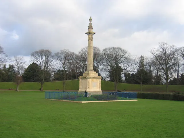 Hereford Castle Historic site, Hereford0.9 km S
-
Breinton Moat Historic site, Breinton3.8 km W
-
Lyde Castle Historic site, Pipe and Lyde3.6 km N
-
Eaton Camp Historic site, Eaton Bishop5.6 km W
-
Cobhall motte Historic site, Allensmore7.4 km SW
-
Dinedor Camp Mountain, Dinedor4.5 km S
-
Breinton Common Mountain, Breinton5.1 km W
-
Mansell Lacy Moat Historic site, Mansell Lacy9.6 km NW
Nearest towns and villages
-
Hereford City, Hereford0.5 km SE
-
Moorfields Neighbourhood, Hereford0.2 km SW
-
Belmont Village, Belmont Rural2.6 km SW
-
Widemarsh Neighbourhood, Hereford0.7 km NW
Sources & licences
Data last updated: · 2 independent sources