Hereford Castle
Located in Hereford, Herefordshire Coordinates: 52°03′11″ N 2°42′50″ W
- Local time
- UTC+00:00
- Europe/London · UTC+00:00
- Elevation
- 59 m
- above sea level
- Airports
- BRS Bristol Airport75 km
- BHX Birmingham Airport80 km
About Hereford Castle
Hereford Castle is a historic site. Location: Hereford, Herefordshire.
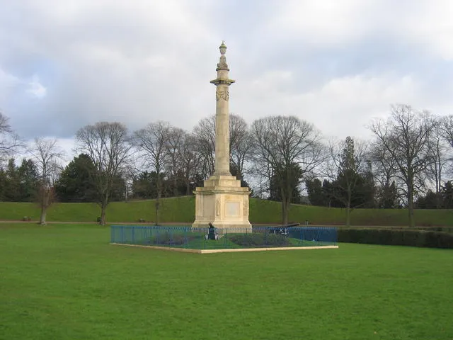
Hereford Castle is a castle that used to be in the cathedral city of Hereford, the county town of Herefordshire, England (grid reference SO511396). Founded sometime before 1052, it was one of the earliest castles in England. Hereford Castle was probably destroyed when the Welsh sacked Hereford in 1055, but seems to have been replaced by the following decade.
Source: Wikipedia · CC BY-SA 4.0
At a glance
- Heritage designation
- scheduled monument
Source: Wikidata
Photos of Hereford Castle
-
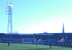
Edgar Street Bigmike at English Wikipedia · Public domain

Climate of Hereford Castle
Best months for sightseeingBest months for sightseeing: June–August.
This month · November
A cold month
Day 10° · Night 4° · Rain 66 mm
- Hottest month
- July (day 22°)
- Coldest month
- February (night 1°)
- Wettest month
- January (77 mm)
- Driest month
- July (42 mm)
Bars: average monthly low and high temperature. Below: precipitation. Monthly averages for 1970–2000 at about 18 km resolution, adjusted for elevation. Highlighted months are mild and relatively dry. Source: WorldClim 2.1 (CC BY 4.0).
Show values as a table
| Month | Jan | Feb | Mar | Apr | May | Jun | Jul | Aug | Sep | Oct | Nov | Dec |
|---|---|---|---|---|---|---|---|---|---|---|---|---|
| Average high (°C) | 7° | 7° | 10° | 12° | 16° | 19° | 22° | 21° | 18° | 14° | 10° | 8° |
| Average low (°C) | 1° | 1° | 3° | 4° | 7° | 9° | 11° | 11° | 9° | 6° | 4° | 2° |
| Precipitation (mm) | 77 | 52 | 56 | 48 | 50 | 54 | 42 | 58 | 64 | 66 | 66 | 74 |
How to get to Hereford Castle
The nearest airport is Bristol Airport (BRS), 75 km to the south as the crow flies. The nearest large city is Worcester, 37 km to the northeast.
Airports
- Bristol Airport (BRS) Bristol 75 kmsouth
- Birmingham Airport (BHX) Birmingham, West Midlands 80 kmnortheast
- Cardiff International Airport (CWL) Cardiff 85 kmsouthwest
Nearby large cities
- Worcester Population: 101.7K 37 kmnortheast
- Gloucester Population: 132.4K 39 kmsoutheast
- Cheltenham Population: 118.8K 47 kmeast
- Newport Population: 161.5K 55 kmsouth
- Dudley Population: 199.1K 66 kmnortheast
Straight-line distances; road distances are longer. Airport data: OurAirports.
Day trips from Hereford Castle
Within 100 km: 1,027 historic and cultural sites, 2,168 natural sites, 148 lakes, rivers and coasts.
0–25 km234 places
- The Island Island 23 kmN
- Edmund's Tump Mountain 21 kmSW
- Garway Hill Mountain 16 kmSW
- Burton Hill Mountain 15 kmNW
25–60 km1,138 places
- Alney Island Island 38 kmSE
- Glover's Island Island 52 kmE
- Denny Island Island 59 kmS
- Bevere Island Island 38 kmNE
60–100 km1,971 places
- Steep Holm Island 84 kmS
- Flat Holm Island 80 kmS
- Barry Island Island 83 kmSW
- Sully Island Island 80 kmSW
Straight-line distances.
Nearby attractions & nature
Everything nearby-
Edgar Street Landmark, Hereford0.9 km N
-
Breinton Moat Historic site, Breinton3.9 km W
-
Lyde Castle Historic site, Pipe and Lyde4.5 km N
-
Eaton Camp Historic site, Eaton Bishop5.8 km W
-
Dinedor Camp Mountain, Dinedor3.6 km S
-
Cobhall motte Historic site, Allensmore7.1 km SW
-
Breinton Common Mountain, Breinton5.4 km W
-
Didley Court Farm Motte Historic site, St. Devereux9.8 km SW
Nearest towns and villages
-
Hereford City, Hereford0.4 km N
-
Belmont Village, Belmont Rural2.2 km SW
-
Portfields Neighbourhood, Hereford0.3 km E
-
Blackmarstone Neighbourhood, Hereford0.5 km SW
Sources & licences
Data last updated: · 2 independent sources