Pembridge Castle
Located in Welsh Newton, Herefordshire Coordinates: 51°52′11″ N 2°44′42″ W
- Local time
- UTC+00:00
- Europe/London · UTC+00:00
- Elevation
- 187 m
- above sea level
- Airports
- BRS Bristol Airport54 km
- CWL Cardiff International Airport67 km
About Pembridge Castle
Pembridge Castle is a historic site. Location: Welsh Newton, Herefordshire.
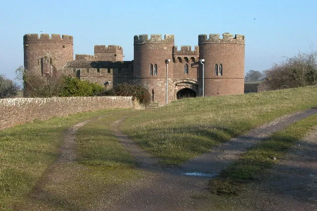
Pembridge Castle, originally called Newland Castle, is a late 12th century to early 13th century Grade I listed former border castle located approximately 1 mile (1.6 km) northwest of Welsh Newton in Herefordshire, England. It was most likely constructed by Matilda de St Valery sometime before 1208. It is over 40 km (25 mi) away from the actual village of Pembridge. Founded by 1208, it was the seat of the Pembridge family, then later the Wakes and Mortimer families in the 14th and 15th centuries.
Source: Wikipedia · CC BY-SA 4.0
At a glance
- Built
- c. 1208
- Heritage designation
- Grade I listed building
Source: Wikidata
Photos of Pembridge Castle
-

Fabian Musto · CC BY-SA 2.0 -

Fabian Musto · CC BY-SA 2.0 -

Philip Pankhurst · CC BY-SA 2.0 -

Philip Pankhurst · CC BY-SA 2.0 -
Orcop Castle Tony Powell · CC BY-SA 2.0


Climate of Pembridge Castle
Best months for sightseeingBest months for sightseeing: June–August.
This month · November
A cold month
Day 9° · Night 4° · Rain 78 mm
- Hottest month
- July (day 20°)
- Coldest month
- February (night 1°)
- Wettest month
- January (88 mm)
- Driest month
- July (43 mm)
Bars: average monthly low and high temperature. Below: precipitation. Monthly averages for 1970–2000 at about 18 km resolution, adjusted for elevation. Highlighted months are mild and relatively dry. Source: WorldClim 2.1 (CC BY 4.0).
Show values as a table
| Month | Jan | Feb | Mar | Apr | May | Jun | Jul | Aug | Sep | Oct | Nov | Dec |
|---|---|---|---|---|---|---|---|---|---|---|---|---|
| Average high (°C) | 6° | 6° | 9° | 11° | 15° | 18° | 20° | 20° | 17° | 13° | 9° | 7° |
| Average low (°C) | 1° | 1° | 2° | 4° | 7° | 9° | 12° | 11° | 9° | 7° | 4° | 2° |
| Precipitation (mm) | 88 | 61 | 65 | 56 | 57 | 58 | 43 | 65 | 72 | 75 | 78 | 87 |
How to get to Pembridge Castle
The nearest airport is Bristol Airport (BRS), 54 km to the south as the crow flies. The nearest large city is Gloucester, 35 km to the east.
Airports
- Bristol Airport (BRS) Bristol 54 kmsouth
- Cardiff International Airport (CWL) Cardiff 67 kmsouthwest
- Birmingham Airport (BHX) Birmingham, West Midlands 94 kmnortheast
Nearby large cities
- Gloucester Population: 132.4K 35 kmeast
- Newport Population: 161.5K 36 kmsouthwest
- Cheltenham Population: 118.8K 46 kmeast
- Bristol Population: 479K 47 kmsouth
- Worcester Population: 101.7K 51 kmnortheast
Straight-line distances; road distances are longer. Airport data: OurAirports.
Day trips from Pembridge Castle
Within 100 km: 969 historic and cultural sites, 1,980 natural sites, 136 lakes, rivers and coasts.
0–25 km264 places
- Hobbs Mountain 21 kmE
- Sugar Loaf Mountain 22 kmW
- May Hill Mountain 21 kmE
- Ysgyryd Fawr Mountain 16 kmW
25–60 km1,016 places
- Alney Island Island 34 kmE
- Glover's Island Island 60 kmNE
- Denny Island Island 38 kmS
- The Island Island 44 kmN
60–100 km1,805 places
- Kilve Beach Beach 82 kmSW
- Steep Holm Island 64 kmSW
- Flat Holm Island 61 kmSW
- Barry Island Island 64 kmSW
Straight-line distances.
Nearby attractions & nature
Everything nearby-
 Skenfrith Castle Historic site, Llangattock-Vibon-Avel3.3 km W
-
Skenchill Mountain, Llanrothal1.2 km SW
-
Tregate Castle Historic site, Llanrothal2.3 km S
-
 Treago Castle Historic site, St. Weonards4.6 km N
-
Welsh Newton Common Mountain, Welsh Newton2.9 km SE
-
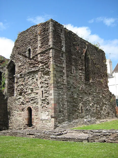 Monmouth Castle Historic site, Monmouth6.7 km S
-
Newcastle Historic site, Llangattock-Vibon-Avel4.5 km SW
-
Coedanghred Hill Mountain, Llangattock-Vibon-Avel3 km W
Nearest towns and villages
-
 Skenfrith Village, Llangattock-Vibon-Avel3.2 km W
-
Welsh Newton Village, Welsh Newton1.7 km SE
-
Llanrothal Municipality, Herefordshire1.5 km S
-
Llanrothal Village, Llanrothal1.5 km W
Sources & licences
Data last updated: · 2 independent sources