- Elevation
- 201 m
- above sea level
- Local time
- UTC+00:00
- Europe/London · UTC+00:00
- Airports
- LTN London Luton Airport15 km
- LHR London Heathrow Airport39 km
About Ringshall
Ringshall is a village. Location: Little Gaddesden, Dacorum District. Elevation: 201 m. The best months to visit are June–August. The nearest airport is London Luton Airport (15 km). Nearby sights include Clipper Down and Aldbury Nowers.
Photos of Ringshall
-
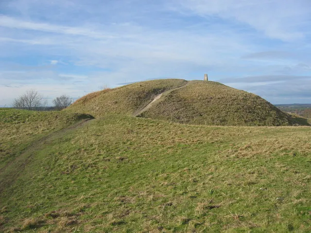
Totternhoe Castle Marc Cohen · CC BY-SA 2.0

Climate of Ringshall
Best months for sightseeingBest months for sightseeing: June–August.
This month · November
A cold month
Day 9° · Night 3° · Rain 68 mm
- Hottest month
- July (day 21°)
- Coldest month
- February (night 1°)
- Wettest month
- December (71 mm)
- Driest month
- July (44 mm)
Bars: average monthly low and high temperature. Below: precipitation. Monthly averages for 1970–2000 at about 18 km resolution, adjusted for elevation. Highlighted months are mild and relatively dry. Source: WorldClim 2.1 (CC BY 4.0).
Show values as a table
| Month | Jan | Feb | Mar | Apr | May | Jun | Jul | Aug | Sep | Oct | Nov | Dec |
|---|---|---|---|---|---|---|---|---|---|---|---|---|
| Average high (°C) | 6° | 7° | 9° | 12° | 16° | 19° | 21° | 21° | 18° | 14° | 9° | 7° |
| Average low (°C) | 1° | 1° | 2° | 4° | 7° | 10° | 12° | 12° | 10° | 7° | 3° | 2° |
| Precipitation (mm) | 68 | 49 | 56 | 52 | 56 | 58 | 44 | 57 | 63 | 70 | 68 | 71 |
How to get to Ringshall
The nearest airport is London Luton Airport (LTN), 15 km to the northeast as the crow flies. The nearest large city is Luton, 13 km to the northeast.
Airports
- London Luton Airport (LTN) Luton, Luton 15 kmnortheast
- London Heathrow Airport (LHR) London 39 kmsouth
- London City Airport (LCY) London 56 kmsoutheast
Nearby large cities
- Luton Population: 225.3K 13 kmnortheast
- Watford Population: 125.7K 22 kmsoutheast
- High Wycombe Population: 133.2K 24 kmsouthwest
- Milton Keynes Population: 256.4K 28 kmnorthwest
- Harrow Population: 149.2K 31 kmsoutheast
Straight-line distances; road distances are longer. Airport data: OurAirports.
Day trips from Ringshall
Within 100 km: 895 historic and cultural sites, 586 natural sites, 282 lakes, rivers and coasts.
0–25 km156 places
- Heron Island Island 17 kmSE
- Chantry Island Island 21 kmSE
- Reservoir Lake 16 kmNE
- Reservoir Lake 19 kmNE
25–60 km807 places
- White Hart Lane Landmark 42 kmSE
- The Lynch Island 42 kmSW
- Holm Island Island 43 kmS
- Sunbury Court Island 47 kmS
60–100 km800 places
- Spotlites @ Kings Theatre Attraction 91 kmSE
- Yantlet beach Beach 94 kmSE
- Osea Island Island 93 kmE
- Northey Island Island 90 kmE
Straight-line distances.
Nearby attractions & nature
Everything nearby-
Clipper Down Mountain, Ivinghoe2.1 km NW
-
Aldbury Nowers Mountain, Aldbury3.2 km W
-
Ivinghoe Beacon Mountain, Ivinghoe3.6 km NW
-
Totternhoe Castle Historic site, Totternhoe7.9 km N
-
Berkhamsted Castle Historic site, Berkhamsted6.1 km S
-
Dunstable Downs, Chilterns Gateway Centre and Whipsnade Estate Natural site, Whipsnade5.8 km NE
Sources & licences
Data last updated: