- Population
- 22,639
- 22.6K
- Elevation
- 125 m
- above sea level
- Local time
- UTC+00:00
- Europe/London · UTC+00:00
- Airports
- LTN London Luton Airport24 km
- LCY London City Airport26 km
About Potters Bar
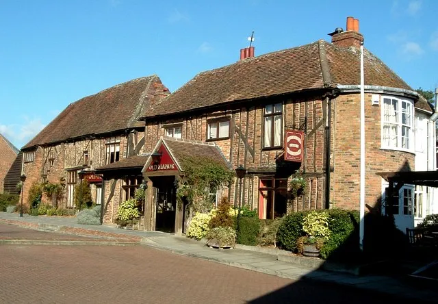
Potters Bar is a town. Location: Hertsmere District, Hertfordshire. Population: 22,639. Elevation: 125 m.
Potters Bar is a town in Hertfordshire, England, 13 miles (21 km) north of central London. In 2011, it had a population of 21,882. In the 2021 census, the four wards that make up Potters Bar – Bentley Heath & The Royds, Furzefield, Oakmere and Parkfield – had a combined population of 22,536; this includes several smaller outlying hamlets contained in the Bentley Heath & The Royds ward, such as Bentley Heath and Ganwick Corner. In 2022, the population was around 23,325.
Source: Wikipedia · CC BY-SA 4.0
Photos of Potters Bar
-

SmoIchopper · CC BY 2.0 -

SmoIchopper · CC BY 2.0 -

kitmasterbloke · CC BY 2.0 -

Peter O'Connor aka anemoneprojectors · CC BY-SA 2.0 -

Matt Brown · CC BY 4.0


Travel notes for Potters Bar
From Wikivoyage
Potters Bar is a town of 22,000 people (in 2011) in Hertfordshire. It was founded in the 13th century. It borders the northern part of metropolitan London and is today very much in the city's commuter belt. The town is surrounded by Green Belt countryside.
Understand+
Orientation:
Potters Bar has 2 main parallel shopping streets: High Street (A1000) with the Bus Garage and Darkes Lane with the Railway Station - which are linked by The Walk.
History:
Its name may refer to the fact that pottery was manufactured here in Roman times. The town, dating from the early 13th century, was small but on the coaching route between Barnet and Hatfield. The 'Bar' may refer to a toll gate on the Great North Road (now the A1000). It began growing when the Great Northern Railway was built through it in 1850.
Get in+
By bus:
1 Potters Bar Bus Garage The bus service also connects the town to London and other nearby towns.
By train:
2 Potters Bar Railway Station the Great Northern Railway links Potters Bar to London Kings Cross and to many towns to the north: Hatfield, Welwyn Garden City, Stevenage.
By road:
The M25 Motorway is at the southern limits of the town. A1000 runs from south to north through the High Street. A1005 links to A111, just on the town's south side, and becomes B556, which runs through the town centre and links Potters Bar to nearby London Colney.
Source: Wikivoyage · CC BY-SA 4.0 · abridged
Climate of Potters Bar
Best months for sightseeingBest months for sightseeing: June–August.
This month · November
A cold month
Day 10° · Night 4° · Rain 63 mm
- Hottest month
- July (day 22°)
- Coldest month
- February (night 1°)
- Wettest month
- October (67 mm)
- Driest month
- July (43 mm)
Bars: average monthly low and high temperature. Below: precipitation. Monthly averages for 1970–2000 at about 18 km resolution, adjusted for elevation. Highlighted months are mild and relatively dry. Source: WorldClim 2.1 (CC BY 4.0).
Show values as a table
| Month | Jan | Feb | Mar | Apr | May | Jun | Jul | Aug | Sep | Oct | Nov | Dec |
|---|---|---|---|---|---|---|---|---|---|---|---|---|
| Average high (°C) | 7° | 7° | 10° | 12° | 16° | 19° | 22° | 21° | 18° | 14° | 10° | 7° |
| Average low (°C) | 1° | 1° | 2° | 4° | 7° | 10° | 12° | 12° | 10° | 7° | 4° | 2° |
| Precipitation (mm) | 66 | 44 | 51 | 48 | 49 | 56 | 43 | 52 | 58 | 67 | 63 | 64 |
How to get to Potters Bar
The nearest airport is London Luton Airport (LTN), 24 km to the northwest as the crow flies. The nearest large city is Enfield, 8 km to the southeast.
Airports
- London Luton Airport (LTN) Luton, Luton 24 kmnorthwest
- London City Airport (LCY) London 26 kmsoutheast
- London Heathrow Airport (LHR) London 32 kmsouthwest
Nearby large cities
- Enfield Population: 156.9K 8 kmsoutheast
- Tottenham Population: 130K 13 kmsoutheast
- Archway Population: 215.7K 14 kmsouth
- Watford Population: 125.7K 16 kmwest
- Walthamstow Population: 109.4K 16 kmsoutheast
Straight-line distances; road distances are longer. Airport data: OurAirports.
Day trips from Potters Bar
Within 100 km: 851 historic and cultural sites, 567 natural sites, 312 lakes, rivers and coasts.
0–25 km340 places
- White Hart Lane Landmark 13 kmSE
- Lot's Ait Island 25 kmS
- Rook Island Island 21 kmSE
- Duck Island Island 21 kmS
25–60 km646 places
- The Lynch Island 54 kmSW
- Canvey Island Island 56 kmE
- Holm Island Island 38 kmSW
- Sunbury Court Island 35 kmSW
60–100 km744 places
- Isle of Sheppey Island 77 kmSE
- Spotlites @ Kings Theatre Attraction 60 kmSE
- St Nicholas Church Shoreham Attraction 95 kmS
- The Marlipins Museum Museum 96 kmS
Straight-line distances.
Nearby attractions & nature
Everything nearby-
South Mymms Castle Historic site, South Mimms3.4 km NW
-
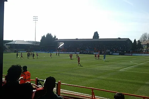 Underhill Stadium Landmark, Barnet5.4 km S
-
Brookmans Park Transmitter, T-Antenna South, Tower West Landmark, North Mymms3.8 km N
-
Brookmans Park Transmitter, T-Antenna South, Tower East Landmark, North Mymms3.9 km N
-
Brookmans Park Transmitter, T-Antenna North, Tower West Landmark, North Mymms4 km N
-
Brookmans Park Transmitter, T-Antenna North, Tower East Landmark, North Mymms4.1 km N
-
Brookmans Park Transmitter, Mediumwave Mast Landmark, North Mymms4.3 km N
-
Brookmans Park Natural site, North Mymms4.4 km N
Other cities and towns in Hertsmere District
-
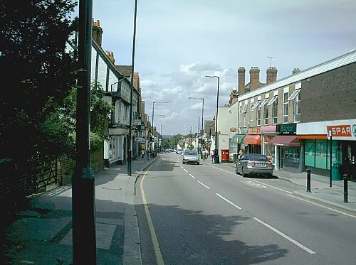 Bushey Town, Hertsmere District14 km SW
-
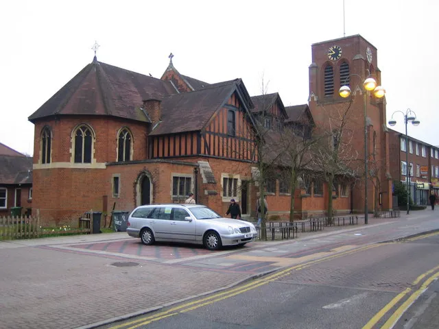 Borehamwood Town, Elstree and Borehamwood8.1 km SW
-
Radlett Town, Aldenham9.7 km W
Sources & licences
Data last updated: · 2 independent sources