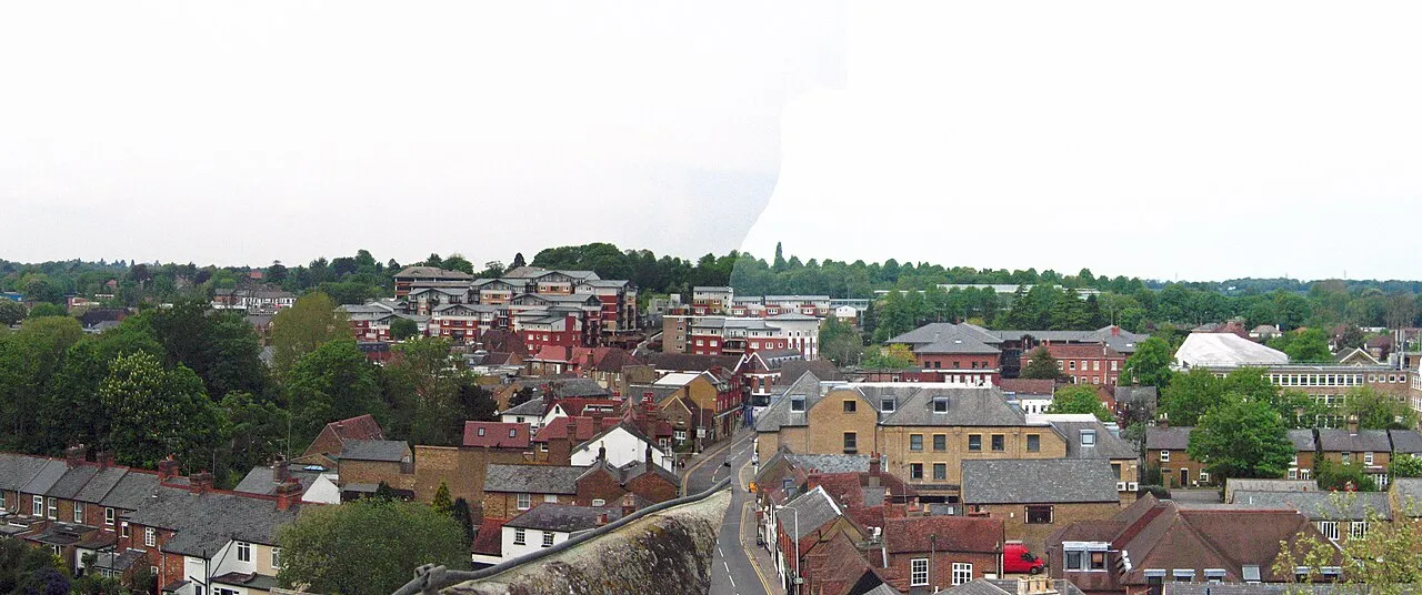
- Population
- 25,413
- 25.4K
- Elevation
- 53 m
- above sea level
- Local time
- UTC+00:00
- Europe/London · UTC+00:00
- Airports
- LHR London Heathrow Airport19 km
- LTN London Luton Airport27 km
About Rickmansworth
Rickmansworth is a town. Location: Three Rivers, Hertfordshire. Population: 25,413. Elevation: 53 m.
Rickmansworth () is a town in south-west Hertfordshire, England, located approximately 17 miles (27 km) north-west of central London, 5 miles (8 km) south-west of Watford and inside the perimeter of the M25 motorway. The town is mainly to the north of the Grand Union Canal (formerly the Grand Junction Canal) and the River Colne.
Source: Wikipedia · CC BY-SA 4.0
Photos of Rickmansworth
-

Stephen McKay · CC BY-SA 2.0 -

Peter O'Connor aka anemoneprojectors · CC BY-SA 2.0 -

No Swan So Fine · CC BY-SA 4.0 -

allen watkin from London, UK · CC BY-SA 2.0 -

allen watkin from London, UK · CC BY-SA 2.0


Travel notes for Rickmansworth
From Wikivoyage
Rickmansworth is a small town in Hertfordshire, its hinterland includes Chorleywood and the largely suburban Maple Cross.
Understand+
Rickmansworth itself, is the administrative centre of the Three Rivers District, so named after the confluence of 3 rivers within Rickmansworth's borders (rivers Colne, Chess and Gade, together with the Grand Union Canal).
Chorleywood is dual centered, with a predominantly rural common, and expensive properties aside the main (Amersham) road, most of the town being on the Western side of the railway in the valley.
Get in+
By car:
Rickmansworth is on the A412, and A404 (Signposted from M25 J18)
By rail:
1 Rickmansworth Station, Station Approach, WD3 1QY. Served by National Rail services between London Marylebone and Aylesbury (Chiltern Railways), and by the slower but more frequent London Underground Metropolitan line service between Baker Street and Amersham. (updated Jun 2017)
2 Chorleywood Station, Station Approach, WD3 5ND. Served by National Rail services between London Marylebone and Aylesbury (Chiltern Railways), and by the slower but more frequent London Underground Metropolitan line service between Baker Street and Amersham. (updated Jan 2018)
By bicycle:
National Cycle Route 6. From London to the Lake District through the town (updated Jun 2017)
National Cycle Route 61. From Maidenhead to Hertford through the town. (updated Jun 2017)
By Narrowboat:
The Grand Union Canal passes to the South of the town.
Source: Wikivoyage · CC BY-SA 4.0 · abridged
Climate of Rickmansworth
Best months for sightseeingBest months for sightseeing: June–August.
This month · November
A cold month
Day 11° · Night 4° · Rain 59 mm
- Hottest month
- July (day 23°)
- Coldest month
- February (night 2°)
- Wettest month
- October (64 mm)
- Driest month
- February (40 mm)
Bars: average monthly low and high temperature. Below: precipitation. Monthly averages for 1970–2000 at about 18 km resolution, adjusted for elevation. Highlighted months are mild and relatively dry. Source: WorldClim 2.1 (CC BY 4.0).
Show values as a table
| Month | Jan | Feb | Mar | Apr | May | Jun | Jul | Aug | Sep | Oct | Nov | Dec |
|---|---|---|---|---|---|---|---|---|---|---|---|---|
| Average high (°C) | 8° | 8° | 11° | 13° | 17° | 20° | 23° | 22° | 19° | 15° | 11° | 8° |
| Average low (°C) | 2° | 2° | 3° | 4° | 8° | 11° | 13° | 13° | 10° | 7° | 4° | 3° |
| Precipitation (mm) | 60 | 40 | 47 | 46 | 51 | 53 | 41 | 51 | 57 | 64 | 59 | 60 |
How to get to Rickmansworth
The nearest airport is London Heathrow Airport (LHR), 19 km to the south as the crow flies. The nearest large city is Watford, 6 km to the east.
Airports
- London Heathrow Airport (LHR) London 19 kmsouth
- London Luton Airport (LTN) Luton, Luton 27 kmnorth
- London City Airport (LCY) London 40 kmeast
Nearby large cities
- Watford Population: 125.7K 6 kmeast
- Harrow Population: 149.2K 12 kmsoutheast
- Slough Population: 164.8K 17 kmsouthwest
- High Wycombe Population: 133.2K 19 kmwest
- Archway Population: 215.7K 25 kmeast
Straight-line distances; road distances are longer. Airport data: OurAirports.
Day trips from Rickmansworth
Within 100 km: 882 historic and cultural sites, 643 natural sites, 306 lakes, rivers and coasts.
0–25 km184 places
- Holm Island Island 23 kmS
- Lot's Ait Island 21 kmSE
- Windsor Racecourse Island Island 21 kmSW
- Magna Carta Island Island 22 kmS
25–60 km840 places
- White Hart Lane Landmark 29 kmE
- The Lynch Island 33 kmSW
- Sunbury Court Island 26 kmS
- Rivermead Island 26 kmS
60–100 km807 places
- Isle of Sheppey Island 95 kmE
- Spotlites @ Kings Theatre Attraction 76 kmE
- St Nicholas Church Shoreham Attraction 90 kmS
- The Marlipins Museum Museum 91 kmS
Straight-line distances.
Nearby attractions & nature
Everything nearby-
Rickmansworth Park Natural site, Three Rivers0.6 km NE
-
River Chess River, Three Rivers1.1 km E
-
Batchworth Heath Mountain, Three Rivers3 km SE
-
Tumbling Bay Natural site, Three Rivers3.1 km SW
-
Lynsters Lake Lake, Three Rivers3.2 km SW
-
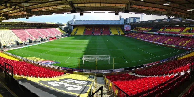 Vicarage Road Landmark, Watford District5.4 km E
-
Horse Shoe Bay Natural site, Three Rivers4.1 km S
-
Pynesfield Lake Lake, Three Rivers3.8 km SW
Sources & licences
Data last updated: · 2 independent sources