Digswell Park
Located in Welwyn Hatfield, Hertfordshire Coordinates: 51°49′01″ N 0°12′23″ W
- Elevation
- 88 m
- above sea level
- Local time
- UTC+00:00
- Europe/London · UTC+00:00
- Airports
- LTN London Luton Airport13 km
- STN London Stansted Airport31 km
About Digswell Park
Digswell Park is a neighbourhood. Location: Welwyn Hatfield, Hertfordshire. The best months to visit are June–August. The nearest airport is London Luton Airport (13 km). Nearby sights include Burnham Green and Broadhall Way.
Climate of Digswell Park
Best months for sightseeingBest months for sightseeing: June–August.
This month · November
A cold month
Day 10° · Night 4° · Rain 63 mm
- Hottest month
- July (day 22°)
- Coldest month
- February (night 1°)
- Wettest month
- October (67 mm)
- Driest month
- July (43 mm)
Bars: average monthly low and high temperature. Below: precipitation. Monthly averages for 1970–2000 at about 18 km resolution, adjusted for elevation. Highlighted months are mild and relatively dry. Source: WorldClim 2.1 (CC BY 4.0).
Show values as a table
| Month | Jan | Feb | Mar | Apr | May | Jun | Jul | Aug | Sep | Oct | Nov | Dec |
|---|---|---|---|---|---|---|---|---|---|---|---|---|
| Average high (°C) | 7° | 7° | 10° | 12° | 16° | 19° | 22° | 22° | 18° | 14° | 10° | 8° |
| Average low (°C) | 1° | 1° | 3° | 4° | 7° | 10° | 12° | 12° | 10° | 7° | 4° | 2° |
| Precipitation (mm) | 66 | 44 | 51 | 48 | 49 | 56 | 43 | 52 | 58 | 67 | 63 | 64 |
How to get to Digswell Park
The nearest airport is London Luton Airport (LTN), 13 km to the northwest as the crow flies. The nearest large city is Luton, 16 km to the northwest.
Airports
- London Luton Airport (LTN) Luton, Luton 13 kmnorthwest
- London Stansted Airport (STN) London, Essex 31 kmeast
- London City Airport (LCY) London 39 kmsoutheast
Nearby large cities
- Luton Population: 225.3K 16 kmnorthwest
- Enfield Population: 156.9K 20 kmsoutheast
- Watford Population: 125.7K 22 kmsouthwest
- Tottenham Population: 130K 26 kmsouth
- Harrow Population: 149.2K 28 kmsouth
Straight-line distances; road distances are longer. Airport data: OurAirports.
Day trips from Digswell Park
Within 100 km: 871 historic and cultural sites, 522 natural sites, 317 lakes, rivers and coasts.
0–25 km122 places
- Latton Island Island 22 kmE
- Broad Water Island Island 5 kmE
- Heron Island Island 12 kmSW
- Chantry Island Island 16 kmSW
25–60 km809 places
- White Hart Lane Landmark 26 kmS
- The Lynch Island 60 kmSW
- Holm Island Island 48 kmSW
- Sunbury Court Island 47 kmS
60–100 km779 places
- Isle of Sheppey Island 86 kmSE
- Spotlites @ Kings Theatre Attraction 71 kmSE
- West Mersea Beach Beach 79 kmE
- Yantlet beach Beach 72 kmSE
Straight-line distances.
Nearby attractions & nature
Everything nearby-
Burnham Green Mountain, Datchworth3.3 km NE
-
 Broadhall Way Landmark, Stevenage District8.1 km N
-
Broad Water Island Island, Hertingfordbury5.1 km E
-
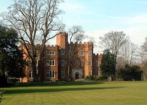 Hertford Castle Historic site, Hertford9 km E
-
Watton Historic site, Watton-at-Stone6.2 km NE
-
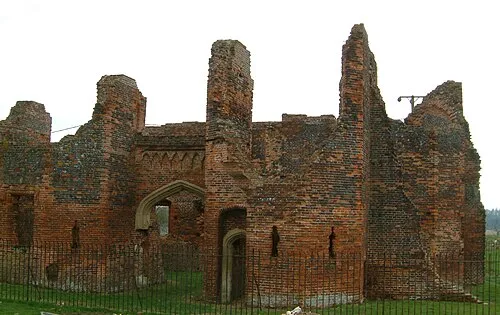 Someries Castle Historic site, Hyde13 km NW
Sources & licences
Data last updated: