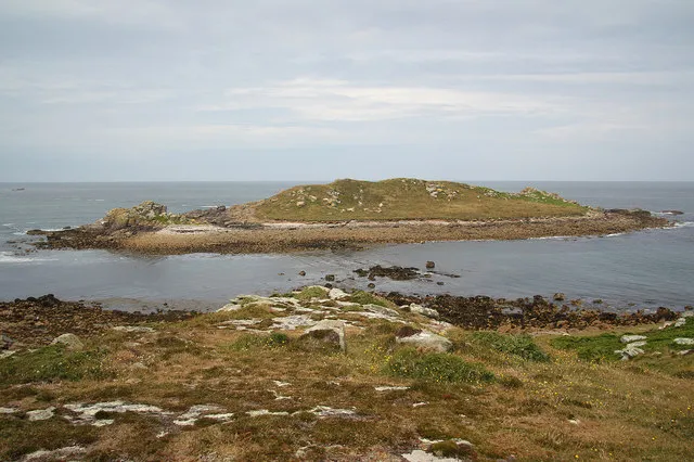
- Elevation
- 13 m
- above sea level
- Local time
- UTC+00:00
- Europe/London · UTC+00:00
- Airports
- NQY Cornwall Airport Newquay112 km
- BES Brest Bretagne airport220 km
About Gweal
Gweal is an island. Location: Bryher, Isles of Scilly.
Gweal ( GWEEL; Cornish: Gwydhyel, lit. 'place of trees') is one of the Isles of Scilly. It is the largest of the seven Norrard Rocks due west of Bryher. The name perhaps refers back to a time before most of the islands' area was inundated. On the top of Gweal Hill are the remnants of an entrance grave and two cairns. The water surrounding the island is about 52 feet deep.
Source: Wikipedia · CC BY-SA 4.0
At a glance
- Length
- 0.5 km
- Area
- 5.8 ha
Source: Wikidata
Photos of Gweal
-
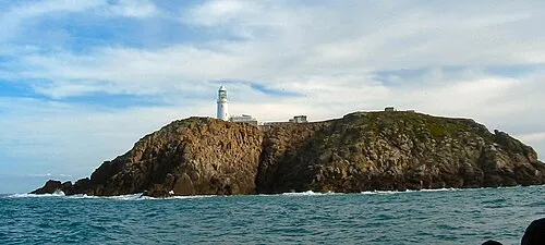
Round Island The original uploader was Benjaminevans82 at English Wikipedia · Public domain -
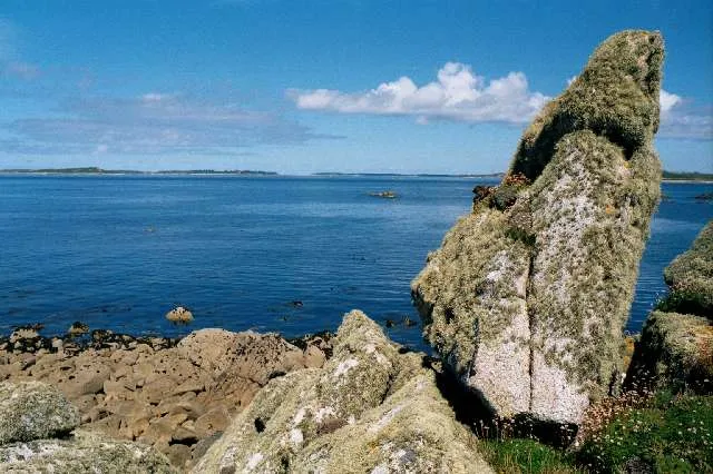
Burnt Island David Lally · CC BY-SA 2.0 -
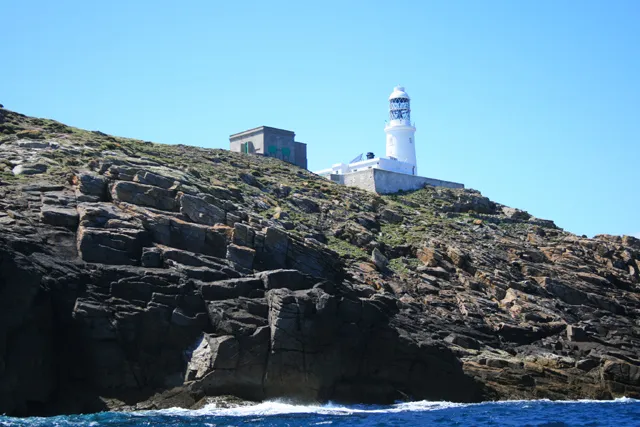
Round Island Lighthouse David Lally · CC BY-SA 2.0


Climate of Gweal
Best months for sightseeingBest months for sightseeing: June–September.
This month · November
A wet month
Day 13° · Night 9° · Rain 111 mm
- Hottest month
- August (day 19°)
- Coldest month
- February (night 7°)
- Wettest month
- January (125 mm)
- Driest month
- July (50 mm)
Bars: average monthly low and high temperature. Below: precipitation. Monthly averages for 1970–2000 at about 18 km resolution, adjusted for elevation. Highlighted months are mild and relatively dry. Source: WorldClim 2.1 (CC BY 4.0).
Show values as a table
| Month | Jan | Feb | Mar | Apr | May | Jun | Jul | Aug | Sep | Oct | Nov | Dec |
|---|---|---|---|---|---|---|---|---|---|---|---|---|
| Average high (°C) | 10° | 10° | 11° | 12° | 14° | 16° | 18° | 19° | 17° | 15° | 13° | 11° |
| Average low (°C) | 7° | 7° | 7° | 8° | 10° | 12° | 14° | 14° | 13° | 11° | 9° | 8° |
| Precipitation (mm) | 125 | 100 | 87 | 57 | 58 | 54 | 50 | 70 | 86 | 101 | 111 | 122 |
Other places to visit in this season: June July August September
How to get to Gweal
The nearest airport is Cornwall Airport Newquay (NQY), 112 km to the northeast as the crow flies. For international flights: Brest Bretagne airport (BES) (220 km). The nearest large city is Plymouth, 166 km to the east.
Airports
- Cornwall Airport Newquay (NQY) Newquay 112 kmnortheast
- Brest Bretagne airport (BES) Brest 220 kmsoutheast
- Exeter International Airport (EXT) Exeter, Devon 228 kmnortheast
Nearby large cities
- Plymouth Population: 260.2K 166 kmeast
- Exeter Population: 130.7K 220 kmnortheast
- Brest Population: 144.9K 222 kmsoutheast
- Swansea Population: 300.4K 252 kmnortheast
- Cork Population: 224K 262 kmnorthwest
Straight-line distances; road distances are longer. Airport data: OurAirports.
Day trips from Gweal
Within 100 km: 32 historic and cultural sites, 84 natural sites, 88 lakes, rivers and coasts.
0–25 km80 places
- Western Rocks Island 9 kmS
- Rosevean Island 10 kmS
- Rosevear Island 10 kmS
- Mount Todden Mountain 7 kmSE
25–60 km29 places
- Merry Maidens Historic site 57 kmE
- Mên-an-Tol Historic site 59 kmNE
- Wolf Rock Lighthouse Landmark 40 kmE
- Boswens Common Mountain 56 kmE
60–100 km95 places
- Rosemullion Head Natural site 95 kmE
- Lizard Lighthouse Landmark 84 kmE
- Perranporth Beach Beach 97 kmNE
- Carn Brea Mountain 86 kmE
Straight-line distances.
Nearest towns and villages
-
Bryher Village, Bryher1.2 km E
-
The Town Village, Bryher1.2 km E
-
Tresco Village, Tresco2.8 km E
-
Tresco Municipality, Isles of Scilly2.4 km E
-
New Grimsby Village, Tresco2.2 km E
-
Dolphin Town Village, Tresco2.3 km E
Nearby attractions & nature
Everything nearby-
Gweal Hill Mountain, Bryher0.5 km E
-
Crow Island Island, Bryher0.5 km SE
-
Merrick Island Island, Bryher0.7 km SE
-
Bryher Island, Isles of Scilly1 km E
-
Samson Hill Mountain, Bryher1.5 km SE
-
Hell Bay Natural site, Isles of Scilly1.1 km NE
-
Shipman Head Island, Bryher1.3 km NE
-
Watch Hill Island, Bryher1.3 km E
Sources & licences
Data last updated: · 2 independent sources