
- Elevation
- 14 m
- above sea level
- Local time
- UTC+00:00
- Europe/London · UTC+00:00
- Airports
- NQY Cornwall Airport Newquay106 km
- BES Brest Bretagne airport216 km
About Higher Town
Higher Town is a village. Location: St. Martin's, Isles of Scilly. Elevation: 14 m.
Higher Town (Cornish: Trewartha) is the easternmost and largest settlement on the island of St Martin's in the Isles of Scilly, England. It is situated just inland, though the more modern of the island's two quays is just south of the settlement and is named Higher Town Quay. The town has a bakery, St Martin's Bakery, and the island's main shop and only post office.
Source: Wikipedia · CC BY-SA 4.0
Photos of Higher Town
-

Oast House Archive · CC BY-SA 2.0 -

Oast House Archive · CC BY-SA 2.0 -

David Purchase · CC BY-SA 2.0 -

Argovian · CC BY-SA 4.0 -

Simon Leatherdale · CC BY-SA 2.0


Climate of Higher Town
Best months for sightseeingBest months for sightseeing: June–September.
This month · November
A wet month
Day 12° · Night 9° · Rain 111 mm
- Hottest month
- August (day 19°)
- Coldest month
- February (night 7°)
- Wettest month
- January (126 mm)
- Driest month
- July (50 mm)
Bars: average monthly low and high temperature. Below: precipitation. Monthly averages for 1970–2000 at about 18 km resolution, adjusted for elevation. Highlighted months are mild and relatively dry. Source: WorldClim 2.1 (CC BY 4.0).
Show values as a table
| Month | Jan | Feb | Mar | Apr | May | Jun | Jul | Aug | Sep | Oct | Nov | Dec |
|---|---|---|---|---|---|---|---|---|---|---|---|---|
| Average high (°C) | 10° | 10° | 11° | 12° | 14° | 16° | 18° | 19° | 17° | 15° | 12° | 11° |
| Average low (°C) | 7° | 7° | 7° | 8° | 10° | 12° | 14° | 14° | 13° | 11° | 9° | 8° |
| Precipitation (mm) | 126 | 100 | 87 | 56 | 58 | 55 | 50 | 70 | 86 | 101 | 111 | 123 |
Other places to visit in this season: June July August September
How to get to Higher Town
The nearest airport is Cornwall Airport Newquay (NQY), 106 km to the northeast as the crow flies. For international flights: Brest Bretagne airport (BES) (216 km). The nearest large city is Plymouth, 160 km to the east.
Airports
- Cornwall Airport Newquay (NQY) Newquay 106 kmnortheast
- Brest Bretagne airport (BES) Brest 216 kmsoutheast
- Exeter International Airport (EXT) Exeter, Devon 222 kmnortheast
Nearby large cities
- Plymouth Population: 260.2K 160 kmeast
- Exeter Population: 130.7K 214 kmnortheast
- Brest Population: 144.9K 218 kmsoutheast
- Swansea Population: 300.4K 248 kmnortheast
- Cork Population: 224K 265 kmnorthwest
Straight-line distances; road distances are longer. Airport data: OurAirports.
Day trips from Higher Town
Within 100 km: 38 historic and cultural sites, 104 natural sites, 95 lakes, rivers and coasts.
0–25 km81 places
- Bishop Rock Island 15 kmSW
- White Island Island 2 kmN
- Tresco Island 4 kmW
- Saint Mary’s Island 5 kmS
25–60 km43 places
- Sennen Cove Beach 44 kmE
- Pedn Vounder Beach Beach 47 kmE
- Porthcurno Beach Beach 46 kmE
- Porthchapel Beach Beach 46 kmE
60–100 km113 places
- Gylly Beach Beach 89 kmE
- Swanpool Beach Beach 89 kmE
- Chapel Porth Beach Beach 84 kmNE
- Perranporth Beach Beach 91 kmNE
Straight-line distances.
Nearby attractions & nature
Everything nearby-
Saint Martin’s Island, St. Martin's0.4 km NW
-
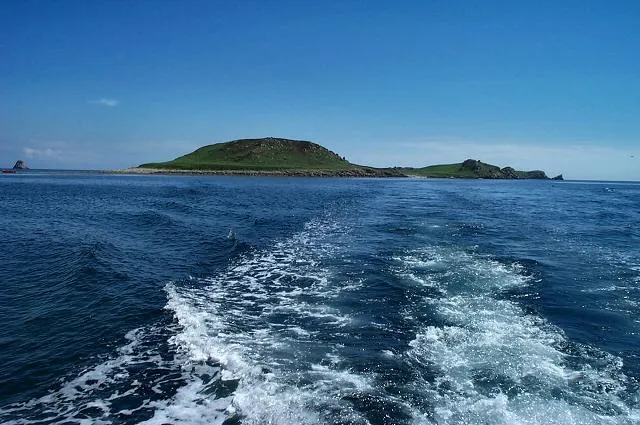 Great Ganilly Island, St. Martin's2 km SE
-
Chapel Down (St Martin's) Island, St. Martin's1.4 km NE
-
Little Ganilly Island, St. Martin's1.5 km SE
-
Nornour Island, St. Martin's1.6 km E
-
Great Ganinick Island, St. Martin's1.6 km S
Sources & licences
Data last updated: · 2 independent sources