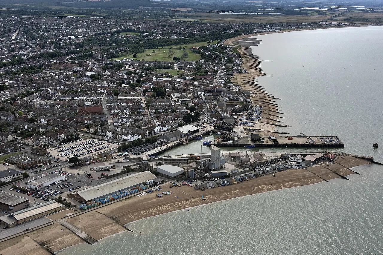
- Population
- 32,196
- 32.2K
- Elevation
- 5 m
- above sea level
- Local time
- UTC+00:00
- Europe/London · UTC+00:00
- Airports
- SEN London Southend Airport33 km
- LCY London City Airport69 km
About Whitstable
Whitstable is a town. Location: City of Canterbury, Kent. Population: 32,196. Elevation: 5 m.
Whitstable ( ) is a town in the Canterbury district, on the north coast of Kent, England, at the convergence of the Swale and the Greater Thames Estuary, five miles (eight kilometres) north of Canterbury and two miles (three kilometres) west of Herne Bay. In 2021 it had a population of 32,196. The town, formerly known as Whitstable-on-Sea, was famous for oysters, collected from beds beyond the low water mark from Roman times until the mid-20th century.
Source: Wikipedia · CC BY-SA 4.0
Photos of Whitstable
-

United Kingdom Hydrographic Office · Public domain -

Marathon · CC BY-SA 2.0 -

Emőke Dénes · CC BY-SA 4.0 -

Emőke Dénes · CC BY-SA 4.0 -

hugh llewelyn · CC BY-SA 2.0


Travel notes for Whitstable
From Wikivoyage
Whitstable is a town on the north coast of Kent in southeast England. It's famous for its oysters, and grew up in the 18th and 19th centuries as a fishing port, general harbour and seaside resort. It's nowadays governed as part of the city of Canterbury, and in 2011 had a population of 32,100 in its constituent communities. They extend from Seasalter to the west through Herne Bay to the east.
Get in+
By plane:
All the London airports have similar travel times to Whitstable, as by public transport you have to head into central London then come out again. (It's almost as quick to fly to Paris CDG IATA and take Eurostar.) By hired car, Gatwick (LGW IATA) or London City (LCY IATA) are closer: that's more of a factor on the return, when you have to consider traffic congestion on M25 to reach your flight.
By train:
Trains from London Victoria run every 30-60 min, taking 80 min via Rochester, Chatham, Gillingham, Sittingbourne and Faversham, where the train may divide. You need to be in the portion running along the north coast to Whitstable, Margate and Ramsgate. The other portion heads south to Canterbury East and Dover Priory.
Trains from London St Pancras run hourly and take 75 min via Stratford, Ebbsfleet, Gravesend, Rochester then the same route to Whitstable and Ramsgate.
1 Whitstable station is quarter of a mile east of High St. It has a staffed ticket office and machines, toilets and a coffee machine. There is step-free access to both platforms.
By bus:
There are no direct buses from London. National Express runs from London Victoria to Canterbury, change there; those buses continue to Ramsgate or Dover.
The Triangle bus runs every 15 min from Canterbury to Whitstable (30 min) then Herne Bay then back to Canterbury; and vice versa.
There isn't a bus station in Whitstable. Buses stop along High St then east along Tankerton Rd towards Herne Bay.
By road:
From London get onto M2. From west of the city that will involve cutting across from M25 via M26 to M20, then near Maidstone use A229 to reach M2. At Faversham M2 becomes A299, follow signs into town along Thanet Way. A299 continues east to Ramsgate.
Parking can be difficult in Whitstable.
Source: Wikivoyage · CC BY-SA 4.0 · abridged
Places bordering Whitstable
- Herne Bay
Twin towns and sister cities of Whitstable
- Borken· Germany
- Albertslund· Denmark
Source: Wikidata. Only places with a page on this site are shown.
Climate of Whitstable
Best months for sightseeingBest months for sightseeing: June–August.
This month · November
A cold month
Day 10° · Night 4° · Rain 64 mm
- Hottest month
- August (day 22°)
- Coldest month
- February (night 2°)
- Wettest month
- October (65 mm)
- Driest month
- February (34 mm)
Bars: average monthly low and high temperature. Below: precipitation. Monthly averages for 1970–2000 at about 18 km resolution, adjusted for elevation. Highlighted months are mild and relatively dry. Source: WorldClim 2.1 (CC BY 4.0).
Show values as a table
| Month | Jan | Feb | Mar | Apr | May | Jun | Jul | Aug | Sep | Oct | Nov | Dec |
|---|---|---|---|---|---|---|---|---|---|---|---|---|
| Average high (°C) | 7° | 7° | 10° | 12° | 16° | 19° | 21° | 22° | 19° | 15° | 10° | 8° |
| Average low (°C) | 2° | 2° | 3° | 5° | 8° | 10° | 13° | 13° | 11° | 8° | 4° | 3° |
| Precipitation (mm) | 54 | 34 | 42 | 39 | 39 | 48 | 41 | 46 | 56 | 65 | 64 | 57 |
How to get to Whitstable
The nearest airport is London Southend Airport (SEN), 33 km to the northwest as the crow flies. For international flights: London Stansted Airport (STN) (80 km). The nearest large city is Saint Peters, 27 km to the east.
Airports
- London Southend Airport (SEN) Southend-on-Sea, Essex 33 kmnorthwest
- London City Airport (LCY) London 69 kmwest
- London Stansted Airport (STN) London, Essex 80 kmnorthwest
Nearby large cities
- Saint Peters Population: 125.4K 27 kmeast
- Southend-on-Sea Population: 295.3K 29 kmnorthwest
- Gillingham Population: 101.2K 33 kmwest
- Maidstone Population: 107.6K 37 kmwest
- Basildon Population: 144.9K 46 kmnorthwest
Straight-line distances; road distances are longer. Airport data: OurAirports.
Day trips from Whitstable
Within 100 km: 596 historic and cultural sites, 332 natural sites, 189 lakes, rivers and coasts.
0–25 km41 places
- Isle of Sheppey Island 14 kmW
- Central Beach Beach 9 kmNW
- Isle of Grain Island 25 kmNW
- The Mount Island 15 kmNW
25–60 km282 places
- Spotlites @ Kings Theatre Attraction 35 kmW
- Camber Sands Beach 50 kmS
- West Mersea Beach Beach 46 kmN
- Yantlet beach Beach 27 kmNW
60–100 km794 places
- White Hart Lane Landmark 81 kmW
- Plage Saint-Gabriel Beach 97 kmSE
- Aldeburgh's Beach Beach 98 kmNE
- Hastings Beach Beach 65 kmSW
Straight-line distances.
Nearby attractions & nature
Everything nearby-
Clapham Hill Mountain, City of Canterbury2.8 km S
-
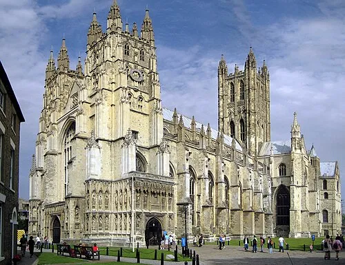 Canterbury Cathedral Attraction, City of Canterbury9.8 km SE
-
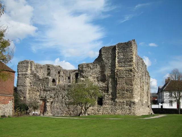 Canterbury Castle Historic site, City of Canterbury10 km S
-
St Dunstans Church Attraction, City of Canterbury9.1 km S
-
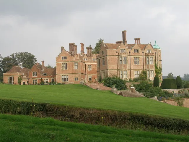 Chilham Castle Historic site, Chilham14 km S
-
Bingley Island Island, City of Canterbury9.9 km S
-
Dane John Gardens Attraction, City of Canterbury10 km S
-
St. Augustine's Abbey Attraction, City of Canterbury10 km SE
Other cities and towns in City of Canterbury
-
 Canterbury Town, City of Canterbury9.8 km SE
-
Sturry Town, Sturry9.4 km SE
Sources & licences
Data last updated: · 2 independent sources