- Population
- 162,416
- 162.4K
- Elevation
- 19 m
- above sea level
- Local time
- UTC+00:00
- Europe/London · UTC+00:00
- Places inside
- 62
- listed under City of Canterbury
- Airports
- SEN London Southend Airport42 km
- LCY London City Airport76 km
About City of Canterbury
City of Canterbury is a municipality. Location: Kent, England. Population: 162,416. Elevation: 19 m. The best months to visit are June–August. The nearest airport is London Southend Airport (42 km). Nearby sights include Chilham Castle and Beech Pollard.
Photos of City of Canterbury
-
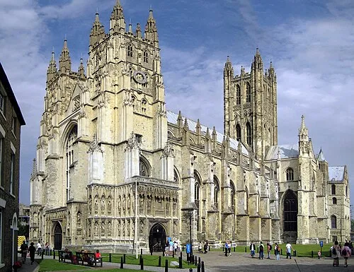
Canterbury Cathedral Hans Musil · CC BY-SA 4.0 -
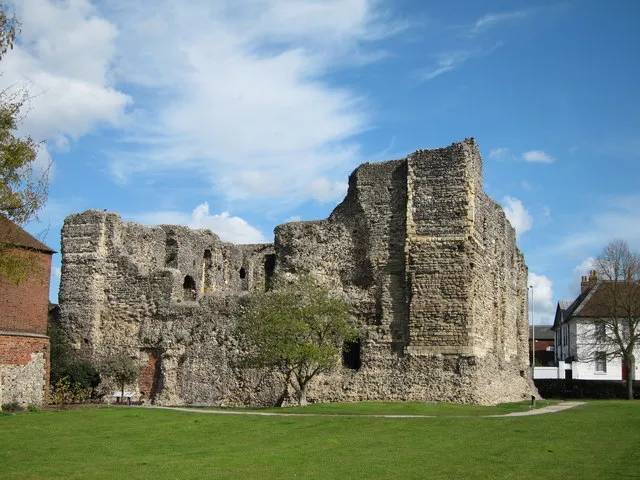
Canterbury Castle Oast House Archive · CC BY-SA 2.0


Climate of City of Canterbury
Best months for sightseeingBest months for sightseeing: June–August.
This month · November
A cold month
Day 10° · Night 4° · Rain 73 mm
- Hottest month
- August (day 22°)
- Coldest month
- February (night 2°)
- Wettest month
- October (73 mm)
- Driest month
- February (40 mm)
Bars: average monthly low and high temperature. Below: precipitation. Monthly averages for 1970–2000 at about 18 km resolution, adjusted for elevation. Highlighted months are mild and relatively dry. Source: WorldClim 2.1 (CC BY 4.0).
Show values as a table
| Month | Jan | Feb | Mar | Apr | May | Jun | Jul | Aug | Sep | Oct | Nov | Dec |
|---|---|---|---|---|---|---|---|---|---|---|---|---|
| Average high (°C) | 7° | 8° | 10° | 12° | 16° | 19° | 21° | 22° | 19° | 15° | 10° | 8° |
| Average low (°C) | 2° | 2° | 3° | 5° | 8° | 10° | 13° | 13° | 11° | 8° | 4° | 3° |
| Precipitation (mm) | 63 | 40 | 48 | 45 | 43 | 50 | 44 | 50 | 63 | 73 | 73 | 66 |
How to get to City of Canterbury
The nearest airport is London Southend Airport (SEN), 42 km to the northwest as the crow flies. For international flights: London Stansted Airport (STN) (89 km). The nearest large city is Saint Peters, 25 km to the northeast.
Airports
- London Southend Airport (SEN) Southend-on-Sea, Essex 42 kmnorthwest
- London City Airport (LCY) London 76 kmwest
- London Stansted Airport (STN) London, Essex 89 kmnorthwest
Nearby large cities
- Saint Peters Population: 125.4K 25 kmnortheast
- Southend-on-Sea Population: 295.3K 38 kmnorthwest
- Gillingham Population: 101.2K 39 kmwest
- Maidstone Population: 107.6K 39 kmwest
- Basildon Population: 144.9K 54 kmnorthwest
Straight-line distances; road distances are longer. Airport data: OurAirports.
Day trips from City of Canterbury
Within 100 km: 561 historic and cultural sites, 309 natural sites, 171 lakes, rivers and coasts.
0–25 km77 places
- Isle of Sheppey Island 22 kmNW
- Central Beach Beach 18 kmNW
- Sunny Sands Beach 23 kmS
- The Mount Island 23 kmNW
25–60 km215 places
- Spotlites @ Kings Theatre Attraction 40 kmW
- Camber Sands Beach 44 kmSW
- West Mersea Beach Beach 56 kmN
- Yantlet beach Beach 36 kmNW
60–100 km749 places
- White Hart Lane Landmark 88 kmNW
- Plage Saint-Gabriel Beach 87 kmSE
- Lot's Ait Island 99 kmW
- Horsey Island Island 67 kmN
Straight-line distances.
City of Canterbury and similar cities
Side by side with cities of similar size in the same country: population, elevation and climate.
| Measure | City of Canterbury | Oxford | Newport | Peterborough |
|---|---|---|---|---|
| Population | 162.4K | 162.1K | 161.5K | 163.4K |
| Elevation | 19 m | 72 m | 16 m | 12 m |
| Summer day (hottest month) | 22° | 22° | 21° | 22° |
| Winter night (coldest month) | 2° | 2° | 2° | 1° |
| Annual rainfall | 658 mm | 646 mm | 914 mm | 580 mm |
| Best months | Jun–Aug | Jun–Aug | Jun–Aug | Jun–Aug |
| Distance | — | 171 km | 286 km | 171 km |
Climate values are 1970–2000 monthly averages; straight-line distance.
Places in City of Canterbury
62 places
Canterbury
Population: 55.1K
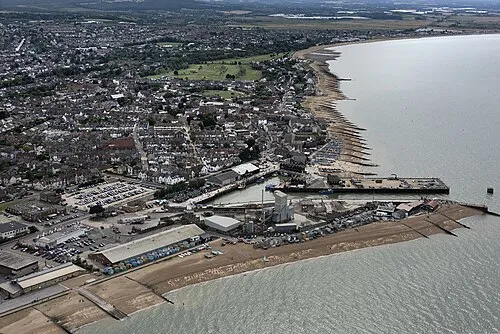
Whitstable
Population: 32.2K
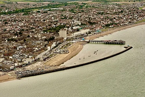
Herne Bay
Population: 24.9K
Tankerton
Population: 4.9K
Reculver
Population: 135
Cities & villages47
- Archidiocese of Canterbury · Village
- Barham · Village
- Bekesbourne-with-Patrixbourne · Village
- Beltinge · Village
- Bishopsbourne · Village
- Bishopstone · Village
- Bridge · Village
- Chartham · Village
- Chestfield · Village
- Chislet · Village
- Church Street · Neighbourhood
- Eddington · Neighbourhood
- Fordwich · Village
- Greenhill · Village
- Hackington · Village
- Hales Place · Neighbourhood
- Hampton · Neighbourhood
- Harbledown and Rough Common · Village
- Hawthorn Corner · Village
- Herne and Broomfield · Village
- Hillborough · Neighbourhood
- Hoath · Village
- Ickham and Well · Village
- Kingston · Village
- Littlebourne · Village
- Lower Hardres · Village
- Lower Island · Neighbourhood
- Northgate · Neighbourhood
- Petham · Village
- Scotland Hills · Neighbourhood
- Seasalter · Village
- South Street · Neighbourhood
- South Tankerton · Neighbourhood
- St. Cosmus and St. Damian in the Blean · Village
- St Dunstan's · Neighbourhood
- St Martin's · Neighbourhood
- St Stephen's · Neighbourhood
- Studd Hill · Neighbourhood
- Sturry · Village
- Swalecliffe · Village
- Thanington Without · Village
- Thurston Park · Neighbourhood
- Upper Hardres · Village
- Waltham · Village
- Westbere · Village
- West End · Village
- Wickhambreaux · Village
Mountains & nature1
- Clapham Hill · Mountain
Lakes, rivers & coasts1
- Bingley Island · Island
Heritage & sights5
- Canterbury Castle · Historic site
- Canterbury Cathedral · Attraction
- Dane John Gardens · Attraction
- St. Augustine's Abbey · Attraction
- St Dunstans Church · Attraction
Nearby attractions & nature
Everything nearby-
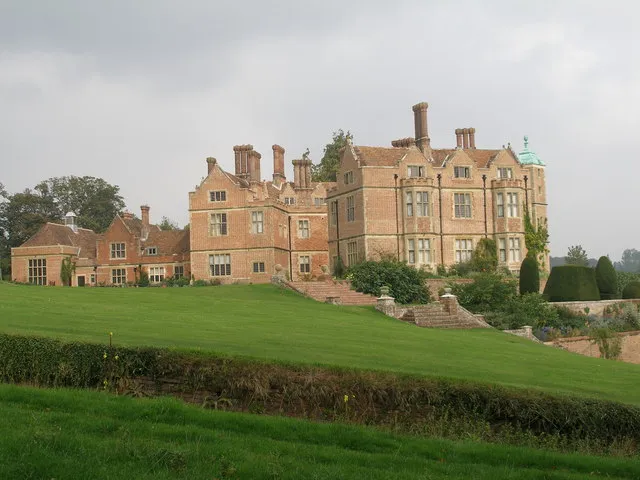 Chilham Castle Historic site, Chilham9.4 km SW
-
Beech Pollard Mountain, Dunkirk8.3 km W
-
Beltinge Bay Natural site, Kent12 km NE
-
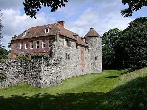 Westenhanger Castle Historic site, Stanford21 km S
-
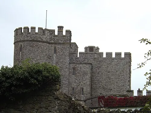 Saltwood Castle Historic site, Saltwood22 km S
-
The Mount Mountain, Chilham11 km W
-
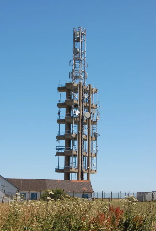 Tolsford Hill BT Tower Landmark, Lyminge19 km S
-
Selling Perry Wood Historic site, Selling11 km W
Sources & licences
Data last updated: