- Elevation
- 50 m
- above sea level
- Local time
- UTC+00:00
- Europe/London · UTC+00:00
- Airports
- LGW London Gatwick Airport24 km
- LCY London City Airport37 km
About Weller's Town
Weller's Town is a village. Location: Chiddingstone, Sevenoaks. Elevation: 50 m. The best months to visit are June–August. The nearest airport is London Gatwick Airport (24 km). Nearby sights include Hever Castle and Redleaf Hill.
Photos of Weller's Town
-
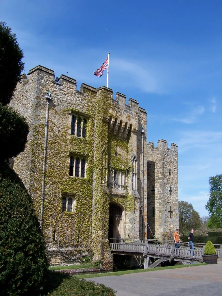
Hever Castle Nigel Lamb · CC BY 2.0

Climate of Weller's Town
Best months for sightseeingBest months for sightseeing: June–August.
This month · November
A cold month
Day 10° · Night 4° · Rain 80 mm
- Hottest month
- July (day 22°)
- Coldest month
- February (night 1°)
- Wettest month
- January (82 mm)
- Driest month
- July (45 mm)
Bars: average monthly low and high temperature. Below: precipitation. Monthly averages for 1970–2000 at about 18 km resolution, adjusted for elevation. Highlighted months are mild and relatively dry. Source: WorldClim 2.1 (CC BY 4.0).
Show values as a table
| Month | Jan | Feb | Mar | Apr | May | Jun | Jul | Aug | Sep | Oct | Nov | Dec |
|---|---|---|---|---|---|---|---|---|---|---|---|---|
| Average high (°C) | 7° | 7° | 10° | 12° | 16° | 19° | 22° | 22° | 19° | 15° | 10° | 8° |
| Average low (°C) | 2° | 1° | 3° | 4° | 7° | 10° | 12° | 12° | 10° | 7° | 4° | 3° |
| Precipitation (mm) | 82 | 52 | 59 | 50 | 51 | 57 | 45 | 53 | 66 | 76 | 80 | 79 |
How to get to Weller's Town
The nearest airport is London Gatwick Airport (LGW), 24 km to the west as the crow flies. The nearest large city is Crawley, 25 km to the west.
Airports
- London Gatwick Airport (LGW) London 24 kmwest
- London City Airport (LCY) London 37 kmnorth
- London Heathrow Airport (LHR) London 54 kmnorthwest
Nearby large cities
- Crawley Population: 124K 25 kmwest
- Maidstone Population: 107.6K 27 kmeast
- Croydon Population: 173.3K 29 kmnorthwest
- Bexley Population: 228K 29 kmnorth
- Sutton Population: 187.6K 31 kmnorthwest
Straight-line distances; road distances are longer. Airport data: OurAirports.
Day trips from Weller's Town
Within 100 km: 693 historic and cultural sites, 534 natural sites, 281 lakes, rivers and coasts.
0–25 km111 places
- Osprey Island Island 15 kmSE
- Tinker's Island Island 8 kmE
- Hawk Island Island 23 kmSW
- Sixteen Acre Island Island 3 kmNW
25–60 km771 places
- Isle of Sheppey Island 53 kmNE
- White Hart Lane Landmark 50 kmN
- Spotlites @ Kings Theatre Attraction 34 kmNE
- St Nicholas Church Shoreham Attraction 49 kmSW
60–100 km626 places
- Portsea Island Natural site 96 kmSW
- West Mersea Beach Beach 85 kmNE
- Sunny Sands Beach 73 kmE
- Climping Beach Beach 67 kmSW
Straight-line distances.
Nearby attractions & nature
Everything nearby-
Hever Castle Historic site, Hever3 km W
-
Redleaf Hill Mountain, Penshurst2 km NE
-
Penshurst Place Historic site, Penshurst2 km E
-
Penshurst Place Historic site, Penshurst2.1 km E
-
Sixteen Acre Island Island, Hever2.6 km NW
-
Two Bridges Island Island, Hever3 km W
Sources & licences
Data last updated: