Wheatsheaf Hill
Located in Sundridge with Ide Hill, Sevenoaks Coordinates: 51°14′39″ N 0°08′01″ E
- Elevation
- 218 m
- above sea level
- Local time
- UTC+00:00
- Europe/London · UTC+00:00
- Airports
- LGW London Gatwick Airport25 km
- LCY London City Airport30 km
About Wheatsheaf Hill
Wheatsheaf Hill is a mountain. Location: Sundridge with Ide Hill, Sevenoaks. Elevation: 218 m. The best months to visit are June–August. The nearest airport is London Gatwick Airport (25 km). Nearby sights include Toy's Hill and Bayley's Hill.
Photos of Wheatsheaf Hill
-
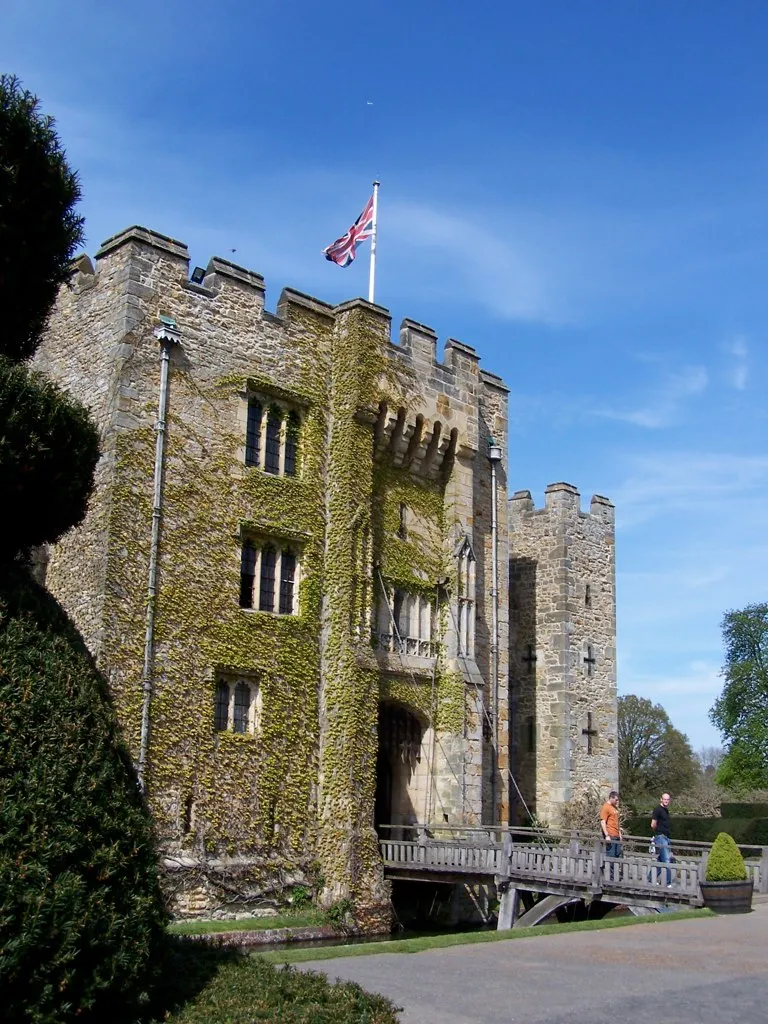
Hever Castle Nigel Lamb · CC BY 2.0

Climate of Wheatsheaf Hill
Best months for sightseeingBest months for sightseeing: June–August.
This month · November
A cold month
Day 9° · Night 3° · Rain 80 mm
- Hottest month
- July (day 21°)
- Coldest month
- February (night 0°)
- Wettest month
- January (82 mm)
- Driest month
- July (45 mm)
Bars: average monthly low and high temperature. Below: precipitation. Monthly averages for 1970–2000 at about 18 km resolution, adjusted for elevation. Highlighted months are mild and relatively dry. Source: WorldClim 2.1 (CC BY 4.0).
Show values as a table
| Month | Jan | Feb | Mar | Apr | May | Jun | Jul | Aug | Sep | Oct | Nov | Dec |
|---|---|---|---|---|---|---|---|---|---|---|---|---|
| Average high (°C) | 6° | 6° | 9° | 11° | 15° | 18° | 21° | 21° | 18° | 14° | 9° | 7° |
| Average low (°C) | 1° | 0° | 2° | 3° | 6° | 9° | 11° | 11° | 9° | 6° | 3° | 2° |
| Precipitation (mm) | 82 | 52 | 59 | 50 | 51 | 57 | 45 | 53 | 66 | 76 | 80 | 79 |
How to get to Wheatsheaf Hill
The nearest airport is London Gatwick Airport (LGW), 25 km to the southwest as the crow flies. The nearest large city is Bexley, 22 km to the north.
Airports
- London Gatwick Airport (LGW) London 25 kmsouthwest
- London City Airport (LCY) London 30 kmnorth
- London Heathrow Airport (LHR) London 48 kmnorthwest
Nearby large cities
- Bexley Population: 228K 22 kmnorth
- Croydon Population: 173.3K 22 kmnorthwest
- Sutton Population: 187.6K 26 kmnorthwest
- Crawley Population: 124K 27 kmsouthwest
- Maidstone Population: 107.6K 27 kmeast
Straight-line distances; road distances are longer. Airport data: OurAirports.
Day trips from Wheatsheaf Hill
Within 100 km: 716 historic and cultural sites, 547 natural sites, 282 lakes, rivers and coasts.
0–25 km117 places
- Osprey Island Island 21 kmSE
- Tinker's Island Island 10 kmSE
- Sixteen Acre Island Island 6 kmS
- Two Bridges Island Island 6 kmS
25–60 km814 places
- Isle of Sheppey Island 52 kmE
- White Hart Lane Landmark 42 kmN
- Spotlites @ Kings Theatre Attraction 32 kmNE
- St Nicholas Church Shoreham Attraction 54 kmSW
60–100 km614 places
- Portsea Island Natural site 98 kmSW
- West Mersea Beach Beach 81 kmNE
- Sunny Sands Beach 76 kmE
- Climping Beach Beach 70 kmSW
Straight-line distances.
Nearest towns and villages
-
Ide Hill Village, Sundridge with Ide Hill0.5 km NW
-
Goathurst Common Village, Sundridge with Ide Hill0.8 km NE
-
Sundridge Village, Sundridge with Ide Hill3.8 km N
-
Whitley Row Village, Sundridge with Ide Hill1.5 km NE
-
Sevenoaks Town, Sevenoaks5 km NE
-
Brasted Village, Brasted4 km NW
Nearby attractions & nature
Everything nearby-
Toy's Hill Mountain, Brasted2.2 km W
-
Bayley's Hill Mountain, Sevenoaks Weald2.5 km E
-
Crockham Hill Mountain, Westerham4.4 km W
-
River Hill Mountain, Sevenoaks Weald5.2 km E
-
Betsom's Hill Mountain, Westerham7.3 km NW
-
Redleaf Hill Mountain, Penshurst7.3 km SE
-
Sixteen Acre Island Island, Hever6.2 km S
-
Two Bridges Island Island, Hever6.3 km S
Sources & licences
Data last updated: