- Elevation
- 277 m
- above sea level
- Local time
- UTC+00:00
- Europe/London · UTC+00:00
- Places inside
- 2
- listed under Anglezarke
- Airports
- MAN Manchester Airport38 km
- LPL Liverpool John Lennon Airport40 km
About Anglezarke
Anglezarke is a village. Location: Chorley District, Lancashire. Elevation: 277 m. The best months to visit are June–August. The nearest airport is Manchester Airport (38 km). Nearby sights include Healey Nab and Winter Hill transmitting station.
Climate of Anglezarke
Best months for sightseeingBest months for sightseeing: June–August.
This month · November
A wet month
Day 8° · Night 3° · Rain 119 mm
- Hottest month
- July (day 18°)
- Coldest month
- February (night 0°)
- Wettest month
- October (119 mm)
- Driest month
- May (63 mm)
Bars: average monthly low and high temperature. Below: precipitation. Monthly averages for 1970–2000 at about 18 km resolution, adjusted for elevation. Highlighted months are mild and relatively dry. Source: WorldClim 2.1 (CC BY 4.0).
Show values as a table
| Month | Jan | Feb | Mar | Apr | May | Jun | Jul | Aug | Sep | Oct | Nov | Dec |
|---|---|---|---|---|---|---|---|---|---|---|---|---|
| Average high (°C) | 5° | 6° | 8° | 10° | 14° | 16° | 18° | 18° | 15° | 12° | 8° | 6° |
| Average low (°C) | 0° | 0° | 1° | 3° | 6° | 8° | 11° | 10° | 8° | 6° | 3° | 1° |
| Precipitation (mm) | 104 | 68 | 87 | 66 | 63 | 76 | 75 | 94 | 97 | 119 | 119 | 114 |
How to get to Anglezarke
The nearest airport is Manchester Airport (MAN), 38 km to the southeast as the crow flies. The nearest large city is Bolton, 11 km to the southeast.
Airports
- Manchester Airport (MAN) Manchester, Greater Manchester 38 kmsoutheast
- Liverpool John Lennon Airport (LPL) Liverpool 40 kmsouthwest
- Leeds Bradford Airport (LBA) Leeds, West Yorkshire 64 kmeast
Nearby large cities
- Bolton Population: 141.3K 11 kmsoutheast
- Blackburn Population: 146.5K 12 kmnortheast
- Wigan Population: 175.4K 13 kmsouthwest
- Preston Population: 313.3K 16 kmnorthwest
- Salford Population: 129.8K 25 kmsoutheast
Straight-line distances; road distances are longer. Airport data: OurAirports.
Places in Anglezarke
2 placesCities & villages1
- White Coppice · Village
Mountains & nature1
- Spitlers Edge · Mountain
Nearby attractions & nature
Everything nearby-
Healey Nab Mountain, Chorley District2.8 km W
-
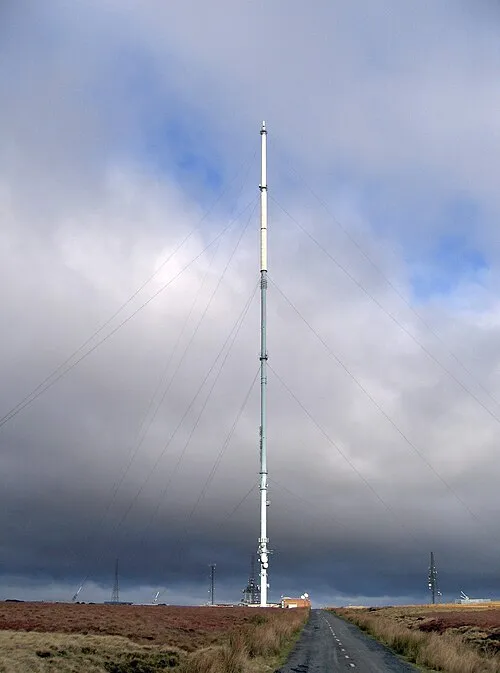 Winter Hill transmitting station Landmark, Rivington3.9 km SE
-
Winter Hill (boundary) Mountain, North Turton4 km SE
-
Roscoe Lowe Hill Mountain, Anderton4.3 km SW
-
The Island Island, North Turton3.8 km E
-
Cartridge Hill Mountain, Tockholes4.5 km NE
Sources & licences
Data last updated: