- Population
- 23,000
- 23K
- Elevation
- 171 m
- above sea level
- Local time
- UTC+00:00
- Europe/London · UTC+00:00
- Airports
- MAN Manchester Airport39 km
- LBA Leeds Bradford Airport45 km
About Rawtenstall
Rawtenstall is a town. Location: Rossendale District, Lancashire. Population: 23,000. Elevation: 171 m.
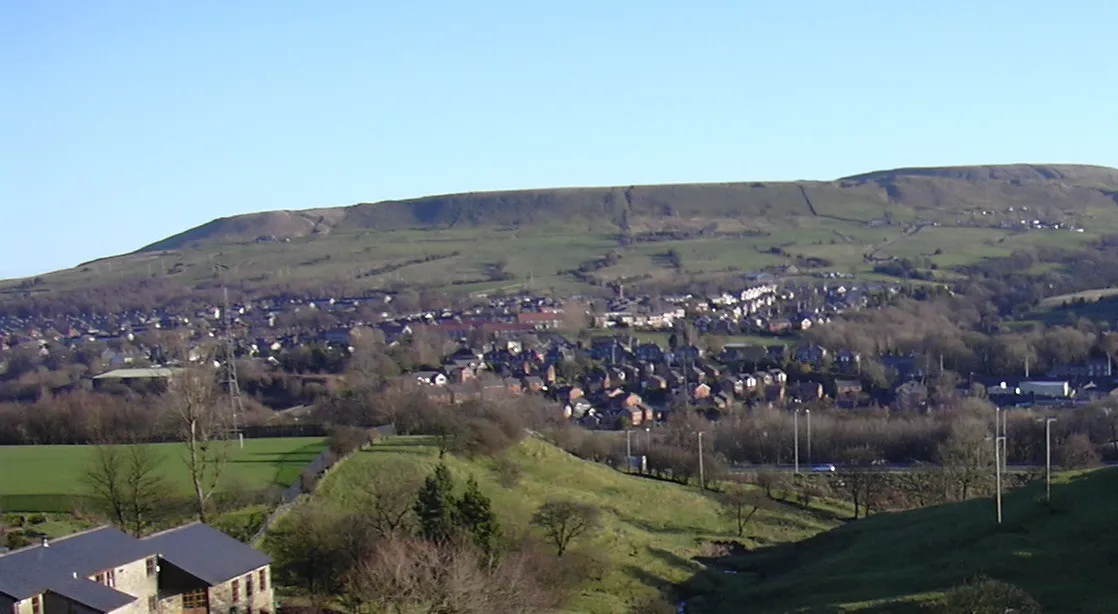
Rawtenstall () is a town in the borough of Rossendale, Lancashire, England. The town lies 15 miles (24 km) north of Manchester, 22 miles (35 km) east of Preston and 45 miles (70 km) south east of Lancaster. The town is at the centre of the Rossendale Valley. As of 2022, it had a population of 23,000.
Source: Wikipedia · CC BY-SA 4.0
Photos of Rawtenstall
-

Dangerousismyname · CC BY-SA 4.0 -

Dangerousismyname · CC BY-SA 4.0 -

Bill Boaden · CC BY-SA 2.0 -

Bill Boaden · CC BY-SA 2.0 -
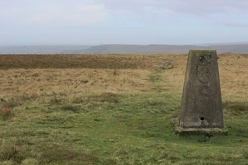
Cowpe Lowe Chris Heaton · CC BY-SA 2.0


Travel notes for Rawtenstall
From Wikivoyage
The Rossendale Valley is a borough in Lancashire, consisting of a number of small towns and villages including Haslingden, Rawtenstall, Bacup, Waterfoot and 1 Acre. . It lies within the West Pennine Moors.
Understand+
1MISSING WIKILINK Haslingden in the 14th century was a Royal Hunting Park, the "Forest of Rossendale". Parts of the park's boundary are still clearly visible around Helmshore, which lies a mile or so south and west of Haslingden. The town includes the suburb of Acre.
Haslingden became a mill-town during the Industrial Revolution, but few signs of its textile heritage are now immediately apparent. However, on closer inspection the visitor will find a number of cotton mills remaining, mostly without their chimneys, and either derelict or taken over by other businesses. The town has a slightly neglected air, although improvements to Higher Deardengate where the original cobbled road setts were restored, and a replica Big Lamp erected, have smartened up parts of the town centre.
It is the birthplace of the composer Alan Rawsthorne (1905–1971).
2MISSING WIKILINK Bacup is a textile mill-town community that developed rapidly during the Industrial Revolution. However, in the late 20th century it suffered from serious economic decline from chronic depopulation and urban decay. Great efforts have been made to regenerate the town, with some success. Bacup's historic character, culture and festivities have encouraged the town's development as a commuter town. English Heritage has proclaimed Bacup as the best preserved cotton town in England, and its town centre is designated as a conservation area for its special architectural qualities.
Bacup is the base of the Britannia Coconut Dancers, a unique folk dance group of uncertain origin, who appear on Easter Saturday to dance around the town, attracting large crowds.
Get in+
By bus:
The x43 is a frequent bus service to Manchester and Blackburn.
The 464 is a frequent local bus running from Rochdale to Accrington, via Haslingden, passing through Bacup.
By car:
The M65/A65 runs directly to Rawtenstall from the M62. Rawtenstall is a little over 30 minutes drive from the centre of Manchester. A regular and high-quality bus service, the X43 and X44, or the Witch Way, runs from Manchester to Rawtenstall and on to Burnley and Nelson.
By train:
Rawtenstall and Rossendale generally suffers from the lack of rail links, although there are steam and heritage trains running at the weekend (and at other times, but infrequently) from Bury, via Ramsbottom.
Source: Wikivoyage · CC BY-SA 4.0 · abridged
Climate of Rawtenstall
Best months for sightseeingBest months for sightseeing: June–August.
This month · November
A wet month
Day 9° · Night 4° · Rain 143 mm
- Hottest month
- July (day 19°)
- Coldest month
- January (night 1°)
- Wettest month
- November (143 mm)
- Driest month
- May (75 mm)
Bars: average monthly low and high temperature. Below: precipitation. Monthly averages for 1970–2000 at about 18 km resolution, adjusted for elevation. Highlighted months are mild and relatively dry. Source: WorldClim 2.1 (CC BY 4.0).
Show values as a table
| Month | Jan | Feb | Mar | Apr | May | Jun | Jul | Aug | Sep | Oct | Nov | Dec |
|---|---|---|---|---|---|---|---|---|---|---|---|---|
| Average high (°C) | 6° | 6° | 8° | 11° | 15° | 17° | 19° | 19° | 16° | 12° | 9° | 7° |
| Average low (°C) | 1° | 1° | 2° | 4° | 7° | 9° | 11° | 11° | 9° | 7° | 4° | 2° |
| Precipitation (mm) | 136 | 91 | 110 | 80 | 75 | 87 | 87 | 107 | 113 | 137 | 143 | 143 |
How to get to Rawtenstall
The nearest airport is Manchester Airport (MAN), 39 km to the south as the crow flies. The nearest large city is Burnley, 12 km to the north.
Airports
- Manchester Airport (MAN) Manchester, Greater Manchester 39 kmsouth
- Leeds Bradford Airport (LBA) Leeds, West Yorkshire 45 kmnortheast
- Liverpool John Lennon Airport (LPL) Liverpool 55 kmsouthwest
Nearby large cities
- Burnley Population: 149.4K 12 kmnorth
- Blackburn Population: 146.5K 14 kmnorthwest
- Bolton Population: 141.3K 16 kmsouthwest
- Oldham Population: 237.1K 21 kmsoutheast
- Salford Population: 129.8K 24 kmsouth
Straight-line distances; road distances are longer. Airport data: OurAirports.
Day trips from Rawtenstall
Within 100 km: 680 historic and cultural sites, 1,499 natural sites, 246 lakes, rivers and coasts.
0–25 km153 places
- The Island Island 15 kmSW
- Pickup Bank Reservoir Lake 9 kmW
- Hollingworth Lake Lake 15 kmSE
- Anglezarke Reservoir Lake 20 kmW
25–60 km711 places
- Great Britain Island 38 kmNE
- Formby Beach Beach 56 kmW
- Ainsdale Beach Beach 53 kmW
- St Anne's Beach Beach 50 kmW
60–100 km1,561 places
- High Moor Mountain 80 kmNW
- Thurstaston Beach Beach 70 kmSW
- Roanhead Beach Beach 82 kmNW
- The Island Island 73 kmNE
Straight-line distances.
Nearby attractions & nature
Everything nearby-
Cowpe Lowe Mountain, Rossendale District2.3 km SE
-
Cribden Hill Mountain, Rossendale District1.9 km NW
-
Rossendale Valley Natural site, England1.2 km E
-
Cribdon Hill Transmitter Landmark, Rossendale District2 km NW
-
Whittle Pike Mountain, Rossendale District4 km S
-
Forest of Rossendale Natural site, England2.9 km NE
-
Higher Hill Mountain, Rossendale District4.8 km SE
-
Hail Storm Hill Mountain, Rossendale District4 km SE
Other cities and towns in Rossendale District
Sources & licences
Data last updated: · 2 independent sources