Old Wood
Located in Scarisbrick, West Lancashire District Coordinates: 53°36′27″ N 2°55′22″ W
- Elevation
- 25 m
- above sea level
- Local time
- UTC+00:00
- Europe/London · UTC+00:00
- Airports
- LPL Liverpool John Lennon Airport31 km
- MAN Manchester Airport51 km
About Old Wood
Old Wood is a natural site. Location: Scarisbrick, West Lancashire District. The best months to visit are June–September. The nearest airport is Liverpool John Lennon Airport (31 km). Nearby sights include Paddock Wood and Dam Wood.
Photos of Old Wood
-
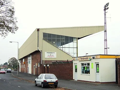
Haig Avenue Small-town hero · Public domain

Climate of Old Wood
Best months for sightseeingBest months for sightseeing: June–September.
This month · November
A cold month
Day 10° · Night 4° · Rain 96 mm
- Hottest month
- August (day 20°)
- Coldest month
- February (night 2°)
- Wettest month
- October (97 mm)
- Driest month
- April (52 mm)
Bars: average monthly low and high temperature. Below: precipitation. Monthly averages for 1970–2000 at about 18 km resolution, adjusted for elevation. Highlighted months are mild and relatively dry. Source: WorldClim 2.1 (CC BY 4.0).
Show values as a table
| Month | Jan | Feb | Mar | Apr | May | Jun | Jul | Aug | Sep | Oct | Nov | Dec |
|---|---|---|---|---|---|---|---|---|---|---|---|---|
| Average high (°C) | 7° | 7° | 9° | 12° | 16° | 18° | 20° | 20° | 17° | 14° | 10° | 8° |
| Average low (°C) | 2° | 2° | 3° | 4° | 7° | 10° | 12° | 12° | 10° | 7° | 4° | 3° |
| Precipitation (mm) | 79 | 53 | 67 | 52 | 52 | 61 | 60 | 77 | 82 | 97 | 96 | 89 |
Other places to visit in this season: June July August September
How to get to Old Wood
The nearest airport is Liverpool John Lennon Airport (LPL), 31 km to the south as the crow flies. The nearest large city is Wigan, 20 km to the east.
Airports
- Liverpool John Lennon Airport (LPL) Liverpool 31 kmsouth
- Manchester Airport (MAN) Manchester, Greater Manchester 51 kmsoutheast
- Leeds Bradford Airport (LBA) Leeds, West Yorkshire 88 kmeast
Nearby large cities
- Wigan Population: 175.4K 20 kmeast
- St Helens Population: 183.2K 22 kmsoutheast
- Liverpool Population: 496.8K 22 kmsouth
- Preston Population: 313.3K 23 kmnortheast
- Birkenhead Population: 325.3K 25 kmsouth
Straight-line distances; road distances are longer. Airport data: OurAirports.
Day trips from Old Wood
Within 100 km: 600 historic and cultural sites, 1,886 natural sites, 256 lakes, rivers and coasts.
0–25 km104 places
- Formby Beach Beach 12 kmW
- Ainsdale Beach Beach 9 kmW
- St Anne's Beach Beach 17 kmNW
- Goose Island Island 8 kmSE
25–60 km482 places
- Thurstaston Beach Beach 33 kmSW
- Hilbre Island Island 32 kmSW
- Foulney Island Island 51 kmN
- Barrow Island Island 59 kmN
60–100 km2,156 places
- British Isles Island 83 kmNW
- Great Britain Island 75 kmNE
- High Moor Mountain 69 kmN
- Traeth Lligwy Beach 93 kmW
Straight-line distances.
Nearest towns and villages
-
 Bescar Neighbourhood, Scarisbrick0.7 km NW
-
Drummersdale Village, Scarisbrick0.5 km NE
-
Scarisbrick Village, Scarisbrick1 km NW
-
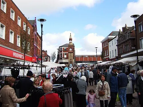 Ormskirk Town, West Lancashire District5.3 km SE
-
Pinfold Neighbourhood, Scarisbrick1.2 km S
-
Smithy Lane Ends Neighbourhood, Scarisbrick1.5 km E
Nearby attractions & nature
Everything nearby-
Paddock Wood Natural site, Scarisbrick0.6 km SW
-
Dam Wood Natural site, Scarisbrick0.8 km E
-
Spring Wood Natural site, Scarisbrick0.8 km SE
-
Such Hey Wood Natural site, Scarisbrick0.9 km SE
-
Meadow Hey Wood Natural site, Scarisbrick1 km SE
-
Mill Stream River, Scarisbrick1.3 km N
-
Drummersdale River, Scarisbrick2.8 km NW
-
Hurlston Brook River, Scarisbrick2.8 km SE
Sources & licences
Data last updated: