- Elevation
- 282 m
- above sea level
- Local time
- UTC+00:00
- Europe/London · UTC+00:00
- Airports
- LBA Leeds Bradford Airport4 km
- MME Teesside International Airport71 km
About The Chevin
The Chevin is a mountain. Location: Otley, Leeds. Elevation: 282 m. The best months to visit are June–August. The nearest airport is Leeds Bradford Airport (4 km). Nearby sights include Otley Methodist Church and Otley All Saints Parish Church.
Climate of The Chevin
Best months for sightseeingBest months for sightseeing: June–August.
This month · November
A cold month
Day 8° · Night 3° · Rain 98 mm
- Hottest month
- July (day 18°)
- Coldest month
- January (night 0°)
- Wettest month
- December (106 mm)
- Driest month
- July (62 mm)
Bars: average monthly low and high temperature. Below: precipitation. Monthly averages for 1970–2000 at about 18 km resolution, adjusted for elevation. Highlighted months are mild and relatively dry. Source: WorldClim 2.1 (CC BY 4.0).
Show values as a table
| Month | Jan | Feb | Mar | Apr | May | Jun | Jul | Aug | Sep | Oct | Nov | Dec |
|---|---|---|---|---|---|---|---|---|---|---|---|---|
| Average high (°C) | 5° | 5° | 7° | 10° | 14° | 16° | 18° | 18° | 15° | 12° | 8° | 6° |
| Average low (°C) | 0° | 0° | 1° | 3° | 5° | 8° | 10° | 10° | 8° | 6° | 3° | 1° |
| Precipitation (mm) | 105 | 76 | 80 | 67 | 63 | 72 | 62 | 77 | 81 | 91 | 98 | 106 |
How to get to The Chevin
The nearest airport is Leeds Bradford Airport (LBA), 4 km to the southeast as the crow flies. The nearest large city is Bradford, 12 km to the south.
Airports
- Leeds Bradford Airport (LBA) Leeds, West Yorkshire 4 kmsoutheast
- Teesside International Airport (MME) Darlington, Durham 71 kmnorth
- Manchester Airport (MAN) Manchester, Greater Manchester 72 kmsouthwest
Nearby large cities
- Bradford Population: 366.2K 12 kmsouth
- Leeds Population: 536.3K 15 kmsoutheast
- Wakefield Population: 109.8K 27 kmsoutheast
- Huddersfield Population: 149K 28 kmsouth
- Burnley Population: 149.4K 37 kmwest
Straight-line distances; road distances are longer. Airport data: OurAirports.
Day trips from The Chevin
Within 100 km: 674 historic and cultural sites, 1,270 natural sites, 242 lakes, rivers and coasts.
0–25 km117 places
- Great Britain Island 23 kmNW
- Lud Stream Islands Island 17 kmNW
- Mill Island Island 22 kmNW
- Beanlands Island Island 8 kmNW
25–60 km663 places
- The Island Island 38 kmN
- Bird Island Island 48 kmW
- The Island Island 28 kmNE
- The Island Island 51 kmE
60–100 km1,406 places
- Formby Beach Beach 99 kmW
- Ainsdale Beach Beach 96 kmW
- St Anne's Beach Beach 89 kmW
- Seaton Carew Beach Beach 92 kmN
Straight-line distances.
Nearest towns and villages
Nearby attractions & nature
Everything nearby-
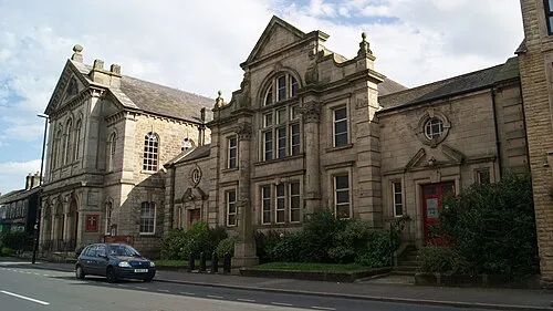 Otley Methodist Church Attraction, Otley1.5 km N
-
Otley All Saints Parish Church Attraction, Otley1.2 km N
-
Beech Hill Church Attraction, Otley1.3 km N
-
Newall Old Hall Landmark, Otley2.2 km N
-
Billing Hill Mountain, Leeds4.7 km S
-
River Washburn River, England3.2 km E
-
Tinshill Moor Mountain, Leeds7 km SE
-
Baildon Hill Mountain, Baildon7.1 km SW
Sources & licences
Data last updated: