Leicestershire
Located in England, United Kingdom Coordinates: 52°40′00″ N 1°00′00″ W
- Population
- 1,133,921
- 1.1M
- Elevation
- 112 m
- above sea level
- Local time
- UTC+00:00
- Europe/London · UTC+00:00
- Places inside
- 7
- listed under Leicestershire
About Leicestershire
Leicestershire is a district. Location: England, United Kingdom. Population: 1,133,921.
In comparison
- 11 sights and natural places within 10 km Scraptoft, Monks Grave
- Listed here: Municipality: 7
Places in Leicestershire
7 places-
Charnwood District Municipality179.4K
-
Hinckley and Bosworth District Municipality110.1K
-
North West Leicestershire Municipality98.6K
-
Blaby Municipality97.7K
-
Harborough District Municipality90.4K
-
Oadby and Wigston Municipality55.8K
-
Melton District Municipality50.9K
Nature and heritage in Leicestershire
-
Bardon Hill Mountain, Bardon
-
Whatborough Hill Mountain, Tilton
-
Beacon Hill Mountain, Woodhouse
-
Waltham on the Wolds Hill Mountain, Waltham on the Wolds and Thorpe Arnold
-
Life Hill Mountain, Billesdon
-
Robin-a-Tiptoe Hill Mountain, Tilton
Nearby attractions & nature
Everything nearby-
River Wreak River, England5.9 km W
-
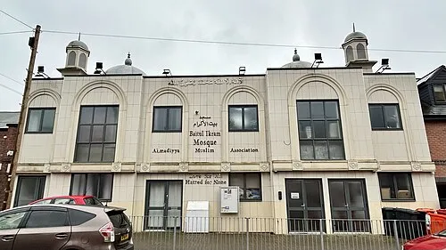 Bait-ul-Ikram Attraction, Leicester9.9 km SW
-
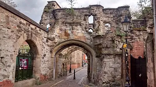 Leicester Castle Historic site, Leicester10 km W
-
Cossington Recreation Ground Natural site, Leicester8.4 km W
-
Abbey Park Natural site, Leicester9.2 km W
-
Leicester Abby Attraction, Leicester9.5 km W
Sources & licences
Data last updated: