Market Harborough
Located in Harborough District, Leicestershire Coordinates: 52°28′39″ N 0°55′14″ W
- Population
- 24,779
- 24.8K
- Elevation
- 81 m
- above sea level
- Local time
- UTC+00:00
- Europe/London · UTC+00:00
- Airports
- EMA East Midlands Airport48 km
- BHX Birmingham Airport56 km
About Market Harborough
Market Harborough is a town. Location: Harborough District, Leicestershire. Population: 24,779. Elevation: 81 m.
Market Harborough is a market town in the Harborough district of Leicestershire, England, close to the border with Northamptonshire. The population was 24,779 at the 2021 census. It is the administrative headquarters of the Harborough district. Market Harborough was part of Rockingham Forest, a royal hunting forest used by medieval monarchs, whose boundaries stretched from Market Harborough to Stamford and included Corby, Kettering, Desborough, Rothwell, Thrapston and Oundle.
Source: Wikipedia · CC BY-SA 4.0
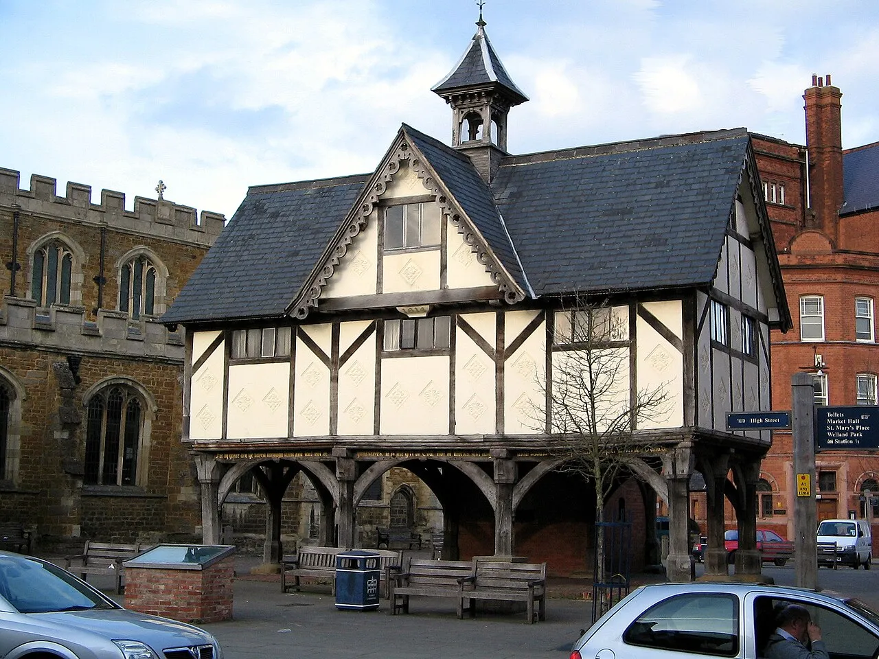
Photos of Market Harborough
-

Bill Boaden · CC BY-SA 2.0 -

Ed6767 · CC BY-SA 4.0 -

Andrew Abbott · CC BY-SA 2.0 -

Dave Spicer · CC BY-SA 2.0 -

Simon Burchell · CC BY-SA 4.0


Travel notes for Market Harborough
From Wikivoyage
Market Harborough is a market town of 25,000 people (2019) on the River Welland in Leicestershire, England.
Understand+
Market Harborough used to be a centre for fox hunting. The district simply called Harborough includes the smaller town of Lutterworth and a number of other villages.
1 Market Harborough Tourist Information Centre, Council Offices, Adam and Eve Street, LE16 7AG, ☏ +44 1858 821270. (updated May 2020)
Get in+
Market Harborough is on the A6 in between Leicester and Rothwell, west of Kettering (though its been bypassed), the A427 from Corby, the A508 from Northampton and the A4304 from Lutterworth.
1 Market Harborough railway station, St Marys Road, LE16 7DT. It's on the Midland Main Line. (updated May 2020)
Source: Wikivoyage · CC BY-SA 4.0 · abridged
Climate of Market Harborough
Best months for sightseeingBest months for sightseeing: June–August.
This month · November
A cold month
Day 10° · Night 4° · Rain 59 mm
- Hottest month
- July (day 21°)
- Coldest month
- February (night 1°)
- Wettest month
- December (61 mm)
- Driest month
- February (42 mm)
Bars: average monthly low and high temperature. Below: precipitation. Monthly averages for 1970–2000 at about 18 km resolution, adjusted for elevation. Highlighted months are mild and relatively dry. Source: WorldClim 2.1 (CC BY 4.0).
Show values as a table
| Month | Jan | Feb | Mar | Apr | May | Jun | Jul | Aug | Sep | Oct | Nov | Dec |
|---|---|---|---|---|---|---|---|---|---|---|---|---|
| Average high (°C) | 7° | 7° | 10° | 12° | 16° | 19° | 21° | 21° | 18° | 14° | 10° | 8° |
| Average low (°C) | 1° | 1° | 2° | 4° | 6° | 9° | 11° | 11° | 9° | 7° | 4° | 2° |
| Precipitation (mm) | 58 | 42 | 50 | 47 | 49 | 56 | 53 | 60 | 57 | 55 | 59 | 61 |
How to get to Market Harborough
The nearest airport is East Midlands Airport (EMA), 48 km to the northwest as the crow flies. The nearest large city is Leicester, 23 km to the northwest.
Airports
- East Midlands Airport (EMA) Nottingham, Leicestershire 48 kmnorthwest
- Birmingham Airport (BHX) Birmingham, West Midlands 56 kmwest
- London Luton Airport (LTN) Luton, Luton 77 kmsoutheast
Nearby large cities
- Leicester Population: 368.6K 23 kmnorthwest
- Northampton Population: 245.9K 25 kmsouth
- Coventry Population: 345.3K 41 kmwest
- Peterborough Population: 163.4K 47 kmeast
- Bedford Population: 106.9K 49 kmsoutheast
Straight-line distances; road distances are longer. Airport data: OurAirports.
Day trips from Market Harborough
Within 100 km: 645 historic and cultural sites, 487 natural sites, 131 lakes, rivers and coasts.
0–25 km74 places
- The Islands Island 13 kmNW
- Brown's Island Island 25 kmNE
- Whatborough Hill Mountain 19 kmN
- Honey Hill Mountain 14 kmSW
25–60 km380 places
- Park Island Island 49 kmNE
- Heron Island Island 38 kmSE
- Crescent Wood Island Island 54 kmW
- Apple Island Island 46 kmSE
60–100 km809 places
- Andersey Island Island 94 kmS
- Newark Island Island 67 kmN
- Horninglow island Island 60 kmNW
- Rose Isle Island 87 kmS
Straight-line distances.
Nearby attractions & nature
Everything nearby-
East Farndon Moot Hill Historic site, East Farndon2.9 km SW
-
Foxton Locks Natural site, Foxton4.9 km NW
-
Braybrooke Castle Historic site, Braybrooke5.2 km SE
-
Sutton Bassett Hill Mountain, Ashley5.7 km NE
-
Debdale Wharf Bridge Landmark, Smeeton Westerby5.9 km NW
-
Sibbertoft Castle Yard Historic site, Sibbertoft5.9 km SW
-
Gumley Historic site, Gumley6.2 km NW
-
Langton Brook River, Kibworth Beauchamp5.9 km NW
Sources & licences
Data last updated: · 2 independent sources