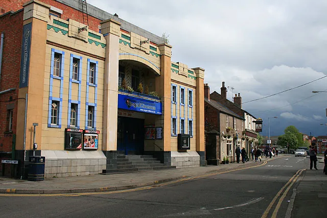
- Population
- 27,737
- 27.7K
- Elevation
- 79 m
- above sea level
- Local time
- UTC+00:00
- Europe/London · UTC+00:00
- Airports
- EMA East Midlands Airport31 km
- BHX Birmingham Airport68 km
About Melton Mowbray
Melton Mowbray is a town. Location: Melton District, Leicestershire. Population: 27,737. Elevation: 79 m.
Melton Mowbray () is a market town in the Melton district in Leicestershire, England, 19 miles (31 km) north-east of Leicester and 20 miles (32 km) south-east of Nottingham. It lies on the River Eye, known below Melton as the Wreake. The town had a population of 27,670 in 2019. The town is sometimes promoted as Britain's "Rural Capital of Food"; it is the home of the Melton Mowbray pork pie and is the nearest market for most licensed producers of Stilton cheese.
Source: Wikipedia · CC BY-SA 4.0
Photos of Melton Mowbray
-

Dun.can from Leicestershire, UK · CC BY 2.0 -

kitmasterbloke · CC BY 2.0 -

kitmasterbloke · CC BY 2.0 -

Tim Heaton · CC BY-SA 2.0 -

David Hallam-Jones · CC BY-SA 2.0


Travel notes for Melton Mowbray
From Wikivoyage
Melton Mowbray, usually referred to locally as just Melton, is a market town in the county of Leicestershire, England. It is famous for the Melton Mowbray Pork Pie and as the centre of Stilton Cheese production. Melton Mowbray is also recognised as the "Rural Capital of Food".
Get in+
By car:
Melton Mowbray lies about 15 miles (25km) north-east of Leicester.
By train:
Train services are provided by East Midlands Trains and CrossCountry to 1 Melton Mowbray station (not to be confused with Melton in Suffolk) on the Birmingham - Leicester - Peterborough line, with services about hourly in both directions (a bit more frequently during rush hours, and a very poor service on Sundays).
By bus:
Buses also arrive from Leicester, Oakham, Nottingham, Loughborough and Grantham. There are no buses in or out of Melton in the evenings or on Sundays and Bank Holidays. The main two bus companies are Arriva and Centerbus.
Source: Wikivoyage · CC BY-SA 4.0 · abridged
Climate of Melton Mowbray
Best months for sightseeingBest months for sightseeing: June–August.
This month · November
A cold month
Day 9° · Night 4° · Rain 61 mm
- Hottest month
- July (day 21°)
- Coldest month
- February (night 1°)
- Wettest month
- December (64 mm)
- Driest month
- February (47 mm)
Bars: average monthly low and high temperature. Below: precipitation. Monthly averages for 1970–2000 at about 18 km resolution, adjusted for elevation. Highlighted months are mild and relatively dry. Source: WorldClim 2.1 (CC BY 4.0).
Show values as a table
| Month | Jan | Feb | Mar | Apr | May | Jun | Jul | Aug | Sep | Oct | Nov | Dec |
|---|---|---|---|---|---|---|---|---|---|---|---|---|
| Average high (°C) | 6° | 7° | 9° | 12° | 16° | 19° | 21° | 21° | 18° | 14° | 9° | 7° |
| Average low (°C) | 1° | 1° | 2° | 4° | 6° | 9° | 11° | 11° | 9° | 7° | 4° | 2° |
| Precipitation (mm) | 59 | 47 | 51 | 51 | 49 | 60 | 51 | 59 | 58 | 58 | 61 | 64 |
How to get to Melton Mowbray
The nearest airport is East Midlands Airport (EMA), 31 km to the west as the crow flies. The nearest large city is Leicester, 22 km to the southwest.
Airports
- East Midlands Airport (EMA) Nottingham, Leicestershire 31 kmwest
- Birmingham Airport (BHX) Birmingham, West Midlands 68 kmsouthwest
- Humberside Airport (HUY) Grimsby, Lincolnshire 97 kmnorth
Nearby large cities
- Leicester Population: 368.6K 22 kmsouthwest
- Nottingham Population: 323.6K 27 kmnorthwest
- Derby Population: 270.5K 43 kmnorthwest
- Mansfield Population: 172K 46 kmnorthwest
- Peterborough Population: 163.4K 48 kmsoutheast
Straight-line distances; road distances are longer. Airport data: OurAirports.
Day trips from Melton Mowbray
Within 100 km: 589 historic and cultural sites, 586 natural sites, 121 lakes, rivers and coasts.
0–25 km63 places
- Brown's Island Island 18 kmSE
- Rutland Water Lake 19 kmSE
- Whatborough Hill Mountain 13 kmS
- Beacon Hill Mountain 25 kmW
25–60 km316 places
- Newark Island Island 35 kmN
- Horninglow island Island 50 kmW
- Park Island Island 44 kmE
- Barton Island Island 27 kmNW
60–100 km917 places
- Snettisham Beach Beach 90 kmE
- Inner Tidal Bank Island 79 kmE
- Don Island Island 80 kmNW
- Heron Island Island 66 kmS
Straight-line distances.
Nearby attractions & nature
Everything nearby-
Melton Mowbray The Mount Historic site, Melton District0.6 km SW
-
Thorpe Arnold Historic site, Waltham on the Wolds and Thorpe Arnold1.8 km E
-
River Eye River, England1.8 km S
-
Gartree Hill Mountain, Burton and Dalby4.8 km S
-
Broughton Hill Mountain, Ab Kettleby6.1 km NW
-
Waltham transmitting station Landmark, Waltham on the Wolds and Thorpe Arnold7 km NE
-
Garthorpe Motte Historic site, Garthorpe8.5 km E
-
Waltham on the Wolds Hill Mountain, Waltham on the Wolds and Thorpe Arnold7.5 km NE
Sources & licences
Data last updated: · 2 independent sources