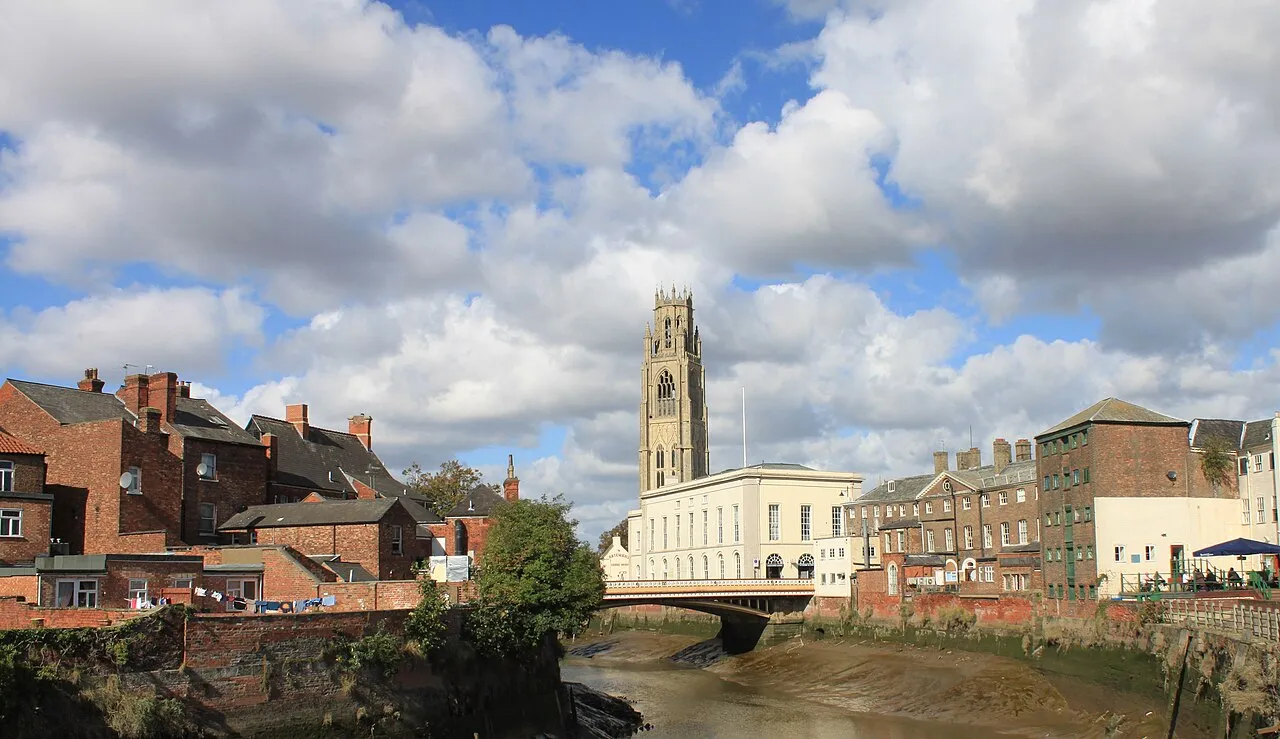
- Population
- 45,339
- 45.3K
- Elevation
- 9 m
- above sea level
- Local time
- UTC+00:00
- Europe/London · UTC+00:00
- Airports
- HUY Humberside Airport70 km
- EMA East Midlands Airport89 km
About Boston
Boston is a town. Location: Boston District, Lincolnshire. Population: 45,339. Elevation: 9 m.
Boston is a market town and inland port in the borough of the same name in the county of Lincolnshire, England. It lies to the south-east of Lincoln, east of Nottingham and north-east of Peterborough. The town had a population of 45,339 at the 2021 census, while the borough had an estimated population of 66,900 at the ONS mid-2015 estimates. The Haven in Boston flows about 5 mi (8 km) to the Lincolnshire coast at The Wash, a bay between Lincolnshire and Norfolk.
Source: Wikipedia · CC BY-SA 4.0
Photos of Boston
-

Mike McBey · CC BY 2.0 -

Joseph Culham · CC BY-SA 4.0 -

Dmitrij M · CC BY 3.0 -

Geof Sheppard · CC BY-SA 4.0 -

Geof Sheppard · CC BY-SA 4.0


Travel notes for Boston
From Wikivoyage
Boston is a market town in Lincolnshire, England, with a population of 70,500 in 2021. Boston's most notable landmark is St Botolph's Church, which is visible from miles away across the flat lands of Lincolnshire.
Understand+
The Prime Meridian passes directly though Boston. It lends its name to the now much larger city that is the capital of Massachusetts in the United States.
Get in+
By train:
1 Boston station. On the Poacher Line from Grantham to Skegness. (updated Jan 2020)
Source: Wikivoyage · CC BY-SA 4.0 · abridged
Twin towns and sister cities of Boston
- Hakusan Shi· Japan
Source: Wikidata. Only places with a page on this site are shown.
Climate of Boston
Best months for sightseeingBest months for sightseeing: June–September.
This month · November
A cold month
Day 10° · Night 4° · Rain 54 mm
- Hottest month
- July (day 21°)
- Coldest month
- February (night 1°)
- Wettest month
- August (56 mm)
- Driest month
- February (37 mm)
Bars: average monthly low and high temperature. Below: precipitation. Monthly averages for 1970–2000 at about 18 km resolution, adjusted for elevation. Highlighted months are mild and relatively dry. Source: WorldClim 2.1 (CC BY 4.0).
Show values as a table
| Month | Jan | Feb | Mar | Apr | May | Jun | Jul | Aug | Sep | Oct | Nov | Dec |
|---|---|---|---|---|---|---|---|---|---|---|---|---|
| Average high (°C) | 7° | 7° | 10° | 12° | 16° | 19° | 21° | 21° | 18° | 14° | 10° | 7° |
| Average low (°C) | 1° | 1° | 3° | 4° | 7° | 10° | 12° | 12° | 10° | 7° | 4° | 2° |
| Precipitation (mm) | 54 | 37 | 47 | 46 | 49 | 51 | 45 | 56 | 49 | 49 | 54 | 52 |
Other places to visit in this season: June July August September
How to get to Boston
The nearest airport is Humberside Airport (HUY), 70 km to the north as the crow flies. For international flights: East Midlands Airport (EMA) (89 km). The nearest large city is Lincoln, 44 km to the northwest.
Airports
- Humberside Airport (HUY) Grimsby, Lincolnshire 70 kmnorth
- East Midlands Airport (EMA) Nottingham, Leicestershire 89 kmwest
- Norwich Airport (NWI) Norwich, Norfolk 94 kmeast
Nearby large cities
- Lincoln Population: 103.8K 44 kmnorthwest
- Peterborough Population: 163.4K 47 kmsouth
- Nottingham Population: 323.6K 76 kmwest
- Mansfield Population: 172K 81 kmwest
- Leicester Population: 368.6K 83 kmsouthwest
Straight-line distances; road distances are longer. Airport data: OurAirports.
Day trips from Boston
Within 100 km: 375 historic and cultural sites, 179 natural sites, 101 lakes, rivers and coasts.
0–25 km33 places
- Outer Trial Bank Island 24 kmSE
- Mardon Hill Mountain 21 kmN
- Pinchbeck Marsh Mountain 16 kmS
- The Wash Natural site 20 kmE
25–60 km152 places
- Snettisham Beach Beach 34 kmE
- Scolt Head Island Island 48 kmE
- Ramsey Salt Marsh Island 50 kmE
- Newark Island Island 55 kmW
60–100 km470 places
- Weybourne Beach Beach 78 kmE
- Sheringham Beach Beach 83 kmE
- Sunk Island Island 75 kmN
- Read's Island Island 86 kmNW
Straight-line distances.
Nearby attractions & nature
Everything nearby-
Hussey Tower Landmark, Boston District0.6 km SE
-
Rochford Tower Landmark, Fishtoft2.5 km E
-
Wyberts Castle Historic site, Wyberton3.1 km S
-
Frampton Castle Historic site, Frampton4.8 km S
-
Butterwick Tower Landmark, Freiston5.4 km E
-
Kirton Drove Mediumwave Transmitter Landmark, Holland Fen with Brothertoft6.7 km W
-
Swineshead Abbey Historic site, Swineshead8.4 km W
-
Swineshead Historic site, Swineshead8.8 km W
Sources & licences
Data last updated: · 2 independent sources