- Elevation
- 4 m
- above sea level
- Local time
- UTC+00:00
- Europe/London · UTC+00:00
- Places inside
- 2
- listed under Tydd St. Mary
- Airports
- NWI Norwich Airport78 km
- STN London Stansted Airport95 km
About Tydd St. Mary
Tydd St. Mary is a village. Location: South Holland, Lincolnshire. Elevation: 4 m. The best months to visit are June–September. The nearest airport is Norwich Airport (78 km). Nearby sights include Fleet Motte and All Saints.
Climate of Tydd St. Mary
Best months for sightseeingBest months for sightseeing: June–September.
This month · November
A cold month
Day 10° · Night 4° · Rain 55 mm
- Hottest month
- July (day 21°)
- Coldest month
- February (night 1°)
- Wettest month
- August (55 mm)
- Driest month
- February (36 mm)
Bars: average monthly low and high temperature. Below: precipitation. Monthly averages for 1970–2000 at about 18 km resolution, adjusted for elevation. Highlighted months are mild and relatively dry. Source: WorldClim 2.1 (CC BY 4.0).
Show values as a table
| Month | Jan | Feb | Mar | Apr | May | Jun | Jul | Aug | Sep | Oct | Nov | Dec |
|---|---|---|---|---|---|---|---|---|---|---|---|---|
| Average high (°C) | 7° | 7° | 10° | 12° | 16° | 19° | 21° | 21° | 18° | 14° | 10° | 7° |
| Average low (°C) | 1° | 1° | 3° | 4° | 7° | 10° | 12° | 12° | 10° | 7° | 4° | 2° |
| Precipitation (mm) | 53 | 36 | 47 | 44 | 48 | 51 | 44 | 55 | 50 | 50 | 55 | 51 |
Other places to visit in this season: June July August September
How to get to Tydd St. Mary
The nearest airport is Norwich Airport (NWI), 78 km to the east as the crow flies. For international flights: London Stansted Airport (STN) (95 km). The nearest large city is Peterborough, 32 km to the southwest.
Airports
- Norwich Airport (NWI) Norwich, Norfolk 78 kmeast
- London Stansted Airport (STN) London, Essex 95 kmsouth
- Humberside Airport (HUY) Grimsby, Lincolnshire 98 kmnorth
Nearby large cities
- Peterborough Population: 163.4K 32 kmsouthwest
- Cambridge Population: 145.7K 60 kmsouth
- Lincoln Population: 103.8K 70 kmnorthwest
- Bedford Population: 106.9K 79 kmsouthwest
- Norwich Population: 143.1K 80 kmeast
Straight-line distances; road distances are longer. Airport data: OurAirports.
Day trips from Tydd St. Mary
Within 100 km: 463 historic and cultural sites, 189 natural sites, 119 lakes, rivers and coasts.
0–25 km31 places
- Inner Tidal Bank Island 14 kmNE
- Outer Trial Bank Island 14 kmNE
- Knights Hill Mountain 23 kmE
- Ferrets' Hill Mountain 23 kmE
25–60 km195 places
- Snettisham Beach Beach 25 kmNE
- Scolt Head Island Island 47 kmNE
- Warham Salt Marsh - West Island 58 kmNE
- Lodge Marsh Island 56 kmNE
60–100 km545 places
- Weybourne Beach Beach 72 kmE
- Sheringham Beach Beach 76 kmE
- Spurn Island Island 93 kmN
- Morston Salt Marsh Island 64 kmNE
Straight-line distances.
Places in Tydd St. Mary
2 placesCities & villages2
- Tydd Gote · Village
- Tydd Saint Mary · Village
Nearby attractions & nature
Everything nearby-
Fleet Motte Historic site, Fleet7.5 km NW
-
All Saints Attraction, Walsoken8.3 km SE
-
St Peter and St Paul Attraction, Wisbech8.7 km S
-
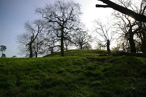 Wormegay Castle Historic site, Wormegay23 km E
-
St Mary Attraction, Wisbech St. Mary10 km S
-
River Nene River, England9.4 km NE
Sources & licences
Data last updated: