- Elevation
- 3 m
- above sea level
- Local time
- UTC+00:00
- Europe/London · UTC+00:00
- Places inside
- 7
- listed under Whaplode
- Airports
- EMA East Midlands Airport87 km
- NWI Norwich Airport91 km
About Whaplode
Whaplode is a village. Location: South Holland, Lincolnshire. Elevation: 3 m. The best months to visit are June–September. The nearest airport is East Midlands Airport (87 km). Nearby sights include Moulton and Fleet Motte.
Climate of Whaplode
Best months for sightseeingBest months for sightseeing: June–September.
This month · November
A cold month
Day 10° · Night 4° · Rain 53 mm
- Hottest month
- July (day 21°)
- Coldest month
- February (night 1°)
- Wettest month
- August (56 mm)
- Driest month
- February (37 mm)
Bars: average monthly low and high temperature. Below: precipitation. Monthly averages for 1970–2000 at about 18 km resolution, adjusted for elevation. Highlighted months are mild and relatively dry. Source: WorldClim 2.1 (CC BY 4.0).
Show values as a table
| Month | Jan | Feb | Mar | Apr | May | Jun | Jul | Aug | Sep | Oct | Nov | Dec |
|---|---|---|---|---|---|---|---|---|---|---|---|---|
| Average high (°C) | 7° | 7° | 10° | 12° | 16° | 19° | 21° | 21° | 18° | 14° | 10° | 7° |
| Average low (°C) | 1° | 1° | 3° | 4° | 7° | 10° | 12° | 12° | 10° | 7° | 4° | 2° |
| Precipitation (mm) | 53 | 37 | 47 | 46 | 49 | 51 | 45 | 56 | 50 | 48 | 53 | 50 |
Other places to visit in this season: June July August September
How to get to Whaplode
The nearest airport is East Midlands Airport (EMA), 87 km to the west as the crow flies. The nearest large city is Peterborough, 25 km to the southwest.
Airports
- East Midlands Airport (EMA) Nottingham, Leicestershire 87 kmwest
- Norwich Airport (NWI) Norwich, Norfolk 91 kmeast
- Humberside Airport (HUY) Grimsby, Lincolnshire 92 kmnorth
Nearby large cities
- Peterborough Population: 163.4K 25 kmsouthwest
- Lincoln Population: 103.8K 61 kmnorthwest
- Cambridge Population: 145.7K 64 kmsouth
- Leicester Population: 368.6K 75 kmwest
- Bedford Population: 106.9K 76 kmsouth
Straight-line distances; road distances are longer. Airport data: OurAirports.
Day trips from Whaplode
Within 100 km: 480 historic and cultural sites, 225 natural sites, 113 lakes, rivers and coasts.
0–25 km28 places
- Inner Tidal Bank Island 23 kmE
- Park Island Island 19 kmSW
- Outer Trial Bank Island 21 kmNE
- Pinchbeck Marsh Mountain 9 kmNW
25–60 km194 places
- Snettisham Beach Beach 35 kmE
- Scolt Head Island Island 56 kmNE
- Ramsey Salt Marsh Island 57 kmNE
- The Island Island 50 kmS
60–100 km596 places
- Weybourne Beach Beach 83 kmE
- Sheringham Beach Beach 87 kmE
- Sunk Island Island 98 kmN
- Spurn Island Island 91 kmN
Straight-line distances.
Places in Whaplode
7 placesBar: population relative to the most populous place in this list.
Cities & villages5
- Dowsdale · Village
- Saracen's Head · Village
- Shepeau Stow · Village
- Whaplode Drove · Village
- Whaplode St Catherine · Village
Nearby attractions & nature
Everything nearby-
Moulton Historic site, Moulton0.9 km NW
-
Fleet Motte Historic site, Fleet7.3 km E
-
Pinchbeck Marsh Mountain, Pinchbeck8.9 km NW
-
River Glen River, England8.7 km NW
-
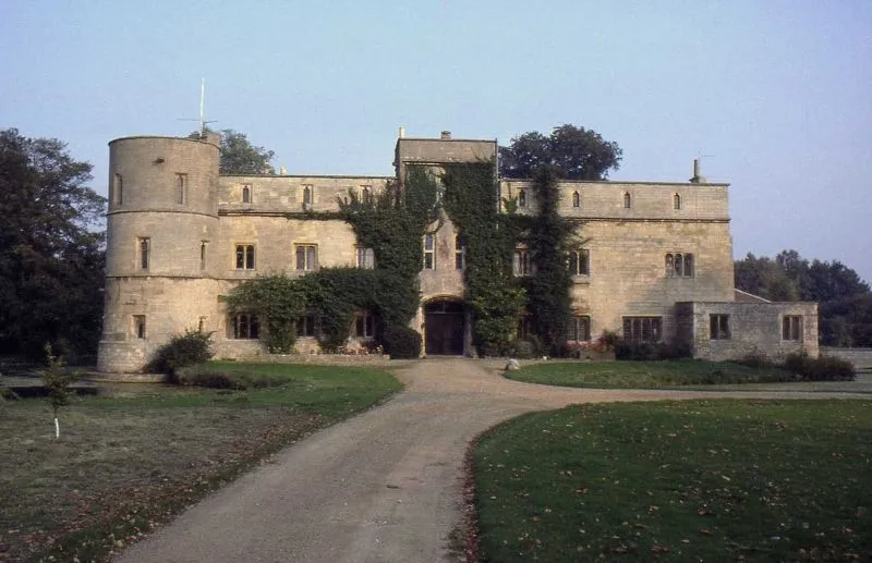 Woodcroft Castle Historic site, Etton24 km SW
-
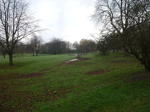 Bourne Castle Historic site, Bourne22 km W
Other cities and towns in South Holland
-
Low Fulney Village, South Holland5.5 km NW
-
 Weston Hills Village, Weston3.5 km NW
-
Fleet Village, South Holland5.3 km SE
-
Fulney Neighbourhood, South Holland6.8 km NW
-
Cowbit Village, Cowbit5.9 km SW
-
Clay Lake Neighbourhood, South Holland6.4 km W
Sources & licences
Data last updated: