- Population
- 151,589
- 151.6K
- Elevation
- 30 m
- above sea level
- Local time
- UTC+00:00
- Europe/London · UTC+00:00
- Places inside
- 114
- listed under King's Lynn and West Norfolk District
- Airports
- NWI Norwich Airport54 km
- STN London Stansted Airport94 km
About King's Lynn and West Norfolk District
King's Lynn and West Norfolk District is a municipality. Location: Norfolk, England. Population: 151,589. Elevation: 30 m. The best months to visit are June–September. The nearest airport is Norwich Airport (54 km). Nearby sights include River Ouse and River Nar.
Photos of King's Lynn and West Norfolk District
-
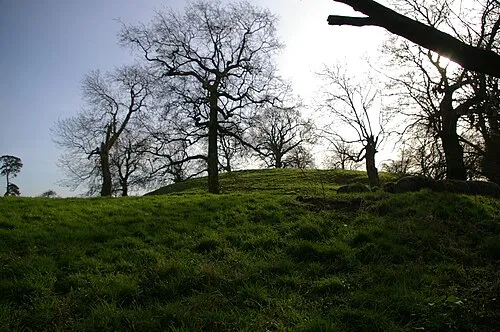
Wormegay Castle Ben Harris · CC BY-SA 2.0

Climate of King's Lynn and West Norfolk District
Best months for sightseeingBest months for sightseeing: June–September.
This month · November
A cold month
Day 10° · Night 4° · Rain 60 mm
- Hottest month
- July (day 21°)
- Coldest month
- February (night 1°)
- Wettest month
- November (60 mm)
- Driest month
- February (40 mm)
Bars: average monthly low and high temperature. Below: precipitation. Monthly averages for 1970–2000 at about 18 km resolution, adjusted for elevation. Highlighted months are mild and relatively dry. Source: WorldClim 2.1 (CC BY 4.0).
Show values as a table
| Month | Jan | Feb | Mar | Apr | May | Jun | Jul | Aug | Sep | Oct | Nov | Dec |
|---|---|---|---|---|---|---|---|---|---|---|---|---|
| Average high (°C) | 7° | 7° | 10° | 12° | 16° | 19° | 21° | 21° | 18° | 14° | 10° | 7° |
| Average low (°C) | 1° | 1° | 2° | 4° | 7° | 10° | 12° | 12° | 10° | 7° | 4° | 2° |
| Precipitation (mm) | 56 | 40 | 48 | 42 | 46 | 54 | 48 | 57 | 54 | 58 | 60 | 55 |
Other places to visit in this season: June July August September
How to get to King's Lynn and West Norfolk District
The nearest airport is Norwich Airport (NWI), 54 km to the east as the crow flies. For international flights: London Stansted Airport (STN) (94 km). The nearest large city is Peterborough, 52 km to the west.
Airports
- Norwich Airport (NWI) Norwich, Norfolk 54 kmeast
- London Stansted Airport (STN) London, Essex 94 kmsouth
- London Luton Airport (LTN) Luton, Luton 110 kmsouthwest
Nearby large cities
- Peterborough Population: 163.4K 52 kmwest
- Norwich Population: 143.1K 56 kmeast
- Cambridge Population: 145.7K 62 kmsouthwest
- Ipswich Population: 178.8K 86 kmsoutheast
- Lincoln Population: 103.8K 90 kmnorthwest
Straight-line distances; road distances are longer. Airport data: OurAirports.
Day trips from King's Lynn and West Norfolk District
Within 100 km: 374 historic and cultural sites, 115 natural sites, 121 lakes, rivers and coasts.
0–25 km40 places
- Snettisham Beach Beach 18 kmN
- Inner Tidal Bank Island 18 kmNW
- Birdcage Island Island 21 kmSE
- Outer Trial Bank Island 22 kmNW
25–60 km168 places
- Weybourne Beach Beach 51 kmNE
- Sheringham Beach Beach 55 kmNE
- Scolt Head Island Island 33 kmNE
- Warham Salt Marsh - West Island 40 kmNE
60–100 km402 places
- Hemsby Beach Beach 83 kmE
- Aldeburgh's Beach Beach 98 kmSE
- Spurn Island Island 99 kmN
- Newark Island Island 97 kmNW
Straight-line distances.
King's Lynn and West Norfolk District and similar cities
Side by side with cities of similar size in the same country: population, elevation and climate.
| Measure | King's Lynn and West Norfolk District | Poole | Burnley | Harrow |
|---|---|---|---|---|
| Population | 151.6K | 151.5K | 149.4K | 149.2K |
| Elevation | 30 m | 6 m | 140 m | 69 m |
| Summer day (hottest month) | 21° | 22° | 19° | 23° |
| Winter night (coldest month) | 1° | 2° | 1° | 2° |
| Annual rainfall | 618 mm | 805 mm | 1,309 mm | 643 mm |
| Best months | Jun–Sep | Jun–Aug | Jun–Aug | Jun–Aug |
| Distance | — | 280 km | 218 km | 138 km |
Climate values are 1970–2000 monthly averages; straight-line distance.
Places in King's Lynn and West Norfolk District
114 placesBar: population relative to the most populous place in this list.
Cities & villages58
- Anmer · Village
- Bagthorpe with Barmer · Village
- Barton Bendish · Village
- Barwick · Village
- Bawsey · Village
- Bircham · Village
- Boughton · Village
- Brancaster · Village
- Burnham Market · Village
- Burnham Norton · Village
- Burnham Overy · Village
- Burnham Thorpe · Village
- Castle Acre · Village
- Castle Rising · Village
- Choseley · Village
- Clenchwarton · Village
- Congham · Village
- Crimplesham · Village
- Denver · Village
- Dersingham · Village
- Docking · Village
- Downham Market · Village
- Downham West · Village
- East Rudham · Village
- East Walton · Village
- East Winch · Village
- Emneth · Village
- Fairstead · Neighbourhood
- Feltwell · Village
- Fincham · Village
- Flitcham with Appleton · Village
- Fordham · Village
- Fring · Village
- Gayton · Village
- Gaywood · Village
- Great Massingham · Village
- Grimston · Village
- Hardwick · Neighbourhood
- Harpley · Village
- Heacham · Village
- Highgate · Neighbourhood
- Hilgay · Village
- Hillington · Village
- Hockwold cum Wilton · Village
- Holme Next the Sea · Village
- Houghton · Village
- Hunstanton · Village
- Ingoldisthorpe · Village
- Leziate · Village
- Little Massingham · Village
- Marham · Village
- Marshland St. James · Village
- Methwold · Village
- Middleton · Village
- Nordelph · Village
- North Creake · Village
- North End · Neighbourhood
- North Lynn · Neighbourhood
Heritage & sights1
- Kings Lynn · Historic site
Nearby attractions & nature
Everything nearby-
River Ouse River, Norfolk12 km NW
-
River Nar River, Norfolk17 km E
-
River Wissey River, Norfolk19 km SW
-
Wolferton Creek River, Norfolk18 km N
-
Swaffham Park Natural site, Swaffham15 km SE
-
Dunham Lodge Mountain, Little Dunham20 km E
-
Mileham Castle Historic site, Mileham24 km E
-
Birdcage Island Island, Didlington21 km SE
Sources & licences
Data last updated: