- Elevation
- 0 m
- above sea level
- Local time
- UTC+00:00
- Europe/London · UTC+00:00
- Places inside
- 3
- listed under Catfield
- Airports
- NWI Norwich Airport20 km
- STN London Stansted Airport131 km
About Catfield
Catfield is a village. Location: North Norfolk District, Norfolk. Elevation: 0 m. The best months to visit are June–September. The nearest airport is Norwich Airport (20 km). Nearby sights include Hickling Broad and Pleasure Island.
Climate of Catfield
Best months for sightseeingBest months for sightseeing: June–September.
This month · November
A cold month
Day 10° · Night 5° · Rain 65 mm
- Hottest month
- August (day 20°)
- Coldest month
- February (night 2°)
- Wettest month
- November (65 mm)
- Driest month
- February (36 mm)
Bars: average monthly low and high temperature. Below: precipitation. Monthly averages for 1970–2000 at about 18 km resolution, adjusted for elevation. Highlighted months are mild and relatively dry. Source: WorldClim 2.1 (CC BY 4.0).
Show values as a table
| Month | Jan | Feb | Mar | Apr | May | Jun | Jul | Aug | Sep | Oct | Nov | Dec |
|---|---|---|---|---|---|---|---|---|---|---|---|---|
| Average high (°C) | 7° | 7° | 9° | 11° | 14° | 17° | 20° | 20° | 18° | 14° | 10° | 8° |
| Average low (°C) | 2° | 2° | 3° | 5° | 7° | 10° | 12° | 13° | 11° | 8° | 5° | 3° |
| Precipitation (mm) | 53 | 36 | 44 | 43 | 39 | 50 | 47 | 50 | 54 | 58 | 65 | 56 |
Other places to visit in this season: June July August September
How to get to Catfield
The nearest airport is Norwich Airport (NWI), 20 km to the west as the crow flies. For international flights: London Stansted Airport (STN) (131 km). The nearest large city is Norwich, 21 km to the southwest.
Airports
- Norwich Airport (NWI) Norwich, Norfolk 20 kmwest
- London Stansted Airport (STN) London, Essex 131 kmsouthwest
- London Southend Airport (SEN) Southend-on-Sea, Essex 142 kmsouthwest
Nearby large cities
- Norwich Population: 143.1K 21 kmsouthwest
- Ipswich Population: 178.8K 80 kmsouth
- Colchester Population: 130.2K 104 kmsouthwest
- Cambridge Population: 145.7K 115 kmsouthwest
- Peterborough Population: 163.4K 124 kmwest
Straight-line distances; road distances are longer. Airport data: OurAirports.
Day trips from Catfield
Within 100 km: 144 historic and cultural sites, 61 natural sites, 96 lakes, rivers and coasts.
0–25 km53 places
- Hemsby Beach Beach 11 kmSE
- The Island Island 20 kmS
- Cow Holm Island 6 kmSW
- Pleasure Island Island 2 kmE
25–60 km80 places
- Weybourne Beach Beach 37 kmNW
- Sheringham Beach Beach 33 kmNW
- Warham Salt Marsh - West Island 51 kmNW
- Lodge Marsh Island 54 kmNW
60–100 km168 places
- Snettisham Beach Beach 77 kmW
- Aldeburgh's Beach Beach 64 kmS
- Horsey Island Island 98 kmS
- Scolt Head Island Island 65 kmNW
Straight-line distances.
Places in Catfield
3 placesBar: population relative to the most populous place in this list.
Cities & villages1
- Sharp Street · Village
Mountains & nature1
- Hickling Broad National Nature Reserve · Natural site
Nearby attractions & nature
Everything nearby-
Hickling Broad Lake, Hickling1.5 km E
-
Pleasure Island Island, Hickling1.7 km E
-
Ludham & Potter Heigham Marshes National Wildlife Reserve Natural site, Ludham3.5 km S
-
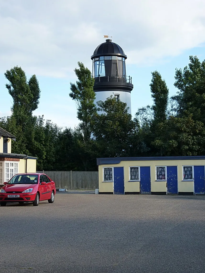 Winterton Lighthouse Landmark, Winterton-on-Sea9.6 km E
-
River Thurne River, Norfolk5.8 km S
-
Cow Holm Island, Horning5.9 km SW
Sources & licences
Data last updated: