- Elevation
- 1 m
- above sea level
- Local time
- UTC+00:00
- Europe/London · UTC+00:00
- Airports
- NWI Norwich Airport11 km
- STN London Stansted Airport113 km
About River Yare
River Yare is a river. Location: Norwich District, Norfolk. The best months to visit are June–September. The nearest airport is Norwich Airport (11 km). Nearby sights include RSPB Surlingham Church Marsh and Bargate.
Photos of River Yare
-
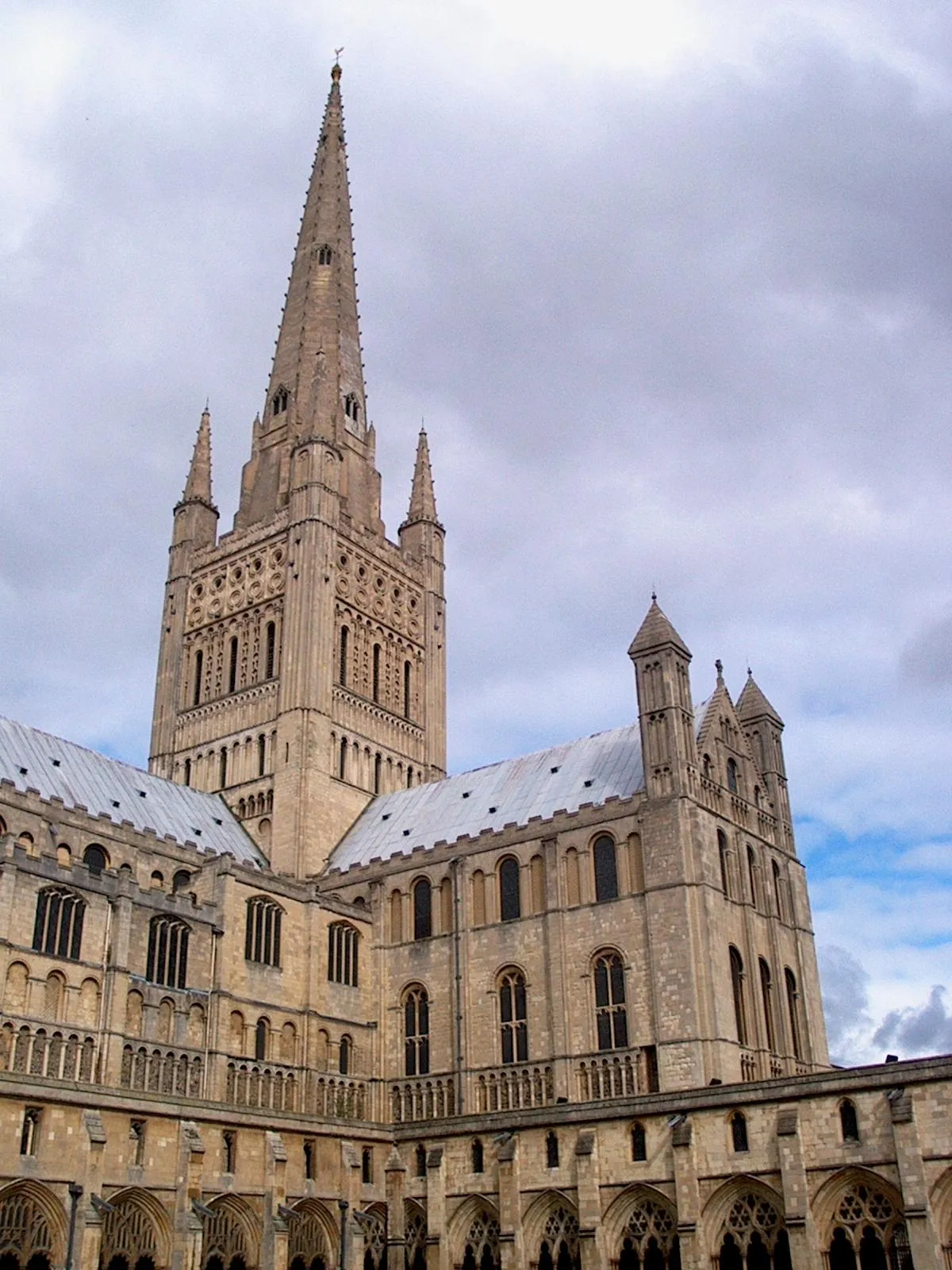
Norwich Cathedral Aleister Crowley 20:33, 19 January 2007 · CC BY-SA 3.0 -

Claxton Castle Graham Hardy · CC BY-SA 2.0 -
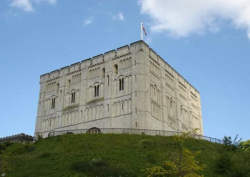
Norwich Castle The original uploader was Bluemoose at English Wikipedia · CC BY-SA 3.0 -

Carrow Road Mls11 at English Wikipedia · Public domain


Climate of River Yare
Best months for sightseeingBest months for sightseeing: June–September.
This month · November
A cold month
Day 10° · Night 4° · Rain 64 mm
- Hottest month
- August (day 21°)
- Coldest month
- February (night 1°)
- Wettest month
- November (64 mm)
- Driest month
- February (37 mm)
Bars: average monthly low and high temperature. Below: precipitation. Monthly averages for 1970–2000 at about 18 km resolution, adjusted for elevation. Highlighted months are mild and relatively dry. Source: WorldClim 2.1 (CC BY 4.0).
Show values as a table
| Month | Jan | Feb | Mar | Apr | May | Jun | Jul | Aug | Sep | Oct | Nov | Dec |
|---|---|---|---|---|---|---|---|---|---|---|---|---|
| Average high (°C) | 7° | 7° | 10° | 12° | 15° | 18° | 21° | 21° | 18° | 14° | 10° | 8° |
| Average low (°C) | 1° | 1° | 3° | 4° | 7° | 10° | 12° | 12° | 10° | 7° | 4° | 3° |
| Precipitation (mm) | 54 | 37 | 46 | 43 | 40 | 51 | 49 | 53 | 54 | 59 | 64 | 57 |
Other places to visit in this season: June July August September
How to get to River Yare
The nearest airport is Norwich Airport (NWI), 11 km to the northwest as the crow flies. For international flights: London Stansted Airport (STN) (113 km). The nearest large city is Norwich, 7 km to the west.
Airports
- Norwich Airport (NWI) Norwich, Norfolk 11 kmnorthwest
- London Stansted Airport (STN) London, Essex 113 kmsouthwest
- London Southend Airport (SEN) Southend-on-Sea, Essex 125 kmsouthwest
Nearby large cities
- Norwich Population: 143.1K 7 kmwest
- Ipswich Population: 178.8K 63 kmsouth
- Colchester Population: 130.2K 87 kmsouthwest
- Cambridge Population: 145.7K 98 kmsouthwest
- Peterborough Population: 163.4K 112 kmwest
Straight-line distances; road distances are longer. Airport data: OurAirports.
Day trips from River Yare
Within 100 km: 175 historic and cultural sites, 69 natural sites, 113 lakes, rivers and coasts.
0–25 km66 places
- Hemsby Beach Beach 23 kmNE
- The Island Island 15 kmE
- Cow Holm Island 12 kmNE
- Pleasure Island Island 19 kmNE
25–60 km122 places
- Weybourne Beach Beach 42 kmNW
- Sheringham Beach Beach 40 kmN
- Aldeburgh's Beach Beach 52 kmS
- Warham Salt Marsh - West Island 52 kmNW
60–100 km169 places
- Snettisham Beach Beach 71 kmNW
- West Mersea Beach Beach 98 kmS
- Mersea Island Island 97 kmS
- Ray Island Island 97 kmS
Straight-line distances.
Nearest towns and villages
-
Postwick Village, Postwick with Witton1.2 km N
-
Surlingham Village, Surlingham1.4 km E
-
Brundall Town, Brundall3 km NE
-
Surlingham Village, South Norfolk District1.5 km E
-
Postwick with Witton Village, Broadland1.7 km N
-
Bramerton Village, South Norfolk District1.7 km S
Nearby attractions & nature
Everything nearby-
RSPB Surlingham Church Marsh Natural site, Surlingham0.1 km E
-
Bargate Lake, Surlingham2.1 km NE
-
River Wensum River, Norfolk2.4 km W
-
Ferry Lane Mediumwave Transmitter Landmark, Postwick with Witton1.1 km N
-
Mid-Yare National Nature Reserve Natural site, Strumpshaw3.1 km E
-
Postwick Mediumwave Transmitter, Mast East Landmark, Postwick with Witton2 km N
-
Postwick Mediumwave Transmitter, Mast West Landmark, Postwick with Witton2.1 km N
-
Whitlingham Great Broad Lake, Trowse with Newton4.6 km W
Sources & licences
Data last updated: