Bait-us-Salaam
Local name: Baitus Salaam Mosque
Located in North Lincolnshire, England Coordinates: 53°35′11″ N 0°40′25″ W
- Local time
- UTC+00:00
- Europe/London · UTC+00:00
- Elevation
- 3 m
- above sea level
- Airports
- HUY Humberside Airport21 km
- LBA Leeds Bradford Airport72 km
About Bait-us-Salaam
Bait-us-Salaam is a tourist attraction. Location: North Lincolnshire, England.
The Baitus Salaam (English: House of Peace) is a mosque in Scunthorpe, Lincolnshire, England and is the first purpose-built mosque of its kind to be built in the town. It was inaugurated on June 17, 2023 and can accommodate 250 worshippers, and built with a library and a community hall.
Source: Wikipedia · CC BY-SA 4.0
At a glance
- Built
- 2002
- Opened
- 2023
Source: Wikidata
Photos of Bait-us-Salaam
-

Glanford Park User:Mightyiron · Public domain

Climate of Bait-us-Salaam
Best months for sightseeingBest months for sightseeing: June–September.
This month · November
A cold month
Day 10° · Night 4° · Rain 49 mm
- Hottest month
- July (day 21°)
- Coldest month
- January (night 1°)
- Wettest month
- December (54 mm)
- Driest month
- February (35 mm)
Bars: average monthly low and high temperature. Below: precipitation. Monthly averages for 1970–2000 at about 18 km resolution, adjusted for elevation. Highlighted months are mild and relatively dry. Source: WorldClim 2.1 (CC BY 4.0).
Show values as a table
| Month | Jan | Feb | Mar | Apr | May | Jun | Jul | Aug | Sep | Oct | Nov | Dec |
|---|---|---|---|---|---|---|---|---|---|---|---|---|
| Average high (°C) | 7° | 7° | 10° | 12° | 16° | 19° | 21° | 21° | 18° | 14° | 10° | 8° |
| Average low (°C) | 1° | 1° | 3° | 4° | 7° | 9° | 12° | 12° | 9° | 7° | 4° | 2° |
| Precipitation (mm) | 50 | 35 | 45 | 42 | 44 | 53 | 44 | 53 | 50 | 47 | 49 | 54 |
Other places to visit in this season: June July August September
How to get to Bait-us-Salaam
The nearest airport is Humberside Airport (HUY), 21 km to the east as the crow flies. For international flights: Leeds Bradford Airport (LBA) (72 km). The nearest large city is Hull, 28 km to the northeast.
Airports
- Humberside Airport (HUY) Grimsby, Lincolnshire 21 kmeast
- Leeds Bradford Airport (LBA) Leeds, West Yorkshire 72 kmnorthwest
- East Midlands Airport (EMA) Nottingham, Leicestershire 95 kmsouthwest
Nearby large cities
- Hull Population: 314K 28 kmnortheast
- Doncaster Population: 113.6K 31 kmwest
- Lincoln Population: 103.8K 41 kmsouth
- Rotherham Population: 117.6K 49 kmwest
- York Population: 156.1K 49 kmnorthwest
Straight-line distances; road distances are longer. Airport data: OurAirports.
Day trips from Bait-us-Salaam
Within 100 km: 417 historic and cultural sites, 592 natural sites, 124 lakes, rivers and coasts.
0–25 km31 places
- Read's Island Island 14 kmNE
- Whitton Island Island 14 kmN
- Howden Dyke Island Island 20 kmNW
- Saxby Wold Mountain 14 kmNE
25–60 km297 places
- Fraisethorpe Beach Beach 60 kmNE
- Sunk Island Island 41 kmE
- Spurn Island Island 52 kmE
- Newark Island Island 58 kmS
60–100 km805 places
- Great Britain Island 99 kmNW
- North Beach Beach 65 kmNE
- The Island Island 97 kmNW
- Peasholm Island Island 80 kmN
Straight-line distances.
Nearby attractions & nature
Everything nearby-
Glanford Park Landmark, Gunness1.4 km W
-
Gokewell Priory Historic site, Broughton6.2 km E
-
Broughton Historic site, Broughton7.9 km E
-
Sheffield's Hill Mountain, Roxby cum Risby5.4 km NE
-
Castlethorpe Historic site, Broughton11 km E
-
Kinaird Castle Historic site, Owston Ferry13 km SW
-
Barton upon Humber Castle Historic site, Barton-upon-Humber19 km NE
-
Redbourne Castle Hills Historic site, Redbourne14 km SE
Nearest towns and villages
-
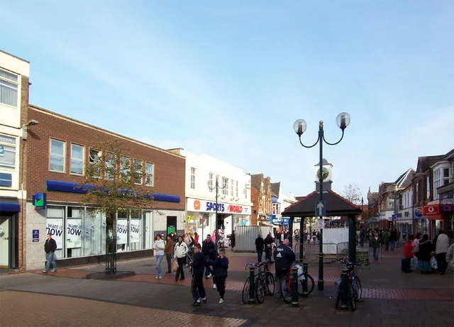 Scunthorpe City, North Lincolnshire1.5 km SE
-
Berkeley Neighbourhood, North Lincolnshire0.9 km NW
-
Westcliff Neighbourhood, North Lincolnshire1.3 km S
-
Old Brumby Neighbourhood, North Lincolnshire1.6 km SE
Sources & licences
Data last updated: · 2 independent sources